
Originally appeared on FrontLines.
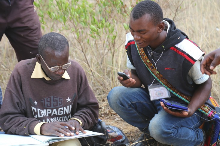
It is mid-morning in Kiponzelo village and already the sun weighs heavily on the Tanzanian landscape. As noon approaches, 23-year-old Gaspar Bangi picks his way through the scrub, trailing one of several surveying teams at work in the community.
Guided by a local farmer, Bangi skirts the boundary between two fields, pausing every so often to register a coordinate on his Android tablet. After 15 minutes, his progress is displayed on screen: Overlaid on a satellite image, the farmer’s plot is neatly outlined from above—the first step in submitting an official land claim.
Like most rural communities in Tanzania, Kiponzelo has a traditional system of land ownership, where property lines are a matter of conjecture, and land is often transferred through undocumented negotiations. That’s changing, however, thanks to teams like Bangi’s.

He is known as a para-surveyor—a local recruit able to accurately map land using informal training and non-traditional tools. Think mobile apps and smart devices rather than measuring tape and tripods. Together with a pair of adjudicators who mediate conflicts when competing claims arise, Bangi is out to register every last land claim in Kiponzelo.
It’s only their first plot of the day, and in a village with hundreds of claims, Kiponzelo’s surveying teams have a long road ahead.
Meanwhile, in Kinywang’anga, another village just down the road, workers haul boxes filled with hundreds of bright blue certificates for distribution. Known as certificates of customary rights of occupancy (the Tanzanian equivalent of a deed), each one issued to a villager will provide legal recognition of their right to a piece of land.
As the first community to partner with the Feed the Future Tanzania Land Tenure Assistance activity, residents of Kinywang’anga are among the first rural citizens to receive such documentation. This provides a number of benefits: indisputable proof of one’s claim, the peace of mind to invest in the land, and a documented means to sell, inherit or transfer land.
“We used to have a lot of conflict between farmers,” said village chairman Adam Garime. “They simply didn’t know where one person’s land ended and another’s began.”
Read the full article on FrontLines.