From 2005-2012, the Government of Burkina Faso put into law an ambitious vision of rural land tenure reform. It included giving rural families a land certificate (APFR) that formally recognized their customary rights to land. The vision also included establishing local offices to prepare these certificates and conduct other land administration activities. Since that time, however, only a few thousand families have actually received APFRs, largely due to the difficult operating conditions in rural Burkina Faso. Thus, there is a need to figure out how to provide APFRs to people faster, cheaper, and easier; otherwise these rural people will not benefit from the new law.
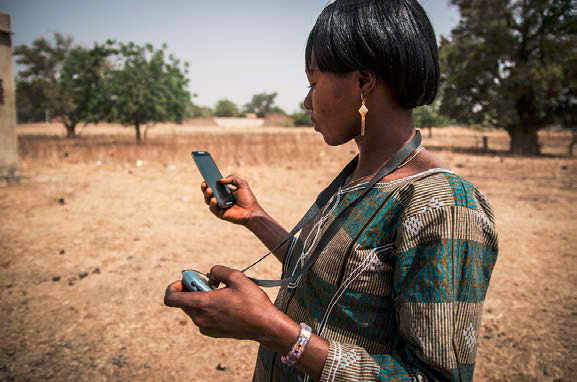
To address this challenge, ERC pilot-tested the use of smartphones, linked with handheld GPS devices, to quickly map rural land parcels and capture data about the land users needed to prepare APFRs for them. The IT platform is called MAST – the Mobile Application to Secure Tenure – and is designed for use by villagers with a high-school education and cell-phone experience. The testing took place in four villages in Boudry Commune (east of Ouagadougou), with significant participation from the local property registration office (SFR) and the National Land Observatory of Burkina Faso (www.onf-bf.org). The implementation period was September 2016-February 2017.
The pilot results were impressive. In only 25 days, 12 villagers used MAST to map and capture data on 2,708 rural land parcels. Prior efforts generally took more time and required deployment of trained surveyors, driving up costs and reducing the ability to implement on a large scale.
Using MAST on a large scale will require additional investment in hardware and software infrastructure and more troubleshooting, but the pilot results offer a compelling case that MAST can deliver APFRs at less expense and greater speed than heretofore seen in Burkina Faso.

