The ERC impact evaluation (IE) of the USAID/Zambia-funded Community-based Forest Management Program (CFP) in Zambia aims to provide USAID with better information on climate change and land tenure and property rights (LTPR) within the context of REDD+ projects. More specifically, USAID’s primary learning objectives for the CFP IE are to understand how REDD+ programs impact LTPR and related livelihoods, and to learn about what aspects of REDD+ programming are most effective in incentivizing long-term carbon sequestration and reduced GHG emissions from forests and landscapes. Baseline data collection for the CFP IE launched in March 2015 and concluded in April 2015. Data collection activities across the Nyimba, Mambwe, and Lundazi districts included the facilitation of 4395 household surveys, 820 wives surveys, 282 headperson surveys, 258 key informant interviews, 80 focus group discussions, and 40 participatory mapping exercises.
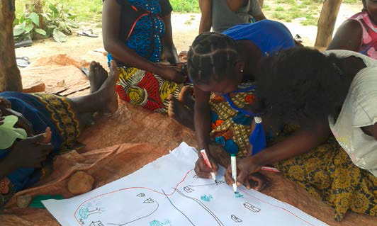
The CFP IE is the first ERC IE to employ participatory mapping exercises as a part of the evaluation methodology. Preliminary findings from this quarter’s analysis of the baseline data suggest that the data obtained from the participatory mapping exercises is particularly valuable in contributing to the survey team’s understanding of forest users, the norms and values they share, and the context in which forest use, access, and decision making take place. Additionally, because the exercise was carried out with separate groups of men and women from the same village, the mapping data contributes to our knowledge of gendered differences in perceptions, needs, and access to resources across the study area.
Throughout each exercise, groups of people were asked by a facilitator to draw a map of their village. Participants were asked to include specific objects and areas relevant to the CFP IE research questions, such as village infrastructure, village boundaries, agricultural fields, nearby forests, and sources of fuel and water. Participants were also asked to identify and explain the spaces and resources most important to their village. Once the map was complete, the facilitator asked the group to share and explain the image they created. Designed to complement the CFP IE quantitative instruments, the mapping exercises allowed participants to articulate and communicate their knowledge and understanding of their village and surrounding areas.
While the maps spatially identify key resources and spaces, the translated transcripts of the corresponding discussions reveal that the participatory mapping exercise successfully created an open forum for discussion and sharing information, allowing respondents to explain in their own words the complex social, political, economic and cultural dimensions of their livelihoods. The preliminary analysis of the data obtained sheds light on primary activities in the study area leading to forest degradation and the reasons they occur, forest access and management, perceptions of climate change and tenure security, and the significant effects of lost access to forest resources on forest-based livelihoods.
While the CFP quantitative survey instruments produce data that answers “what” types of questions, the participatory mapping data can help address “how” and “why” types of questions from the perspective of the participants themselves. This provides the evaluation team with a locally informed, culturally nuanced understanding of villages and their resources. ERC believes that juxtaposing and joining the cultural knowledge of the participatory maps with the other IE data will allow for better comprehension and explanation of CFP impacts, thus showcasing an example of a successful IE instrument that will help better inform USAID and it partners on LTPR in the context of forest-based livelihoods and what aspects of REDD+ programming are most effective.

