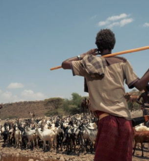
The Ethiopia Land Administration to Nurture Development (LAND) project is a 5-year project (2013-2018) working at the national and regional levels of government to further improve the legal and regulatory framework related to land tenure and property rights, thereby supporting the Government of Ethiopia’s and USAID’s goals of increasing economic growth, improving rural resiliency, and improving resource governance. The project works with pastoral communities in the Afar and Oromia regions of Ethiopia to support the formal recognition of customary land rights and strengthen the capacity of formal and customary pastoral land administration and land use institutions to engage in effective land and resource governance.
THE EVALUATION DESIGN
USAID is supporting a rigorous impact evaluation (IE) of the LAND project intervention in Afar to measure the key development impacts of project activities on communities and households related to enhancements in community resource governance, tenure security, climate resilience, and livelihoods. The IE will utilize a Difference-in-Difference methodology to measure impact, using baseline and endline evaluation data to compare changes over time between communities in Afar receiving the LAND intervention and communities in Afar that are not receiving the LAND intervention. Comprehensive quantitative and qualitative baseline data was collected prior to the start of LAND activities from March to June 2016. The IE data collection instruments were designed to collect information on the conditions of grazing areas and water points, tenure security and access to grazing areas and water points, and natural resource governance. A Baseline Report, Design Report and other materials have been drafted and are available on this page.
DOWNLOAD THE BASELINE DATA
Baseline Data Collection: April 2016
The following baseline data sets and related documents are available for download:
Related survey instruments (surveys, discussion protocols, and interviews) and other evaluation documents can be downloaded below.
BY THE NUMBERS
This evaluation will assess impacts at the household and community levels using five primary sources of data:
- 3000 Household Surveys;
- 1545 Wives Surveys, administered to wives in a subset of male-headed households;
- 263 Village Leader Surveys;
- 32 Focus Group Discussions, with women, youth, and agro-pastoralists;
- 128 Key Informant Interviews, with customary leaders and local government officials; and
- 50 Participatory Mapping Exercises, with herders and scouts.
KEY BASELINE FINDINGS
Baseline findings on the conditions of grazing areas and water points show that the conditions of both wet and dry season grazing areas in the study area are deteriorating due to consisted drought and the encroachment of invasive bush species. Baseline findings on governance in the study area indicate that customary leaders are primarily responsible for allocating land, setting and enforcing rules about land management, resolving conflicts, and decision-making regarding customary land use and management. Nonetheless, local expressions regarding governance reveal a perceived shift in the power and role of customary leaders over land use and rangeland management to formal government officials. In terms of tenure security, baseline findings on the threat of encroachment and risk of land reallocation of grazing areas indicate that respondents generally feel their land use and access rights are secure.
SHARE YOUR RESEARCH WITH USAID
We encourage researchers who request and use this evaluation data to send a copy of any published research that draws on this data to landmatters@usaid.gov. We will post selected materials on this website to share with our visitors. Selected materials are marked “external” and inclusion of research using USAID data does not imply that USAID endorsement or support.

