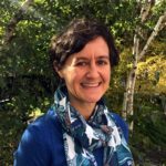
Janet Nackoney is a Land and Resource Governance Officer at USAID where she leads efforts to promote equitable and inclusive access to land and resource rights around the world. She has a background in geospatial data and analysis and works in the areas of land tenure, gender and social inclusion, climate change mitigation, tropical forest and carbon monitoring, ecological conservation, and food and livelihood security.
Educational Background
Dr. Nackoney holds both a Ph.D. and a Master’s degree from the Department of Geographical Sciences at the University of Maryland and a Bachelor’s degree from the Department of Geography at Indiana University – Bloomington.
Regional Experience
Dr. Nackoney has extensive experience working in sub-Saharan African countries, with particular focus on the Democratic Republic of the Congo (DRC), Tanzania, and Kenya.
Previous Experience
Dr. Nackoney has over 20 years of experience as a geographer specializing in applying geospatial technology and analysis to advance information development around biological conservation and sustainable land use and governance, including participatory mapping and community land use planning approaches. Dr. Nackoney’s prior research at the University of Maryland (UMD) focused on building capacity for participatory mapping and forest zoning with local communities in the Democratic Republic of the Congo (DRC), simulating scenario-based models of agricultural expansion and deforestation, and developing data, approaches and tools to advance biological conservation and food security in African countries. Prior to UMD, she worked at the World Resources Institute (WRI) on ecosystem services mapping in Kenya and at the University of Georgia on land cover change mapping. She currently serves on the Board of Directors for the Society for Conservation GIS (SCGIS) and is on the Advisory Board for Congo Education Partners, which assists a small rural college in northern DRC.
Contact Janet


