Donors Release New Tool for Responsible Investment; Seek Companies for Pilot Projects

For investors seeking to purchase, lease or access large areas of land in developing countries, understanding the complex land tenure realities – who has what rights or claims to which pieces of land – can be the difference between a failed investment and a successful, responsible one. Failing to account for or adequately compensate individuals or communities with claims to land that is slated for investment can lead to displacements or loss of livelihoods for local people and communities, and can create significant financial or reputational risks for the investor as well. For investors, conducting proper due diligence and structuring responsible land-based investments to account for all stakeholders can be extremely complex in situations where rights to land are unclear, undocumented, overlapping, or poorly enforced – which is often the case in developing countries.

For these reasons, a group of development organizations, under the leadership of Grow Africa and the New Alliance for Food Security and Nutrition, have released a new tool to help investors better understand risks related to land-based investments and manage them responsibly: the Analytical Framework for Investors Under the New Alliance. The Analytical Framework is designed to help investors identify practical steps to align their policies and actions with global best practices and relevant international guidelines, such as the Voluntary Guidelines on the Responsible Governance of Tenure (VGGT) and the UN Guiding Principles on Business and Human Rights (also known as the Ruggie Principles), and the African Union’s Guiding Principles on Large-Scale Land Based Investments.

Along with a range of other bilateral and multilateral development partners, USAID played a key role in developing the Analytical Framework through a collaborative multi-stakeholder process. USAID’s Operational Guidelines for Responsible Land-Based Investment form the basis of many of the recommendations in the Analytical Framework.

As a next step, Grow Africa is seeking interested companies to pilot the framework in actual investments projects in Africa to determine their effectiveness. Please contact Grow Africa at info@growafrica.com if your firm is interested in participating in this pilot.

Free Online Course on Land Tenure Property Rights

By Heath Cosgrove, Director, USAID’s Land Tenure and Resource Management Office.

Land tenure and property rights are at the heart of our most pressing development issues. Globally, there are more than 500 land governance programs in approximately 100 countries that recognize land rights as foundational for development work. These programs are expected to increase in the coming years because a growing body of evidence demonstrates that more secure rights to land and resources have powerful impacts on ending extreme poverty, promoting women’s empowerment, improving food security, reducing conflict, protecting biodiversity and responding to climate change. For development practitioners, better understanding and incorporating land tenure into existing and future development programming is crucial to achieving our objectives across a variety of sectors, such as agriculture, democracy and governance, environment, urban development, economic growth and disaster risk resilience.

To improve understanding of this critical issue, USAID is announcing the launch of the first Massive Open Online Course (MOOC) on land tenure and property rights. This free course is open to the public and provides a 14-week introduction to land tenure and property rights and their critical role in international development work.

Starting September 14 and running until the end of 2015, the MOOC features lectures from leading researchers and practitioners – including experts from Yale University, Michigan State University, the International Organization for Migration, USAID, and others – presenting theories, evidence and best practices related to property rights in real-world settings. The course also examines case studies in Colombia, Haiti and Tanzania. Participants in the course will receive a certificate upon completion.

The MOOC was developed by USAID’s Land Tenure and Resource Management Office to help promote effective, accessible, and responsive land governance systems for all members of society. USAID developed this course because when it comes to understanding the myriad complex challenges created by insecure land rights–and the evidenced-based global best practices for addressing them–there has not been a shared education tool to guide development practitioners at the programmatic level until now.

Land tenure and secure property rights can be challenging issues for development practitioners across various sectors to understand and address because throughout much of the developing world rights to land and other resources are often unclear and poorly enforced. Importantly, up to 70% of land in the developing world is unregistered. In many countries, these rights are governed by complex and overlapping systems of formal laws and informal customs.

Better understanding of these systems and their implications on economic growth, food security, women’s empowerment and natural resource management can improve development programming across a range of important topics. Secure property rights change how people interact with other people and with land itself. These rights can be the tipping point as to whether farmers are willing to adopt costly multi-year agriculture programs. The ability for women to inherit and own property can be the gateway to greater gender equality. Land issues have played a major role in 27 conflicts in Africa since 1990 and have been recognized by the United Nations Sustainable Development Goals (SDGs) as international priorities. USAID’s new Land Tenure and Property Rights MOOC provides a valuable tool to understand these linkages and to improve development outcomes. I encourage you to join us and learn about this key development topic.

Land Matters for Youth

From securing women’s inheritance rights, to enabling more responsible agricultural investment, to making cities more resilient to disasters—a growing body of evidence indicates that the systems that govern land and property rights have a significant impact on a wide range of critical development issues. Land tenure and property rights are particularly important to vulnerable groups such as women, indigenous peoples, refugees, internally displaced peoples, and the poor. But one vulnerable group has received less attention when it comes to land rights: youth.

Available evidence suggests that youth face significant and unique challenges when it comes to land and property. In many countries, rising pressures on land have left youth increasingly landless or holding only informal or secondary rights to land. This can lead to higher instances of conflict. In Ethiopia, for example, youth are more likely to experience land-related conflict than the general population. A lack of youth access to land may be a contributing factor to the civil wars in both Sierra Leone and Liberia.

Additionally, it should be noted that definitions of ‘youth’ vary widely across countries and can include individuals up to 35 years of age – in some countries the transition to adulthood requires marriage and children.

Recent research is building evidence of the impact of land tenure and property rights on youth. The International Fund for Agricultural Development (IFAD) has pointed out that landlessness among rural youth is one of the primary causes of migration to urban areas as young people seek out alternative sources of income. New research from USAID has begun to examine the impact of perceptions of land tenure security on youth and other vulnerable populations in Ethiopia, Guinea, Liberia and Zambia.

While more research is needed, initial findings indicate that policy makers and development practitioners engaged in land programming should take note of the unique challenges faced by youth. Policies and programs should take steps to promote youth land access and ensure that policies do not disadvantage youth with respect to land.

Download the full paper research paper from USAID.

Photo Essay: The Faces of Ilalasimba

In 2014, USAID launched the Mobile Application to Secure Tenure (MAST) pilot project in Ilalasimba, a village in Iringa Rural District in Tanzania. MAST is testing an innovative approach to document land rights that uses a new mobile application to map and record the geospatial and demographic data that the Government of Tanzania needs to issue Certificates of Customary Rights of Occupancy (CCROs) – formal land rights documents.

Before mapping begins, villagers learn about Tanzania’s land laws, with a special emphasis on women’s statutory land rights. They are taught dispute resolution techniques to help manage conflicts that might arise during mapping. And a small group of villagers were trained to use the MAST application on smart phones. Training was completed in April, 2015. Eight “Trusted Intermediaries” worked alongside members of the Ilalasimba Land Adjudication Committee to map over 900 parcels.

By leveraging open-source technology and a participatory, transparent process to deliver CCROs to villagers, MAST hopes to increase tenure security for women and men while allowing the Government to meet commitments to formalize more land rights in the country. Here is some of what some community members had to say about the project:

It Takes a Village – Mapping Land Rights in Tanzania

Later this month, several hundred villagers of Ilalasimba, Tanzania will receive formal documentation of their land rights thanks to a USAID pilot project called Mobile Application to Secure Tenure (MAST). Launched in 2014, the pilot tests an innovative approach to mapping and registering land rights. Through an easy to use, open-source mobile application, the project empowers villagers with the training and tools to identify parcel boundaries and gather the demographic and tenure information that government officials need to issue formal land rights documents called Certificates of Customary Rights of Occupancy. This makes the process of securing land rights more timely, accessible and transparent for local people and communities.

“BEFORE THIS, MANY PEOPLE DID NOT UNDERSTAND THE IMPORTANCE OF LAND AND THEIR RIGHTS ON LAND.”

USAID has developed a participatory methodology to implement the pilot, combining the use of technology with village-wide trainings on Tanzania’s land laws to build knowledge and strengthen capacity to support dispute resolution.

The approach works this way: first, village and hamlet-level workshops provide training on the legal framework of Tanzania’s land laws to members of the Village Assembly, Village Council, Land Adjudication Committee and others, with a special emphasis on women’s rights to own and inherit land. Next, USAID works with villagers to select and train a small group of young villagers to use the mobile application on Android-based smartphones.

These young people, called Trusted Intermediaries, then work alongside members of the village Land Adjudication Committee to map the boundaries of villagers’ land and enter demographic and other information about parcel holders. The intermediaries make certain that parcel holders (or their representatives) and the neighbors of parcel holders are present when mapping occurs.

Oftentimes, conflicts arise when rights to land and property are being demarcated and recorded. In order comply with Tanzania’s law and to reduce this risk, the four women and four men on the Land Adjudication Committee play a critical role resolving disputes that arise between family members or owners of neighboring parcels and validating the claims of parcels holders.

The information collected by intermediaries is then uploaded to a cloud-based database where government officials can access and validate it. Once validated by the District Land Office, the government is able to issue formal recognition of land rights, certificates, to villagers. This community-driven process is helping build local capacity and addresses one of the major bottlenecks in the traditional process of formalizing land rights: a dearth of surveyors.

The results from first phase of the pilot project are encouraging: In just under three weeks, the intermediaries mapped and collected information for 937 parcels. Some even went a step further and learned how to validate the data that they collected in the field. Jackline Nyantalima, a 23-year old woman said of her experience as a Trusted Intermediary: “This work provided priority to women. I was trained on land rights. Before this, many people did not understand the importance of land and their rights on land. This work has importance for our society.” Her colleague, Desmond Chumbula, a 30-year old man said: “I can tell the importance of this [work]. Before we were using paces to measure land, now we have a simplified process and you really know the size of your farm.”

With greater clarity about ownership and parcel size villagers should have enhanced security and increased incentives to invest in their property. This change may be particularly important for women: as Village Council member Ms. Sandina Kasike said in May:
“Before this project, widows were dispossessed. Now I see I have rights too. This means the future generation will be better off. Even if I pass away, my grandchildren and great grandchildren will have rights to own this land.”

Now the women of Ilalasimba have greater security and protection for their assets; USAID registered 30% of parcels in the names of women alone; 40% were registered jointly to men and women and another 30% were registered to men alone.

In July, when the certificates are delivered to the women and men of Ilalasimba, the project will meet a major milestone: providing local people with formal recognition of their rights. However, the project will not end there. USAID is expanding to two other villages in Tanzania and, as a result, will help improve land tenure security and enhance capacity for several hundred more people – the beginning of a big change in Tanzania’s villages.

Getting Specific on Land Matters: Geospatial Analysis

USAID uses science and technology to achieve, sustain and extend its development impact around the world. Geospatial analysis, which combines scientific methods, cutting edge technology and advanced data visualization, allows the Agency to improve decision-making and programming on issues at the core of its development work, such as improving resilience to natural disasters and responding to climate change, by identifying strategies that are well suited to a particular implementation site or area.

USAID’s Land Tenure and Resource Management (LTRM) Office is home for two of the Agency’s Geospatial Analysts. Ms. Ioana Bouvier and Ms. Silvia Petrova manage all geospatial analytical aspects of the office land and resource governance portfolio. Bouvier and Petrova leverage powerful geospatial analytic processes combined with advanced data management to create compelling visual and statistical information that communicates vital land and resource governance information to a broad audience, including policy and decision makers.

Geospatial Analytics Diagram
In the land sector specifically, Ms. Petrova notes that: “Geospatial analysis helps us understand the resources in an area and how to manage those resources. We can analyze the suitability of land for particular activities and this leads to better, more informed decisions about land and resource governance.” Geospatial analysis helps optimize the management of land and resources, identify important land use and land cover trends over time, and pinpoint areas where land or resource governance programming is most (or least) needed. Geospatial analysis is also a component of LTRM’s growing body of tenure-related impact evaluations. As Ms. Bouvier says about this work: “We help connect the dots and bring new information to support programming.”

With their strong backgrounds in data analysis, data visualization, Geographic Information Systems (GIS) and remote sensing, Ms. Bouvier and Ms. Petrova transform complex geospatial data into actionable information, which informs everything from project design and implementation to data management strategies to sector assessments and policy making. They also work in close collaboration with other USAID Washington offices, overseas Missions, and a number of U.S. Government agencies and departments to incorporate geospatial tools and techniques into a variety of development activities. They collaborate with the Agency’s Global Development Lab to develop geospatial data standards, build agency capacity, and create innovative solutions to development challenges.

Bouvier and Petrova are also helping connect the dots across sectors using rigorous analysis to evaluate land and natural resource dynamics in the context of agriculture. They recently completed a preliminary analysis of historical forest cover change in 19 countries across three continents to shed light on the historical land cover change patterns in potential USAID programming areas and expands learning opportunities while also enhancing decision support.

Beyond this important role supporting improved decision-making and programming through the development, visualization, and analysis of more comprehensive data, Ms. Bouvier and Ms. Petrova are also helping to build the capacity of USAID staff and working closely with implementing partners to apply geospatial analytic methods and build geospatial capacity of host-country partners to make programming more sustainable over time. Ms. Bouvier and Ms. Petrova have participated in an Agency-wide GIS training workshop bringing a focus on land and resource management to several sessions and furthering cross-bureau coordination.

With science, technological innovation and data visualization increasingly recognized as having great potential to improve development programming, the LTRM Office’s geospatial analysts are bringing powerful tools to help reduce extreme poverty, promote resilient societies, improve land and resource governance and strengthen property rights for all members of society, especially women.

Ask the Expert: Olaf Brugman

Each quarter we interview an expert whose work touches on aspects of land tenure and resource management. Read our first interview with Dr. Lauren Persha here. Our second interview is with Mr. Olaf Brugman, Team Leader Sustainability Policy & Dialogue, Rabobank. We asked Mr. Brugman five questions to get a deeper understanding of the trends and challenges in responsible land-based investment.
 

1) Mr. Brugman, tell us about yourself; what is your professional background?

In my professional career, I focus on how to make social entities function in a better way, be it organizations or businesses, at national level or inter-organizational level. I work at a cooperative bank as a manager in the area of sustainable development. This means that I work to make sure that my company, Rabobank, offers value to its clients, maintains a credible and legitimate position in society, avoids adverse impacts and offers inclusive business models.

2) In your professional life how are you involved with issues related to land rights and land tenure?

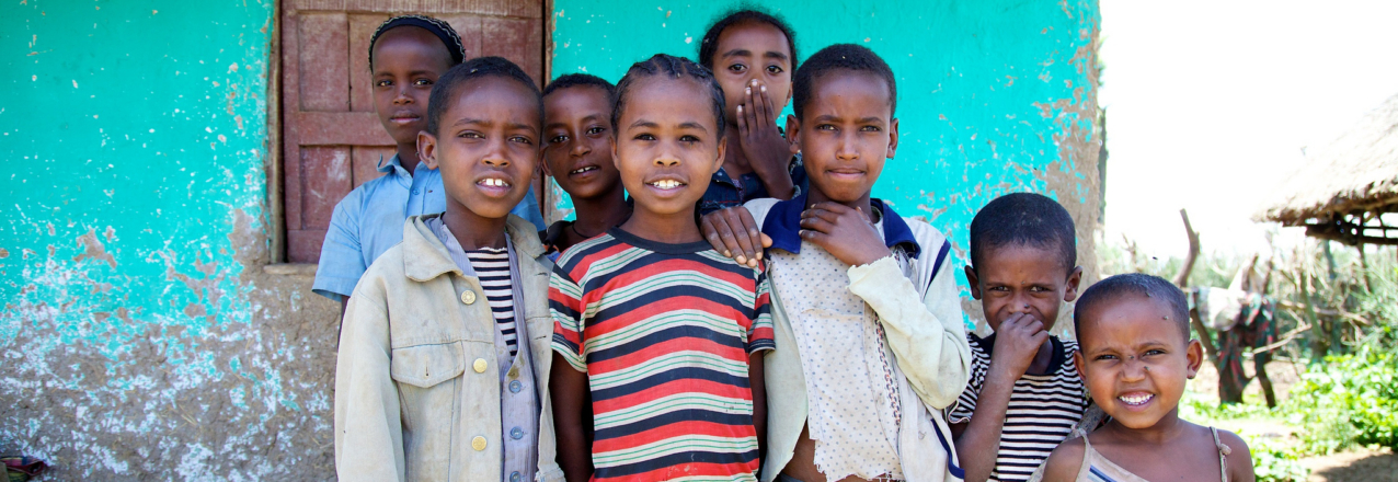
Rabobank has its roots and most of its focus on food and agribusiness. Our services include financial services for companies working in international agri-commodity chains, from “farm to fork” so to speak. We also provide international rural banking services in the United States, South America, Australia, New Zealand, Asia and Africa. So the supply chains we work within reach back to the farmers who work the land. Seventy percent of the world’s population lives and works in jurisdictions where land rights and land tenure are not adequately documented. This makes land rights and land tenure issues a part of reality in the operations of many of our business clients. I current lead the Rabobank Group Sustainability Policies & Reporting team and land governance is a prominent topic in our dialogues with stakeholders and clients. The issue also comes up in our financing policies. In addition, I serve as the Chair of the Round Table for Responsible Soy, and I work to ensure that land governance issues are addressed in our Voluntary Standards, which is the right and good thing to do. Agribusiness commodity producers can show that their products were produced under fair conditions in compliance with legal requirements by following these standards.

3) In your opinion, what are the key challenges that responsible investors face when they wish to acquire rights to use land in the developing world?

The key challenges are, in my view, respecting rights, proper due diligence and adequate stakeholder involvement as it relates to project-related financing for agribusiness. These investments are location-specific, which means you need to acquire in-depth knowledge of each potential location. When a company provides general corporate finance however, by definition it is not linked to a specific location and a known context. In these cases, financing providers really need to assess the general quality of governance that the recipient of financing applies to its operations. This means there may be several degrees of uncertainty with regard to governance risks. However, and more importantly, I believe that investors can differentiate themselves by being part of the solution and contribute to better functioning food and nutrition systems, even when operating under uncertainty and in an imperfect world.

4) How do the organization/s you are involved with deal with these challenges? What actions do you take to better ensure that you work collaboratively and effectively with local people who hold land and resource rights?

At Rabobank, we are providing financing and sharing knowledge in our client relationships and networks. As a cooperative bank, we know that you can achieve more together than by working alone. In the Round Table on Responsible Soy, which is a multi-stakeholder mechanism, different perspectives and interests are considered and built into decisions. We promote an inclusive business model that generates transparent and verifiable governance levels, which helps to mitigate risk by adopting this Voluntary Standard.

5) What are you most excited about when it comes to protecting the land rights of local people? For example, what new efforts/technologies/etc. do you think will support and encourage responsible land-based investing?

Technology will be an accelerator in improving land rights and land use information, and will add tremendous transparency. This will help to protect all those who hold rights. Furthermore, let’s not forget that the primary motive should be to raise standards of living, combat poverty and reduce malnutrition, in a way that can be self-sustained by a business model that supports better functioning businesses, communities and societies. Investments need to be channeled and applied “on the ground.” If our focus is only on improving due diligence, the systemic effect may be that investments do not happen or that specific regions or countries are avoided, and this will exclude many from the chance to improve conditions. But, if the focus is on improving conditions and better management of risks, it becomes apparent that one has to take acceptable risks and deal with uncertainty to realize positive investments and to create the chance to improve living standards. With improved living standards better educational and health opportunities, better business opportunities and social and economic stability. These are all social enablers, and without them operators and investors leave potential untapped, and that is not very sustainable.

Why Land Tenure Matters for Nepal’s Earthquake Relief and Recovery

Guest commentary by Cynthia Caron, PhD. Dr. Caron is a Land Tenure and Gender Specialist with The Cloudburst Group and an Assistant Professor of International Development and Social Change at Clark University.

On April 25, a 7.8 magnitude earthquake struck Nepal, marking the worst natural disaster to strike the country since 1934. Two and a half weeks later, while the nation was trying to recover, an aftershock with a magnitude of 7.3 hit. Families in Nepal continue to grieve lost loved ones and are reliant on the Government of Nepal, relatives, friends, humanitarian agencies and donors to start rebuilding lives and livelihoods. The earthquake affected eight million people in 39 of Nepal’s 75 districts and destroyed or damaged over 760,000 homes. Drawing from recent research on land tenure and disasters, there are two key points development actors should consider as they move into supporting longer term reconstruction and development efforts in the earthquake-affected districts.

Emergency Shelter: With the monsoon season starting this month, immediate shelter is a priority. As of June 3rd there were 394 sites hosting over 41,000 internally-displaced persons. Emergency or transitional shelter might be established in large camp settings, by placing displaced families with host families, or following debris removal, families might build emergency shelter on their own plots of land. Agencies engaged in camp management or looking after displaced families must be attentive to issues such as the length of time that displaced families might stay on a piece of land owned privately by another individual. In the case of a family taking in and ‘hosting’ a displaced family, a clear understanding of how pressure on resources – such as food growing in the garden or drinking water from the host family’s well, toilets or kitchens – can create tensions should be considered. This will help clarify conditions regarding access to and use of the land and resources and avoid or minimize additional displacements or future conflict.

Community-Driven Enumeration: In order to obtain a nuanced understanding of who was considered to own what land, who occupied particular plots, and what tenancy arrangements existed prior to the earthquake, development actors engaged in shelter and settlements programming should consider funding enumeration activities that facilitate cooperation at the lowest administrative levels. This might include bringing local government officials into horizontal alliances with each other and local NGOs .

Enumeration exercises help identify the complex range of tenure arrangements that are specific to the contexts of the affected districts, which standardized tools might not capture, and in doing so address the antecedents of potential land and housing conflicts and allow for a smooth path to restitution, resettlement, and reconstruction. For example, as housing damage assessments continue, data collection should move beyond the initial two main categories of “government houses and private houses” to capture other informal tenure arrangements existing within these two categories, including various relationships between landowners and tenants, as well as the land and resource rights of women and minority groups who may be particularly vulnerable to loss of these rights after the earthquake.

A robust and diverse housing compensation and reconstruction program will take into account not only a wide range of tenure arrangements, but also different family structures. For example, many rural Nepali families continue to live in joint, extended families not nuclear ones. Therefore, the design of compensation and reconstruction packages should take into consideration the various definitions of what constituted a ‘family’ prior to the earthquake. Policymakers and humanitarian agencies must speak with and listen to organizations on the ground and design policies and assistance packages that reflect the plethora of existing tenure arrangements. This includes recognizing the existence and needs of leaseholders, the landless and others who rely on commonly-held property, as well as property owners without formal documentation, but nonetheless longstanding tenancy arrangements. Attention to such detail can mitigate future conflict within and between families and enhance the rebuilding process.

For more information on building more resilient communities both pre-disaster and during the different phases of post-disaster programming, including relief, recovery, and reconstruction, see the USAID Issue Brief: Land Tenure and Disasters.

Land Matters for Children: A Photo Essay

June 1st marks International Children’s Day, a global celebration of children and an opportunity to bring special attention to how secure land tenure positively affects children. Evidence from a number of countries suggests that when women have secure rights to land and other assets their children and their communities also benefit. For example, in countries where women have weak land rights the level of childhood malnutrition is, on average, 60 percent higher compared with countries where those rights are strong. Research also shows that when mothers have more secure rights to land their children stay in school longer. Other studies show that when women hold more secure rights to land they are better able to provide their children with needed healthcare.

These positive outcomes spread through a society:  for each additional year that a child stays in school his wages rise by 10% (more for girls) and children who are better nourished are better able to learn. Educated girls have children later in their life leading to lower rates of childhood pregnancy, which can have potentially serious health consequences.

Securing land rights is an important contributing factor to improving household food security, expanding educational opportunities for children and improving children’s access to healthcare. This means that for children, as well as for their parents, land matters. USAID is working in 24 countries around the world to clarify and strengthen land rights for all members of society, especially women.