How Technology is Transforming Land Rights in Tanzania

As part of the Feed the Future initiative, USAID is helping the Government of Tanzania to improve communities’ understanding of land rights, support village land use planning, and clarify, document and certify property rights. USAID anticipates that this program – the Land Tenure Assistance Activity (LTA) – will reduce land-tenure related risks and lay the foundation for sustainable and inclusive agricultural investment for both smallholders and large-scale commercial investors. The program is a positive example of how a USAID investment is catalyzing innovation and partnerships for economic prosperity and self-reliance in Tanzania.

By the end of 2019, LTA is expected to have registered – for the first time – over 50,000 parcels, benefiting over 14,000 Tanzanian villagers.

At the heart of the program is USAID’s Mobile Application to Secure Tenure (MAST), a suite of innovative approaches, inclusive methods, and mobile technology tools to efficiently, transparently, and affordably document rights to land and other resources. In addition to Tanzania, USAID is working with other governments and communities to use MAST in Burkina Faso, Myanmar, and Zambia.

Evolution of MAST

These days, smartphones and tablets are everywhere, even in some of the most remote villages around the world. To leverage these technologies to meet the challenge of providing affordable, accessible land administration services to rural areas, in 2014 USAID began working with the Tanzanian government and local residents to pilot MAST in Ilalasimba, a small village in Iringa District. The initial pilot was a proof of concept – to test whether the idea of using low cost mobile technology to map and register land rights would work and could be affordably scaled-up to the rest of the country.
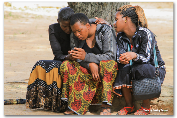
Central to the pilot was the assistance of and input from both the local government and community members themselves, in particular local youth who functioned as “trusted intermediaries,” helping to teach other villagers about MAST. Beyond just technology, the pilot project raised awareness among villagers about their land rights, with a special emphasis on women’s land rights. Only then did the project team map, record, and register those rights using MAST. As USAID/Tanzania’s Hal Carey explains, villagers were “interested and excited about [MAST] because it was an opportunity to participate in land governance…for women, it meant an opportunity to secure tenure for their children; for everyone, it meant access to finance. Everyone saw the potential, although there was some skepticism.”

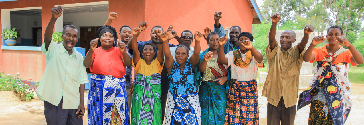
In that first village – Ilalasimba – the pilot team mapped, recorded, and registered 910 parcels using MAST, benefiting 345 families. Soon after, the District Land officials issued official land certificates – known in Tanzania as Certificates of Customary Rights of Occupancy (CCROs) – for each parcel. The number of registered parcels increased to 1139 for the second village and 1886 for the third. Importantly, despite early resistance from many men to the registration of women’s land rights, the pilot’s education, training, and outreach activities resulted in parity in land registration between men and women. For example, in Itagutwa village, 33% of the parcels were registered solely in women’s names, while 32% of parcels were registered jointly in women and men’s names.

Now, with their land certificates in hand, residents of the MAST pilot villages enjoy greater clarity of their rights, including their parcel boundaries, enhanced tenure security, and stronger incentives to make long-term investments on their land. For example, families are using the certificates as collateral to invest in their businesses.

For USAID and the Tanzanian Government, the initial MAST pilot generated many lessons and produced a commitment to continue improving and scaling MAST, given its relative efficiency, low-cost, and user-friendly tools, compared with more traditional adjudication approaches that utilize labor intensive approaches and required expensive equipment and specialized inputs. The initial MAST pilot was judged a success for improving tenure security and in establishing and reinforcing participatory and transparent governance mechanisms at the village level which, in turn, have the potential to lead to greater smallholder and large-scale commercial investments in land.

USAID’s Land Tenure Assistance Activity expands MAST

Based on the success of the initial pilot, USAID launched the Land Tenure Assistance (LTA) activity in 2015 to scale-up the work to a much larger area. Under LTA, USAID has refined MAST’s technology and methods to deliver CCROs as well as village land use plans, which are a precondition for the issuance of land certificates under Tanzania’s Village Land Use Act. As Carey explains, “the [initial] tool had some shortcomings.” However, USAID “took the lessons learned from the MAST pilot and revised the application itself for more accountability…accuracy, and efficiency.”

Through 2017, the LTA program has achieved promising results, including:

  • Registering 14,747 CCROs, covering 20,000 hectares of land in 13 villages;
  • Empowering women to claim their land rights: 48% of all claimants were women;
  • Lowering the cost per parcel from $20.57 at project inception to $7.85;
  • Helping to establish 13 women’s groups and strengthen 32 others;
  • Training 17,714 individuals on land tenure and property rights;
  • Supporting the upgrading of 10 village registry offices;
  • Creating a radio program on land registration and the LTA project on five radio stations; and
  • Launching a youth sensitization program in secondary schools.

Semaly Kisamo, also from USAID/Tanzania, noted that MAST is a “very participatory process with villagers themselves participating. It’s generating ownership, sustainability, and trust… communities trust [each other] more. They are engaging and coming together to resolve issues. They are very appreciative of the project.”
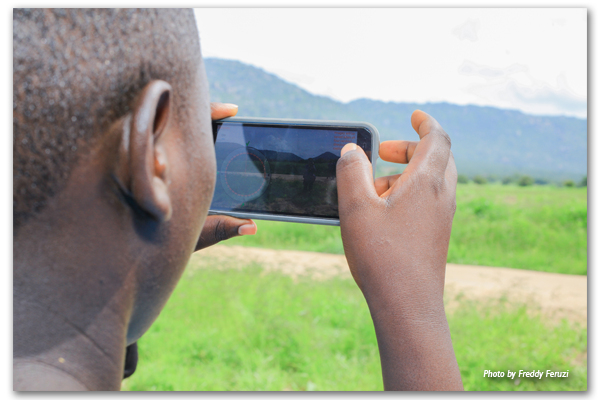
The Government of Tanzania is now exploring opportunities to roll out MAST nationwide. While the Government looks to build a national land information system, which will focus first on the registration and administration of urban land, MAST offers a relatively low-cost, efficient, and user-friendly tool for formalizing customary rights in rural areas. As such, MAST provides an effective and sustainable tool that can easily be made compatible with the national land information system. It may prove beneficial to the Government in contributing to the activities focused on promoting transparency in the administration of rural lands, increasing tenure security, and ultimately enhancing the investment climate in Tanzania.

The Government recently decided that the Land Tenure Support Programme, which several European donors support in Tanzania’s Kilombero District, will use MAST and the same implementation protocols as the LTA program to support the systematic adjudication.

To learn more about MAST, see the MAST Learning Platform, a knowledge portal with documentation, tools, lessons learned, and best practices from existing MAST projects. The MAST Learning Platform also will feature upcoming MAST activities to be implemented under the USAID-supported Land Technology Solutions Project (LTS) and other USAID programs.

Ask the Expert: An Interview with Matt Sommerville, Tenure and Global Climate Change – Global

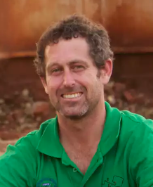
Dr. Matt Sommerville is the chief of party of the USAID Tenure and Global Climate Change (TGCC) program, which has implemented research and pilot activities to improve sustainable land management through strengthening land and resource rights. The program was active in Zambia, Burma, Vietnam, Ghana and Paraguay. From 2014 to 2017, Sommerville was based in Zambia, backstopping a customary land certification process that resulted in the documentation of over 15,000 parcels of land across five chiefdoms in Zambia’s Eastern Province.
Tell us about the Tenure and Global Climate Change project in Zambia.

USAID began supporting customary land documentation in Zambia to test a simple question: Does the documentation of land rights influence farmers’ decision to adopt sustainable farming practices? The intervention was designed as a randomized control trial impact evaluation, and includes almost three hundred villages that were split between four treatment groups: one that participated in a land-tenure-strengthening intervention, a second that participated in an agroforestry intervention, a third that participated in both land tenure and agroforestry interventions and a control group.

As TGCC began to work with local chiefs, it became apparent that there was national interest across Zambia, from chiefs, civil society, and the Ministry of Lands, in low-cost, mobile technology-based, robust processes to document the land rights of Zambia’s millions of landholders. With the Urban and Regional Planning Act of 2015 and the Forest Act of 2015, new opportunities emerged for coordination between state and customary leaders on land use planning and resource management. Based on this, USAID began supporting civil society partners to undertake land documentation at scale. In addition, we also worked across interest groups to build communication and transparency between chiefs, communities and government ministries to improve land and resource management.

Why is this work important?

Zambia has historically been a large land area / low population country and land has been perceived as abundant. However, since liberalizing land markets in the mid-1990s, demand for land has skyrocketed, both from large-scale investments, as well as from middle and upper-class Zambians looking to access small farms in Zambia’s rural customary land.

Zambia’s centralized land record system is incomplete on government administered leasehold land, and is non-existent in the majority of the country under customary management. Incomplete records alongside limited transparency or communication between customary and state systems has created conflicts, disadvantaged women who lack documentation of their rights, reduced economic investment from the private sector, and robbed government of tax revenue.

Customary land documentation and increased transparency between the state and customary systems and presents a solution to the above challenges. With more complete land records and tax systems, the Ministry of Lands can contribute to the national Treasury. With the clarity of land allocations and existing customary rights on land, communities and district councils will be able to undertake land use planning, particularly in peri-urban customary areas, which will subsequently inform private investors, and reduce risks of conflicts related to their developments.

What are key achievements/successes from TGCC’s work in Zambia?

TGCC has contributed significantly to opening up communication among government, civil society, donors, chiefs and communities on land issues, and created opportunities to find common objectives. Through this process, TGCC has supported over thirty consultations across the country on Zambia’s draft land policy, which has evolved significantly over the past three years as a result and is expected to be sent to Cabinet in 2018.

TGCC’s support to the Petauke and Chipata District Land Alliances, local civil society organizations, has demonstrated the ability of civil society organizations to play an active role in delivering land-administration services, acting as an honest broker between chiefs, communities and the district government. Through this work, the two district land alliances have mapped over 15,000 land parcels and documented individuals with ownership and other interest rights in that land. Nearly half of the parcels have a female landholder associated with the parcel, representing equal rights of ownership over the land.

Zambia’s government accepted these customary land parcels into the same national spatial data infrastructure that houses state land. For the first time, this allows the general public to see customary and state land allocations together.

Based on business as usual, the task of documenting the land rights across of Zambia’s land surface would take over 1,000 years. USAID’s participatory process and mobile tools developed under TGCC could bring this work down to under a decade. However, the costs would be substantial. To address this, TGCC has helped coordinate donor engagement with government and among each other to leverage investments in the land sector, and develop tools that can be cost-effectively replicated by government.

With respect to the impact evaluation goals of the program (testing how stronger property rights affect a farmer’s decision to practice climate-smart agriculture, including agroforestry), evaluators found success in each intervention. In terms of strengthening tenure security and increasing investment in agroforestry practices, however, the interactions among the two are more ambiguous. TGCC found some evidence that households with secure land rights invested more in some sustainable land-use practices and that women with secure land rights were marginally more engaged in agroforestry adoption. Indeed many factors go into the decision to adopt sustainable land use practices. However, it is clear that land tenure impacts take time to be felt.

What were the key lessons learned?

  • The process of carrying out customary land documentation can be as important or more important than the document itself, because it can help farmers identify and resolve their long-standing disputes, and involves jointly walking boundaries.
  • Inter-ministerial coordination is essential to resolving land and resource governance disputes as no single ministry has complete authority over land and resources in an area.
  • While mobile tools can support data collection and data entry, they do not replace the need for paper receipts and reference maps in the field.
  • The social dimensions of building understanding of customary land certification processes and goals, and the use of local civil society partners for implementation is essential to build trust and partnerships from local communities.

Where can I find more information?

The Tenure and Global Climate Change program in Zambia developed an abundance of resources including:

  • Films documenting the work on:
    • aligning land-tenure activities with traditional land governance (forthcoming)
    • women’s empowerment (forthcoming)
    • the strength of partnerships (forthcoming)
    • how land tenure helps promote better farming techniques (forthcoming)

These resources and more information about the TGCC program in Zambia can be found at Land-Links.org here.

What’s New on LandLinks – 23 February 2018

In lieu of our weekly scan of recent land tenure and resource management media items, we are highlighting the latest content on LandLinks at the end of each month. In case you missed it, here is a roundup of the new content on LandLinks, from USAID land-related project documents to blogs by our land experts, and more:

USAID LandLinks Blogs & Events

  1. Gaining Ground in 2017 (1/30/18)
  2. USAID Land Champion: Zemen Haddis, PhD (2/6/18)
  3. Webinar: Mangrove Forest Restoration and Management: Social & Governance Dimensions (2/15/18)
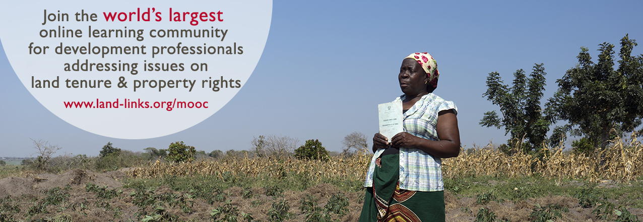
  4. Land Tenure and Property Rights MOOC 3.0 (1/8-4/15/18)

Colombia: Land and Rural Development Project (LRDP)

  1. Historical Land Decree for Women (2/7/18)
  2. Cassava and the Next Generation (2/23/18)

Land-Potential Knowledge System (LandPKS)

  1. LandCover: A Mobile Tool for Vegetation Monitoring (2/21/18)

Tajikistan: Land Market Development Activity (LMDA) Project

  1. LMDA Success Story: Simplified Registration Offices for Immovable Property Rolled Out in Nine Districts of Khatlon Region (1/30/18)

Ukraine: Agriculture and Rural Development Support (ARDS) Project

  1. ARDS Success Story: Land of Plenty: Helping Communities Realize the Benefits of Rural Land (2/21/18)
  2. ARDS Video: Land Management in Consolidated Territorial Community of Kipti (2/21/18)

LandCover: A Mobile Tool for Vegetation Monitoring

The Land Potential-Knowledge System (LandPKS; landpotential.org), a joint USAID-USDA program, is creating mobile applications that help land managers collect, store, and analyze data in order to inform decision making, agricultural production, and vegetation monitoring and restoration. It does this through the use of the LandPKS Mobile app, which is free to download and use for both Android and iPhone. The LandPKS app currently has two modules: LandInfo and LandCover.

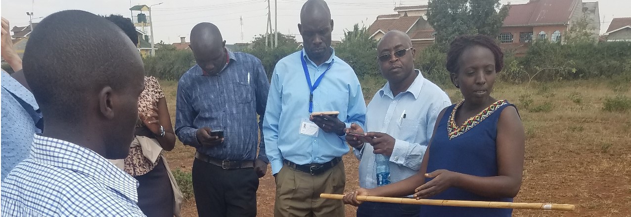
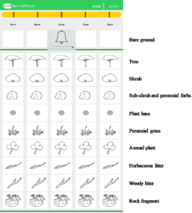
The major goal of the LandCover module is to assist users with collecting vegetation cover data using a point-intercept method. LandCover is designed to be a simple, user-friendly substitute for traditional paper monitoring sheets for vegetation cover. The only equipment needed is a meter/yard stick and the LandPKS app installed on a smartphone. First, the user designates a center point of the plot. Next, the user walks 5 meters/yards in one direction from the center, drops the stick, and enters which vegetation types directly touch the stick at 5 points along the stick, measures plant height, and establishes if there are canopy or basal gaps. This is then repeated at 10, 15, 20, and 25 meters/yards along that given transect. Lastly, this process is repeated in the 3 remaining transect. Overall, this method yields 100 points of vegetation cover data per plot in about 20 minutes.

Screenshot of the LandCover data entry screen and the different types of cover that are collecting with the LandCover module.

Importantly, results are calculated immediately on the phone about cover type, plant cover, canopy height, and gaps. In addition to receiving results on the phone, users can also access their data on our open-source data portal at portal.landpotential.org. Further, a user can enter vegetation cover data for the same plot at various intervals and immediately get results about trends in vegetation cover. LandCover can be used globally, and the module is currently being used extensively in the rangelands of Namibia and Kenya.

There are several important advantages of using the LandCover module for measuring vegetation cover. First, it gets rid of paper forms that can be lost or damaged. Second, results are delivered immediately to a user without the need for extensive data analysis. This benefit was mentioned by rangeland managers in Samburu County, Kenya, who told the LandPKS team that now they can see results directly on the phone themselves, instead of waiting months to maybe get results back from their headquarter offices. This makes it easier and more efficient for real-time vegetation monitoring and decision making. Third, the LandCover module makes vegetation restoration efforts easy to monitor. This has important implications for both maintaining wildlife habitat and encouraging the growth of fodder species for livestock. Lastly, the LandCover results help natural resource managers make more sustainable decisions about their land, which can lead to greater productivity and less environmental degradation. Download the LandPKS app to try out the LandCover module today! For more information about LandPKS please visit our website at landpotential.org or e-mail us at contact@landpotential.org.

Land Matters Media Scan – 2 February 2018

Here are the recent land tenure and resource management media items:

USAID

  1. Gaining Ground in 2017 (1/30/18)
    Source: USAID LandLinks
  2. Of local people and investors: The dynamics of land rights configuration in Tanzania – references USAID’s Mobile Application to Secure Tenure (1/10/18)
    Source: Danish Institute for International Studies
    Related report: Of local people and investors: The dynamics of land rights configuration in Tanzania
  3. Bolívar is the Pioneer of Secondary Occupants (1/22/18)
    Source: USAID Colombia LRDP
  4. Location Matters! LandPKS Can Provide Point-Scale Soil Information (1/22/18)
    Source: USAID LandPKS
  5. USAID Mobile Applications: Helping Smallholder Farmers Document Their Land Rights (1/25/18)
    Source: USAID LTS

Upcoming Events

  1. Land Tenure and Property Rights MOOC 3.0 (1/8-4/15/18)
    Source: USAID LandLinks
  2. Making Rangelands More Secure (1/29-2/9/18)
    Source: International Land Coalition / Land Portal Foundation
  3. Webinar: Women and Land Rights (2/14/18)
    Source: Namati
  4. India Land And Development Conference 2018 (2/19-21/18)
    Source: NRMC

Reports and Publications

  1. Thousands of people forcibly removed (1/25/18)
    Source: Norwegian Refugee Council
    Related report: Back to Square One
  2. Women left out of forest decisions (1/31/18)
    Source: CIFOR
    Related report: Challenges for women’s participation in communal forests: Experience from Nicaragua’s indigenous territories
  3. African women remain marginalized in land access (report) (1/23/18)
    Source: Econfin Agency
    Related report: Reward work, not wealth
  4. From Tree-Planting Drones to Shade-Grown Tea: Businesses Are Making Money by Reforesting the Planet (1/18/18)
    Source: World Resources Institute
    Related report: The Business of Planting Trees: A Growing Investment Opportunity

Global

  1. Q&A: Why land rights are worth a multimillion dollar investment – Interview with Tim Hanstad (1/25/18)
    Source: Devex
  2. Podcast: Land Ownership Is Key to Addressing Poverty, Especially for Women, Charity Leader Says – Discussion with Chris Jochnick (1/26/18)
    Source: The Chronicle of Philanthropy

Indigenous Peoples

  1. Indigenous Peoples & Local Communities Vital to the Global Environment (1/25/18)
    Source: Inter Press Service
  2. Land grabbing: An urgent issue for indigenous peoples around the world (1/25/18)
    Source: Slow Food
  3. Kenya flushes out ‘criminals’ in forest dispute after Sengwer killing (1/19/18)
    Source: Thomson Reuters Foundation
  4. Peru: Protect the Amazon from big business and greed, Pope Francis urges (1/19/18)
    Source: Thomson Reuters Foundation
  5. Indonesia: ‘The forest belongs to the community’ (1/22/18)
    Source: CIFOR

Africa

  1. Chad: Climate Change and Conflict in Chad – Using P3DM to secure peace (1/24/18)
    Source: CTA
  2. Senegal: Women sow seeds, not division to build climate resilience in Senegal (1/18/18)
    Source: National Observer
  3. South Africa is getting land reform wrong (1/25/18)
    Source: The Economist
  4. South Africa: King Goodwill Zwelithini set for bruising battle with the ANC over rural land (1/22/18)
    Source: Business Day
  5. In Uganda, change is afoot for rights to forests (1/18/18)
    Source: CIFOR
  6. Zimbabwe: Ten priorities for getting agriculture moving in Zimbabwe (1/24/18)
    Source: fin24
  7. Zimbabwe: Resolving Who Owns What Land Lies at Heart of Zimbabwe’s Future (1/20/18)
    Source: The New York Times

Americas

  1. Brazil: ‘I used to see them as a bunch of rioters’: Brazil’s radical farmers (1/25/18)
    Source: The Guardian
  2. Colombia: Land title gives new hope to displaced Colombians (1/23/18)
    Source: UNHCR

Asia

  1. Bangladesh: CHT people to enjoy ownership of their land: PM (1/21/18)
    Source: Business News 24 Bd
  2. China: Land rights and agricultural efficiency (1/22/18)
    Source: Vox Dev
  3. India: The Great Indian Land Grab Being Carried out in the Name of Compensatory Afforestation (1/30/18)
    Source: The Wire
  4. The Philippines: ARMM starts Maguindanao land titling to settle disputes (1/20/18)
    Source: Philippine News Agency

Gaining Ground in 2017

Advances in Land Conflict Prevention, Capacity Building Tools, and Responsible Land-Based Investment

USAID’s programming in the land sector in 2017 showcased many of the ways that the Agency is strengthening communities and better preparing them for the day when they will no longer need development assistance. USAID worked with communities to address land conflict, build in-country land delimitation and administration capacity, and partnered with the private sector to make land-based investments less risky and more sustainable. Understanding the challenges and successes from this past year will help us build self-reliant communities who can use the valuable asset of land as the foundation for inclusive economic growth, to help create the conditions for peace and security, and to transform lives, communities, and countries.

Preventing Land Conflict

USAID is collaborating with governments at all levels to advance democracy and governance, and address conflict and support global stability. To share this important issue with the LandLinks community, USAID hosted a webinar discussing the important cross-sector impacts of land and conflict, specifically looking at land-related conflicts in Colombia and Ethiopia. Following the signing of the Colombia peace accord that officially put an end to 52 years of civil war, the story Getting Answers gave a personal account of how the USAID Land and Rural Development Program’s activities in Northern Cauca, Colombia is bringing 1,300 displaced residents home. We also looked at how USAID, through the Property Rights and Artisanal Diamond Development (PRADD) II project in the Central African Republic, is working with local leaders to reduce the flow of conflict diamonds.

The Right Tools and Knowledge to Build Local Capacity and Prosperity

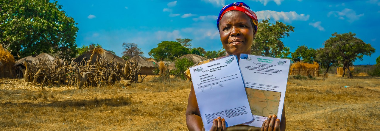
Technology paired with tools and in-country capacity building are reinventing how USAID implements land programming and helps prepare people, communities, and partners to become more self-sufficient. In Zambia, villagers are using a USAID-developed mobile application to map and document land rights in remote areas—leading to more than 6,000 people and families having their land rights certified. In addition, LandLinks launched a learning platform for Mobile Applications to Secure Tenure (MAST), which shares the suite of land-focused applications developed under different USAID activities.

But apps and technology aren’t the only answer: making land management an inclusive process is a key technique for economic growth. In Cote d’Ivoire, the PRADD II project uses maps to demonstrate land use as well as opportunities for activities such as mining, fish farming, poultry raising, and cultivating cashew orchards. The USAID process brings together the entire community of stakeholders, including women, pastoralists, and youth, who have historically been left out of this process, to view the maps and discuss land management. Thanks to the inclusion of these groups, youth are contributing new ideas and techniques to modernize Cote d’Ivoire’s agricultural practices and reinvigorate its economy. And women are forming cooperatives that are transforming inactive diamond mining sites into vegetable farms, an important source of household income and food security.

One of the most practical and effective tools in our development toolbox to enable communities to grow small businesses and become more prosperous continues to be crop selection itself. Many of USAID’s projects focus on building communities’ knowledge on how to use their land for a stable and profitable supply of cash crops such as cacao in Colombia, cashews and honey in Cote d’Ivoire, and apricots in Tajikistan.

Forging Private Sector Partnerships

The private sector can play an important role in strengthening legitimate land tenure rights of vulnerable communities by directly supporting land tenure projects and by ensuring their investments do not infringe on such legitimate rights. This creates important win-win benefits for communities as well as for businesses, whose reputational, operational, and financial risks decrease when legitimate rights are respected.

Collaborative engagement with private sector partners that offered solutions to land-based investment challenges was a priority for USAID’s land programming in 2017. Through projects in Ghana, Kenya, and Mozambique, USAID worked with the private sector to raise awareness of the financial, operational, and reputational risks that insecure land rights pose for business investments and to incentivize responsible investments.

In Ghana, USAID launched a partnership with Hershey’s and its local cocoa supplier, ECOM Trading, to strengthen the land rights of cocoa farmers and improve cocoa yields. This partnership has already mapped 200 cocoa plots and clarified leases between farmers and customary landowners, and it has rehabilitated another 71 farms, improving productivity and reducing supply risks for farmers, ECOM, and Hershey’s. This also supports Hershey’s in meeting social and environmental goals under Tropical Forest Alliance 2020 commitments.

In Kenya, USAID and impact investor Moringa Partnership conducted an enhanced due diligence process related to land tenure and environmental risks for an investment in Kwale County. This work will help Moringa’s local investee identify and execute a business development strategy that respects the land tenure rights of legitimate landholders, reduces the company’s risks, and increases the sustainability of their business.

In Mozambique, USAID and Illovo Sugar, Ltd., Coca-Cola’s largest sugarcane supplier in sub-Saharan Africa, are helping farmers to document their legitimate land rights. This year, the project mapped and created documentation for the customary certification of land rights for 1,400 plots of sugarcane and other crops. The project is also developing a grievance mechanism that will provide a clear, transparent redress process for landowners and will reduce financial and operational risks for Illovo.

USAID’s Sarah Lowery looked at why the private sector is important to USAID’s land programming and, in a webinar that had a record-breaking 440 registered participants, interviewed private sector partners from the Ghana land cocoa program to understand the investor’s perspective on the importance of land rights.

Through this important programming, USAID’s work in land, addressing conflict, introducing the right knowledge and tools, and engaging with the private sector helps communities strengthen their land and resource rights, which are critical to meet food security and other strategic international development objectives. USAID is committed to taking these lessons learned into 2018 alongside our in-country partners—women, men, communities, the private sector, and governments—to promote inclusive economic growth, strengthen in-country capacity, and support their journey to self-reliance.

What’s New on LandLinks – 26 January 2018

In lieu of our weekly scan of recent land tenure and resource management media items, we are highlighting the latest content on LandLinks at the end of each month. In case you missed it, here is a roundup of the new content on LandLinks, from USAID land-related project documents to blogs by our land experts, and more:

USAID Land Champions and Events

  1. USAID Land Champion: Daler Asrorov (1/11/18)
  2. USAID Land Champion: Silvia Petrova (11/28/17)
  3. Land Tenure and Property Rights MOOC 3.0 (1/8-4/15/18)

Central African Republic: Property Rights and Artisanal Diamond Development II (PRADD II)

  1. Building Peace in the Diamond Mining Areas of the Central African Republic (11/21/17)

Colombia: Land and Rural Development Project (LRDP)

  1. Bolívar is the Pioneer of Secondary Occupants (1/22/18)
  2. Ownership, Simplified (1/12/18)
  3. Public Land On Display (12/20/17)
  4. There is No Sense in Doing Such a Complex Job to Lose it All in the End (12/7/17)
  5. Coming to Life (11/27/17)

Côte d’Ivoire: Property Rights and Artisanal Diamond Development II (PRADD II)

  1. Cashew Trees Abuzz in The Diamond Mining Areas of Côte d’Ivoire (12/12/17)
  2. New Technology is Shaking Up The Diamond Mining Industry in Côte d’Ivoire (12/12/17)

Kosovo: Engagement for Equity (E4E)

  1. Property Rights Bring Jobs, Business Growth to Women in Kosovo (12/19/17)

Land-Potential Knowledge System (LandPKS)

  1. Location Matters! LandPKS Can Provide Point-Scale Soil Information (1/22/18)
  2. Online Training for Using the LandPKS App – Available Now! (12/14/17)

Land Technology Solutions (LTS) Project

  1. USAID Mobile Applications: Helping Smallholder Farmers Document Their Land Rights (1/28/18)

The Philippines: Strengthening Urban Resilience for Growth with Equity (SURGE) Project

  1. USAID joins first ASEAN Land Governance Summit in Manila (1/18/18)

USAID Mobile Applications: Helping Smallholder Farmers Document Their Land Rights

Originally appeared on Agrilinks.

In rural places like Iringa District, Tanzania; Chipata, Zambia; or Boudry, Burkina Faso, USAID’s Mobile Applications to Secure Tenure – referred to as MAST – are helping smallholder farmers achieve greater security over their land. In Zambia, for example, USAID has been working with a local civil society organization, the Chipata District Land Alliance, to help chiefs and hundreds of villagers document and certify their land. This has translated into improved perceptions of tenure security – particularly for female-headed and poor households, as indicated through a randomized control trial impact evaluation.

Now, USAID’s Land Technology Solutions Project (LTS) is providing a suite of integrated support services to USAID Missions to promote and scale the use of MAST worldwide. LTS services focus on meeting the needs and interests of USAID Missions and their implementing partners to achieve host country strategic development objectives, including those outlined in the Global Food Security Strategy, the USAID Gender Equality and Women’s Empowerment Policy, and the USAID Biodiversity Policy.

What are USAID’s Mobile Applications to Secure Tenure (MAST)?

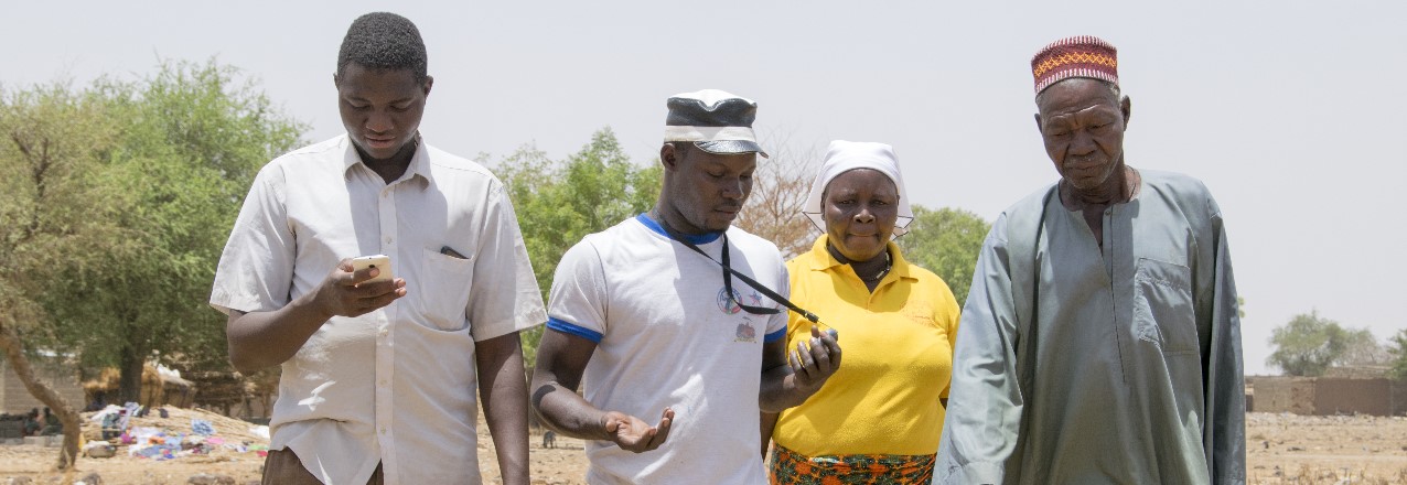
MAST is a suite of innovative mobile technology tools and methods that help communities efficiently, transparently, and affordably map and document their land and resource rights. MAST works through easy-to-use mobile phone applications that empower people to document their own land and resources and to understand their rights. It combines these applications with a robust data management platform to capture and manage land information. This can include names and photos of the people using and occupying land, details about what the land is used for, and information regarding an occupant’s claim to the land. LTS can provide on-the-ground training on MAST to build capacity of communities to document and manage information about their land and resource rights. Training focuses on participatory approaches that ensure communities understand those rights.

How MAST Improves Tenure, Agriculture, and Food Security

MAST’s easy-to-use mobile phone applications and participatory approaches empower local communities, especially vulnerable populations, to clarify their land and resource rights. Doing so, in turn, directly supports key USAID strategic priorities on economic growth, conflict prevention, and food security. Secure land tenure and property rights create incentives that increase long-term investments and boost food security, agricultural productivity and natural resource management. In rural Benin, for example, households that participated in a process to map their land rights had improved tenure security and shifted their focus from subsistence crops to long-term and perennial cash crops. In Ethiopia, the participatory documentation of land rights was found to increase investment in soil and water conservation, which could contribute to improved agricultural productivity and reduced environmental degradation. MAST is a proven, effective tool to strengthen land rights and generate these benefits.

Zambia

In Zambia, USAID’s Tenure and Global Climate Change Program is linking MAST with traditional community engagement practices. These include participatory mapping and support to village governance structures, and improved land-use planning by marrying community information with government records through multi-stakeholder dialogue.

Initial impact evaluation findings from USAID’s randomized control trial in Zambia indicate that the MAST intervention has had a significant and strong effect on perceived tenure security, particularly for female-headed and poor households. These households reported to feel more confident that they could leave their fields fallow longer without threat of encroachment or reallocation.

Tanzania

The USAID Feed the Future Tanzania Land Tenure Assistance Activity is expanding tenure security with MAST technology. Their approach builds off a successful pilot project, which tested an approach for the mapping of land parcels for rural adjudication, which culminated with the delivery of Certificates of Customary Right of Occupancy (CCROs).

To date, over 11,500 parcels have been mapped, and approximately 250 CCROs are being registered per day, with about 4,000 CCROs fully processed. MAST pilot participants in Tanzania, especially women, expressed that they had knowledge of key legal processes as a result of MAST intervention and that they felt that they were less likely to wrongfully lose their land. Other participants noted that they were planning to invest in cash crops.

The MAST Learning Platform

A young woman in Burkina Faso demonstrates how to use MAST on her mobile phone. By: Jeremy Green, USAID Communications and Learning Manager

As part of the LTS Project, the MAST Learning Platform, was launched on the LandLinks website. The MAST Learning Platform is an interactive knowledge management portal that brings together tools, technical documentation, software code, demos, and lessons learned from the implementation of MAST worldwide. Through the MAST Learning Platform, users can access details and lessons learned from current or past MAST projects in Tanzania, Burkina Faso, and Zambia. They can also access guides on how to use the MAST technology and invoke participatory approaches in project design and implementation. The MAST platform features an interactive demonstration of the MAST application used in Tanzania so users can explore how the mobile application functions to inventory and document land information. Users can also find data, access the MAST software code, or even contribute to the MAST software development on Github. The MAST Learning Platform is anticipated to become a living resource and will feature regular updates and contributions from MAST users and projects.

USAID Land Technology Solutions (LTS) Project: Services for USAID Missions and Partners

Using MAST to map and document land in Burkina Faso. By: Jeremy Green, USAID Communications and Learning Manager

The three-year LTS project was specifically designed to support the expansion of MAST into new countries. The LTS project offers a variety of services to USAID Missions and their partners. These include assessments to support the rapid deployment of MAST, design of pilot projects, and training to build capacity at the local, regional and national level in the use of MAST or related land technology solutions.

Examples of Services Offered by the LTS Project

  • Workshops for USAID, host-country government, or NGO actors on how to use land and resource mapping tools to achieve development outcomes
  • Demonstrations, capacity building and training in use of MAST
  • Landscape and feasibility analysis to identify opportunities for use of MAST
  • Land policy, legal and regulatory review
  • Stakeholder engagement and public awareness
  • Development of communications and outreach products
  • Program design, implementation planning and support
  • Development of specifications for country specific land technology solutions, and
  • Design, installation and deployment of customized MAST technology

To learn more, see the LTS Fact Sheet or visit the MAST Learning Platform.

To access LTS services, please contact Ioana Bouvier, USAID E3 Senior Geospatial Analyst and LTS Contracting Officer’s Representative (COR) at ibouvier@usaid.gov or Stephen Brooks, Alternative COR, at sbrooks@usaid.gov.

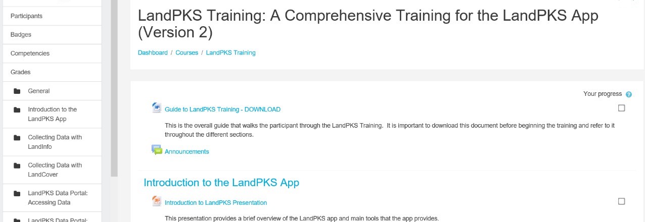
Online Training for Using the LandPKS App – Available Now!

The Land Potential-Knowledge System (LandPKS; landpotential.org), a joint USAID-USDA program, was created to help put valuable information about the land, including climate, soils, and vegetation, in the hands of land managers across the world. LandPKS does this through the use of their free, open-source LandPKS mobile app that allows users to enter data about their land and receive valuable results right on the phone. Sound like a useful tool for you and your work? Want to learn more about using the LandPKS app as well as accessing and interpreting your results on the phone and on the LandPKS Data Portal (portal.landpotential.org)? Now it is as easy as accessing our new online LandPKS training at http://learn.landpotential.org/. You can create an account to track your progress or use the training as a guest. If you have any trouble accessing the training, please contact us as contact@landpotential.org.

We have created this online LandPKS training so that it can be completed by anyone, anywhere, at any time. The LandPKS team gets requests to conduct LandPKS trainings all over the world, and unfortunately we are unable to fulfill most these requests due to time and budgetary constraints. With this online training, now LandPKS users anywhere can complete the online training without waiting for an in-person training or consultation. This makes it easier than ever to learn how to effectively use LandPKS for making more sustainable land use decisions. Upon completion of this training, participants should be able to:

  • Use the app independently when it runs smoothly,
  • Access the Data Portal, and
  • Analyze and interpret the output in specific application contexts.

The online training can be completed in its entirely, or a participant can choose which sections they wish to complete. There are currently seven sections including:

  • Introduction to the LandPKS App
  • Collecting Data with LandInfo
  • Collecting Data with LandCover
  • LandPKS Data Portal: Accessing Data
  • LandPKS Data Portal: Analyzing and Interpreting Data
  • LandPKS Phone Output: Accessing, Analyzing, and Interpreting Data
  • Training Conclusion

Our online training was adapted from the One-Day LandPKS Training that was developed in Nairobi, Kenya by Amy Quandt (LandPKS Global Coordinator), Michaela Buenemann (Associate Professor of Geography, New Mexico State University), and Lillian Ndugu at the Regional Centre for Mapping of Resources for Development (RCMRD). The full One-Day Training Materials are available upon request and meant to guide an instructor in teaching a full in-person training on LandPKS. If you would like access to this full training, please e-mail us at contact@landpotential.org.

A Mobile Application to Secure Land Tenure

Originally appeared on New America’s Future of Property Rights Blog.

There’s an app for that

As smartphones have become ubiquitous over the last decade, an ecosystem of mobile data collection apps has emerged, making the prospect of cheap, crowdsourced data collection more feasible than ever before. Most of these apps have been aimed at users in the developed world, where the use cases impose very different cost and accessibility requirements. An app that only runs on a late-model iPhone, for example, would be unsuitable for community mapping in the developing world no matter its functionality…

In her 2016 Master’s thesis An app for land administration: criteria, functional requirements and a prototype in Ethiopia [PDF], Julinda Dyil of the University of Twente examined 30 of these apps for their suitability for community mapping. The two fundamental requirements she identified were that the apps must be “designed to support poor people and communities” (pro-poor) and “designed to support management of land administration systems” (fit-for-use). Dyli breaks these two requirements down into sixteen criteria. Many of these overlap, and for the sake of simplicity we will distill them them down to four broad criteria:

1) Affordability

The app must be free or very inexpensive. If the purchase price or subscription fee is high, or if the app can only be run on an expensive phone, then it will not be suitable for community mapping.

2) Accessibility

The app must be simple and intuitive to use for people with limited education and literacy. If it is too complex to operate it will not fit into the sort of collaborative, inclusive methodology that is best able to guarantee fairness and transparency. The geospatial data cannot be abstract; it must be tied to a map that shows people what it corresponds to on the ground. The data produced must be in format that is easily shared and read by the different parties involved.

3) Adaptability

Different regions and jurisdictions have different requirements for land and tenure attribute information as well as GPS accuracy. The app must therefore be flexible in its ability to collect both kinds of data. It must be able to collect complex usage and tenure information across the continuum of rights. The app must include forms to enter attribute data, ideally ones that can be customized without programming. Compatibility with external GPS receivers is also important for simple adaptation to regional accuracy standards.

4) Accuracy

The integrity of the information collected must be high so that everyone involved in the process, from the landholder to the government land agency, has trust in the data. The accuracy of the GPS data should be high enough to satisfy legal standards in the area where the mapping takes place, but no higher if increased accuracy will impose greater costs.

Apps designed with these criteria in mind are already being used to record property rights, notably by USAID’s Mobile Application to Secure Tenure (MAST) program.

Read the full post on New America’s blog.