Rewriting a History of Conflict

USAID and the Colombian Government are clearing up land and property conflicts in Cáceres in order to promote a formal land market and spur rural development

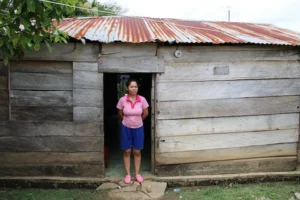
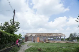
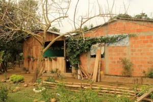
In 2011, Walter Tapia was lucky enough to find a small house near his father in the town of Buenos Aires, located in Cáceres, an isolated municipality in northern Colombia. He put money and sweat into the cinder block house by adding a cement floor, tiling the bathroom, and improving the kitchen’s countertops and backsplash. By 2017, his house felt like a home.

That same year, the owner of the land showed up knocking on his door to ask Walter why he was living in a home built on the owner’s land. Walter never knew the land had a previous owner and the only proof of ownership he had was a notarized compra-venta, denoting how much he paid for the house. Such receipts are typical for property transactions in rural Colombia. Now, Walter faces a difficult negotiation process and a legal battle that he’s not prepared to stage or pay for.

More than a decade before, the mayor of Cáceres had granted a group of empty lots to poor, rural families, but the government provided them with neither a registered land title nor any type of housing subsidies to assist with housing. Unable to build their homes, most of the families moved away in search of other opportunities. Later on, a subsequent mayor provided other families with housing subsidies, and they then unknowingly built on the already spoken for lots.
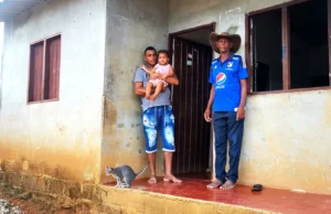
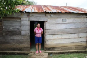
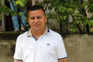
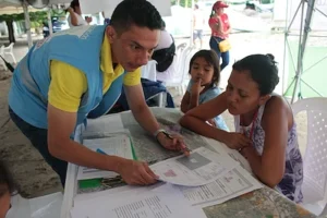
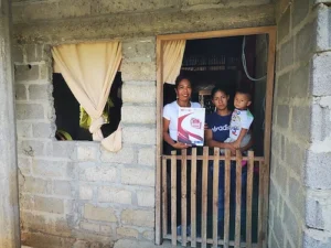
In 2017, Walter Tapia (Left) learned the lot where his house stands has another owner.

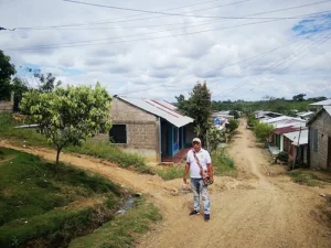
Two doors down lives Walter’s sister. She found out she faces the same issue as Walter, earlier this year. Around the corner there are more, hundreds of cases more. This neighborhood of Buenos Aires is a textbook example of the type of confusion surrounding property ownership in rural municipalities like Cáceres.

“I don’t want to spend any more money on fixing up my house, because I have no idea what is going to happen and I might never see it again,” a dejected Walter says.


A massive property sweep

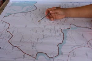
In Cáceres, Colombia’s land administration agencies hope to clear up these types of land conflicts using a land formalization methodology developed by USAID and promoted by the government. The multipurpose cadaster campaign updates the municipality’s official plot map—known as the cadaster—delivers land titles to landowners and brings much needed clarity to property ownership. The campaign, overseen by the National Land Agency (ANT) and supported by USAID, is based on a similar land titling pilot successfully carried out in the municipality of Ovejas, Sucre between 2018 and 2019.


The innovative approach is based on a strategy that integrates social outreach, careful legal analysis, and critical coordination with government agencies to update land ownership information for Cáceres’ more than 11,000 parcels. The methodology has evolved since the Ovejas Pilot, improving through lessons learned, and is proving that a massive approach, which combines titling and cadaster, reduces redundancy. When land entities work together, the government can reduce costs by 60% as well as the time it takes to formalize a property and update the rural cadaster.
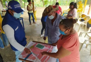
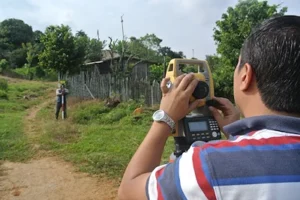
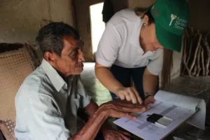
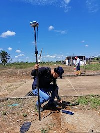
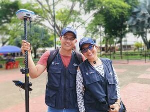
Helping to bring the massive titling endeavor is a team of more than 100 land formalization experts that coordinates with community leaders and triangulates information to the ANT and other agencies. The team is composed of land surveyors, legal experts, and social workers who are well into year two of operation.

In Cáceres, 8 out of 10 properties are informally owned. Properties are typically passed down from generation to generation, abandoned by families due to violence, or been granted by local government, but without land titles. But due to violence stemming from territorial disputes, the last time Colombia’s cadaster authority, IGAC, updated the municipality’s map of properties was in 2003.

To confront the lack of the public’s experience and knowledge related to a formal land market, the campaign employs a robust social strategy that relies on a group of 20 community leaders. The community leaders are essential in order to reach residents with important information about the process and key dates to keep on the calendar.
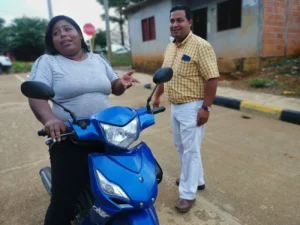
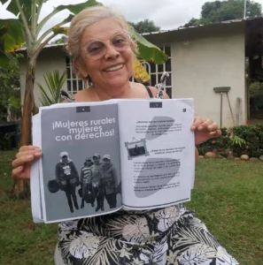
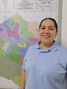
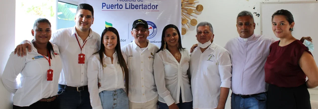
Ana Cristina Marchena, community leader in land formalization

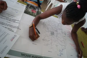
Ana Cristina Marchena is a community leader who lives down the road from Walter Tapia. She is working with the land formalization campaign to prepare residents with the information they need. Marchena and her colleagues received training in basic land tenure policy and how to title a property in Colombia. She prepares residents for exercises in social mapping, assists with locating residents who have been displaced, and helps communities flag major land conflicts in their neighborhoods or towns.

“The campaign’s workers cannot simply go into a rural community. They need somebody who knows the people, and my community recognizes me as a leader because I am always working with women and children. The community trusts me, and I can speak to them in their language,” says Marchena.

Perhaps Marchena’s most important role is as the nexus between the land formalization teams and armed groups who continue to play a role in the lives of so many rural villagers. As a trusted leader, Marchena can communicate with armed actors and prepare villages for the land formalization activities without unexpected episodes of violence resulting in turf wars or misunderstandings.

A far-reaching campaign

USAID is supporting 11 municipal-wide land titling campaigns across Colombia. Each campaign depends on a variety of factors and is expected to require an average of two years to complete implementation. By 2025, the government will have updated more than 115,000 parcels in the national cadaster with the possibility of delivering up to 40,000 land titles.

The updated rural land cadaster will include high-resolution maps defining property borders with more precision than ever before in the region’s history. A detailed cadaster reduces land conflicts and gives the local and regional governments critical information to plan land use strategies and investments that meet the needs of the population.
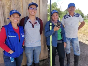
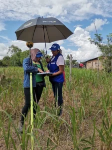


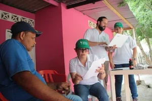
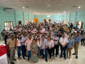
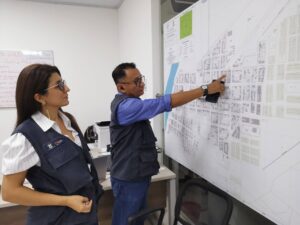
Team of land formalization experts in Colombia.

Beyond land tenure: integrated development
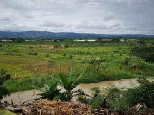
Cáceres has long been of strategic importance to USAID and the government, and this attention has led to a cluster of initiatives. Joint efforts in the territory go beyond the municipality-wide land formalization campaign. USAID’s comprehensive rural development strategy is also developing the capacity of rural producers, such as honey producers in Bajo Cauca, and engaging the private sector to invest in conflict-affected municipalities. By focusing on general issues in rural development, USAID land tenure programming addresses property-related challenges while opening financing routes to reach underfunded areas. This approach bridges the gap between a land title and rural development and helps the government achieve its goals to build self-reliance and promote a more stable, peaceful, and prosperous Colombia.

The new Jerusalem

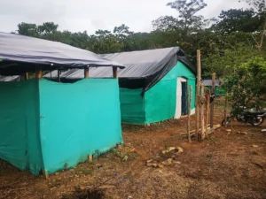
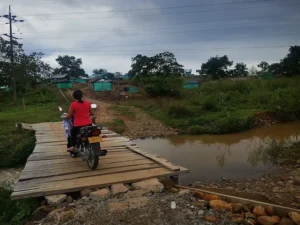
For 800 families, Nuevo Jerusalem is still a dream. The new settlement, located 30 kilometers from Cáceres, Antioquia sees one or two new families arrive every day. Most of them have been displaced from their homes due to the violence and threats that make life impossible in this pocket of rural Colombia known as Bajo Cauca. With nowhere to go, the families attempt to integrate into shanty towns with scrap wood and plastic coverings. Every month, hundreds of people begin their journey to create a home for their families.
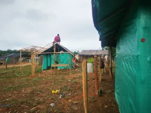
Nuevo Jerusalem paints an accurate picture of how towns are created in today’s Colombia: through invasiones or informal settlements created by internally displaced people (IDP). Colombia is home to a population of more than 6 million IDP—second only to Syria—and has the unfortunate distinction of being the world’s country with the highest number of IDPs and the least number of refugee camps.

With no water, sewage, or electricity, Nuevo Jerusalem will eventually require the municipality of Cáceres to face a problematic reality: find the resources to invest in infrastructure for these displaced families and rezone the land to allow for residential use.

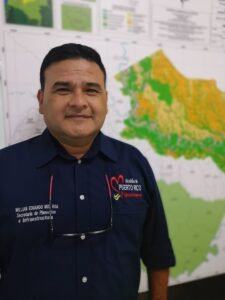
“This is how cities expand in today’s Colombia. The problem is that the municipal government is underfunded and cannot meet the needs of these families,” explains Wilmer Molina, a social worker employed by the Cáceres Municipal Land Office. “On the other hand, the town’s population could mean more than 800 votes, so maybe somebody will help them someday.”

“Unfortunately that’s how Colombia works.”

Through his work, Molina is entwined with Cáceres land issues. He represents one part of a multi-pronged effort supported by USAID to clear up confusion around land ownership, update the municipality’s property cadaster, deliver land titles to residents, and promote a functioning land market. The Municipal Land Office (MLO) is an integral part of Colombia’s National Land Agency’s goal to ensure that the municipality’s 11,000 plus parcels are formalized and reflected in the nation’s rural cadaster. The MLO is located in downtown Cáceres and receives dozens of people each week looking for answers about their properties, laws, and procedures.


© 2022 Land for Prosperity

Cross posted from Land for Prosperity Exposure site

“The Land Office is important, because today everything is geared towards formalizing land.”

Lina Castellanos, Agency for Territorial Renovation in Southern Córdoba, Colombia

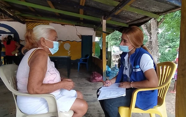
Lina Castellanos has worked in Southern Córdoba for more than ten years, looking for opportunities to support municipal administrations and build their capacities. Under the Rural Development Program with Territorial Approach, known as PDET, the Agency for Territorial Renovation is supporting Municipal Land Offices, created with USAID technical and financial support, to administer property and create an environment for licit economies to grow and all actors can benefit. In this interview, Lina Castellanos talks about land formalization in Southern Córdoba and the role played by Municipal Land Offices.

How can Municipal Land Offices support Puerto Libertador?

The office provides farmers with advice on the formalization of urban and rural property. Thanks to USAID, the office has a lawyer, a topographer, and a social worker who can travel to rural villages and urban areas to help legalize properties. The office also formalizes the properties of public entities such as health centers, schools, police stations, and cemeteries. Often, the government cannot intervene in these properties because they have not been formalized in the name of the municipality yet. This is a barrier to investing in infrastructure or services, and in the end, it affects children and the entire population.

What is the role of the Agency for Territorial Renovation?

We facilitate the process to comply with the PDET approach. We are working with communities that in 2018 said they were interested in the legalization of their parcels and the formalization of schools, health centers and other properties. After celebrating five years since the Peace Accord was signed, these steps to clear ownership are important for the community to access better services, parks, and playgrounds, which all play a role in fighting their recruitment into armed groups, especially for the youth. We have to improve the learning environment, create better opportunities, and promote the good use of free time.

What are some of the characteristics of property in Puerto Libertador?

Puerto Libertador is a big municipality with a lot of mining companies, unlike other areas in Southern Córdoba. Here, a lot of people work and live from mining for many generations. Mining as a way of life has been passed on from generation to generation.

Why is the rate of land ownership so low?

Land tenure is a complex subject, and more than 85% of all properties are informally owned. This is due to several reasons, such as a lack of government presence, history of violence, and the existence of illicit crops.

Why don’t mining communities have access to property?

Today, everything is geared towards formalizing land. This is why the Municipal Land Office is so important in order to empower people when it comes to land formalization. Until now, many people in mining did not have access to any tools for land formalization, and until recently there was no agreement between the municipal administration and the Ministry of Mines and Energy to formalize the land that is used for mining.


“Puerto Libertador has an ocean of needs and with the creation of the municipal land office I believe the voices of the community have been heard by the municipal council. The people who don’t speak up will never be heard.” -Eder Soto, Mayor of Puerto Libertador

What types of conflicts exist because of the mining in Puerto Libertador?

There is a very big social and environmental conflict in the Mina Alacrán village. The community is living straight above the mine’s tunnels, on land that has been conceded to mining companies and that has mining titles. Therefore, these 350 families have to be relocated. But they are not going to leave the area until their rights to housing and land are guaranteed. We have had meetings with the community, land agencies, and the Ombudsman to find solutions.

What role can the Municipal Land Office play in this?

The municipal administration could guide the community and carry out a study to identify which families are living on parcels that are private property or are owned by the government. The history of each parcel needs to be known. With a parcel study, the community would be in a better position to negotiate with the mining company. The Municipal Land Office can also provide legal advice to the community on the process of formalizing property.

Footnotes
Photos by LFP (USAID)
Puerto Libertador, Cordoba, Colombia
© 2022 Land for Prosperity

Cross posted from Land for Prosperity Exposure site

A Law Course that Prepares Future Land Experts

With USAID support, law schools in Cauca, Colombia are promoting courses on land and property administration to respond to a growing need in human resources and expertise in land issues.

At 19 years old, it wasn’t long ago when Faisudy Pechene sat watching her parents farm their land to earn a living for her and her siblings in rural Piendamó, Cauca. The memory is imprinted on her mind, but so are memories of how her family and community suffered from the fear of being displaced due to an unfortunate mix of violence and the lack of formal tenure over the land they called theirs.

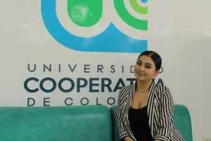
“Many of the farmers that I grew up with never had access to property services. Their land is not formalized, and they don’t have the knowledge about any of this,” says Pechene, a student in her fourth year of law school at the Universidad Cooperativa in Cauca’s capital, Popayan.

“This is one of the reasons I am so interested in land issues” – Feisudy Pechene

The Catedra Payán

Thanks to an initiative created by two Popayan-based universities, Unicomfacauca and Cooperativa de Colombia, and supported by the USAID-funded Land for Prosperity program, Pechene discovered an opportunity to acquire knowledge specific to land laws and policies in Colombia. The Catedra Payán is a new course required by the universities’ law departments that consists of 54 hours of coursework over six months on topics related to public policy in land administration, property formalization, multipurpose cadaster, and land rights for ethnic groups, among others.

“This course appeared at the right time to strengthen what I know about land laws and will prepare me to help people in need in Cauca,” says Pechene.

First Cohort of Land Experts

In September 2022, the first cohort of 25 law students finished the inaugural Catedra Payán, which kicked off in February. With USAID support, the universities aim to train at least two cohorts per year, and the second cohort, of which Pechene is a part, has already begun coursework.

Juan Diego Guerrero is one of the 25 graduates of the Payán Chair and is in his fourth year of law at Unicomfacauca, which means he is about to graduate with a degree and find a job. This diploma not only gives him more security when talking about land issues, but also represents an endorsement when looking for a job in the public sector or with an operator implementing massive land formalization initiatives.

“I am interested in working on a parcel sweep to help those people who do not know the status of their property,” Guerrero says. “Today there are not many professionals who really understand these topics.”


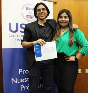
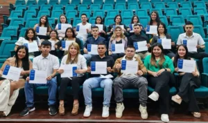
Above, the first cohort of 25 law students finished the Catedra Payán course on Colombian land laws and policies in September 2022. (Middle) Juan Diego Guerrero holds his course completion certification.

Mainstreaming Land Policies

In Colombia, the Unicomfacauca is becoming a pioneer in the development of this type of coursework. What was first an elective course is now a required course for its students, ensuring all law students learn about land issues while they pursue a law degree.

“In Colombia, land represents a long-standing social and cultural problem. With the Catedra Payán, we can strengthen our law students to address these issues and help to meet the objectives of the 2016 Peace Accords,” says Sebastián Toro, Dean of the Faculty of Humanities, Arts, Social Sciences and Education of Unicomfacauca.

The Catedra Payán course is proving to be a successful model that can be replicated by other universities in the country to strengthen the skills of law practitioners and widen a job field in public and private entities related to land administration and land rights advocacy, especially in Cauca where land conflicts persist after centuries of latifundismo and injustice.

Feisudy Pechene will graduate in 2023

“My parents have always told me that if you can help someone you should do it,” says Feisudy Pechene, who will graduate with a law degree in 2023. It’s a motto that Faisudy treasures and that today defines her motivation and driving force to study law, become a lawyer, and dedicate her life to working on issues related to the land rights of underserved rural families in Colombia.

For the past eight years, USAID has provided direct support to the Colombian government to improve land administration in rural areas and implement massive land formalization initiatives to title thousands of rural parcels that families have lived on for years but have never legally owned. Santander de Quilichao, a municipality that lies at the center of Northern Cauca’s many ethnic conflicts over land, is one of the territories being prioritized by the Government to implement this strategy.


Footnotes
Photography by USAID Land for Prosperity
Cauca, Colombia

Cross posted from Land for Prosperity Exposure site
How a Municipal Land Office Leads to Rural Development

Land formalization provides families with legal security and leaders with a wider tax base to improve their communities

The residents in Villa Esperanza can still remember la invasión, which is the word they use in Spanish to describe the day in November 2011 when hundreds of displaced families banded together and occupied a large piece of land that did not belong to them. The parcel, which today is home to more than 850 families, is located on the outskirts of Puerto Libertador, a town located in southern Córdoba in the Caribbean plains of Colombia.

Over a decade ago, Carbón del Caribe, a coal mining company abandoned the land, leaving discarded coal and large piles of dirt in its wake. The new occupants, who were displaced by the violence spurred by narco-trafficking and gold mining, gathered under some of the largest trees and set up makeshift structures covered with palm fronds.

“In the first week, there was a rainstorm that blew our ranchitos away, if it weren’t for the mango trees, we would have had no protection,” explains Jairo Vergara, one of the community’s leaders, whose 10-year-old house still has a dirt floor and no front door.

Villa Esperanza is the latest phenomenon of urbanization taking place in rural parts of Colombia where ongoing violence, a lack of accessible land, and growing mining concessions have left the poor little recourse. This urban poverty in a rural context translates to hundreds of families who cannot access schools, health services, and basic infrastructure.

On top of this, parents like Jairo must worry about shielding their children from joining the illegal armed groups operating in their neighborhood. “These groups infiltrate our barrio, bring money, and recruit the youth. My name has already appeared on four threatening pamphlets, because I defend the children,” he says.


Jairo Vergara (picture on the left) takes a walk through Villa Esperanza in Puerto Libertador. For property issues, a Municipal Land Office can play a role in strengthening the link between the families of San Juan and the government.

Underneath all the problems facing Puerto Libertador’s population, property issues aggravate the confusion. Of the municipality’s nearly 9,000 parcels nearly 70% are not formalized or legalized by the state. This means that the majority of the population does not have any legal guarantees that their land belongs to them. It also means that the municipal administration cannot collect property taxes to invest in improving infrastructure and services. The inability to access new land and to formalize the land they have occupied for decades is a cycle powered by fear and displacement.

“Our municipality has been broken by violence and the payment of property taxes is important to our development. With property taxes, we could invest our own resources in improving the municipality,” says municipal council member, Aristóbulo Ochoa.

Convincing the Council

In Puerto Libertador, where just three out of 10 landowners have a land title, the municipal council is trying to play a stronger role in land administration. The USAID-funded Land for Prosperity Activity is supporting Puerto Libertador with the creation of a Municipal Land Office where a social worker, topographer, and law expert lead the way to formalize urban properties. Before the office’s official launch in November, USAID worked hand-in-hand to build the municipality’s capacity and develop the ordinance that allows the mayor to formalize urban parcels, including those that are located in peri-urban areas like Villa Esperanza.

USAID provided the mayor and his council with expertise and consulting to get the ordinance across the finish line. As part of the negotiation, the council agreed that newly formalized landowners would be exempt from taxes in 2022 and will only begin paying property taxes in 2023.

“The lack of formality in our municipality generates chaos. People buy and sell land and never formalize it,” explains Leonardo Callejas, the municipal council’s current president. “Due to the chaos, there is a culture of no-payment of taxes among our population.”

The Story of Tax Collection

In Colombia, rural municipalities like Puerto Libertador depend on regalías, or the payments made by mining and energy companies to the government, for investments in development. The money is distributed for items like education, health, and infrastructure according to the municipality’s category and needs. The amount of regalías funds disbursed often comes down to the ability of the municipality to mobilize resources.

For example, municipalities that cannot prove rural schools are formalized or show an inventory of its tertiary roads, cannot receive national funding for those items. As such, property taxes, which are levied and collected by the mayor, can provide rural leaders with a critical boost and a way to make investments that improve the quality of life for the general population.

In Ovejas, a rural municipality in the department of Sucre, the former mayor saw property taxes increase significantly in the years following the creation of the local land office. In addition to giving citizens a physical place to go for matters pertaining to property, saving them money and time, the municipal land office grew the municipality’s tax base. In a three year period, Ovejas saw tax revenue increase from 46 million pesos (USD $15,000) in 2016 to 155 million pesos (USD $50,000) in 2018.

“Ovejas invested a considerable amount of money in formalizing urban properties. I would like to say it again, so everybody knows, because these investments aren’t always visible, when compared with investing in cement,” the former mayor, Mauricio García, said back in 2018.


In a three-year period, Ovejas saw tax revenue increase from 46 million pesos (USD $15,000) in 2016 to 155 million pesos (USD $50,000) in 2018.

In Chaparral, a highly populated municipality located in southern Tolima, the current mayor, Hugo Arce, describes the updating and legalization of municipal properties as a “political suicide mission, because people feel like we are putting our hands into their wallets,” he said. “But we did it anyway.”

The strategy seems to have paid off. Arce, who was also mayor between 2012-15, says property taxes increased by 300% over ten years, from 800 million pesos to 3,000 million pesos each year.

“And this has helped us acquire machinery for road work during the rainy season. We had to take the risk and think about the municipality and not just ourselves.”

Foundational Diagnostics

The Municipal Land Office’s first task is carrying out a diagnostic of Puerto Libertador’s existing properties. The analysis has revealed that at least 3,600 parcels are able to be formalized by the office, including 240 public parcels that should be formalized in the name of the municipality, such as schools, health clinics, municipal parks, and city buildings.

In 2022, the Municipal Land Office is targeting 700 properties. Fabian López, the office’s legal specialist, is working with the team to identify the parcels. Each week, the team is approaching communities like Villa Esperanza to raise awareness about land formalization and the benefits and responsibilities of property ownership.

“In the field, all of our activities consist of showing the population that the work of the land office is directly associated with the municipality and linked to a differential approach for women-headed households,” explains López. “Before we start working in the field, it is important to strengthen local institutions.”

Cross posted from Land for Prosperity Exposure site
 

Coordination among USAID programs: a win-win for Colombians

Three USAID programs in Colombia are working together to build the capacity local government to leverage USAID investments, mobilize resources, and improve basic services for rural populations

When people talk about Colombia’s Bajo Cauca region, located north of Medellin, many conjure chapters of the most dramatic violence in the history of the nation’s war. But that perception is changing in Valencia, a small municipality of 42,000 people in Bajo Cauca. In the wake of the 2016 Peace Accords, Valencia has benefited from development programs and become an example of how coordinated efforts made through USAID investments can transform Colombia’s rural territory.

In August, farmers living in the village of Santo Domingo saw how Valencia’s Municipal Land Office delivered land titles to 43 families who had been living on unformalized land for decades. They also witnessed how the local land office titled their health clinic, officially making it a municipal property. The property title is one of the first steps to investing in public goods, since public funds can be spent on health clinics that sit on legalized property. The USAID-funded Land for Prosperity (LFP) is supporting municipalities like Valencia with financial and technical assistance to run local land offices and improve land governance.

USAID Partnerships

“By supporting the Municipal Land Office and land formalization, USAID is also supporting rural development, a in this particular case, improving the local health clinic,” said Héctor Sepúlveda, LFP’s Regional Coordinator of Bajo Cauca Antioqueño, where Valencia is located.

Land for Prosperity is USAID’s largest investment in land tenure programming in the world, aimed at strengthening Colombia’s land administration systems and improving rural development and the conditions of rural households.

“USAID is our strategic partner, both in terms of human resources and the Municipal Land Office,” explains Eliécer Martínez, Valencia’s Secretary of Planning. “USAID provided us with the most modern land survey equipment that is used nationally and internationally.”

Since 2016, USAID has increased its focus on Colombia’s Bajo Cauca region, ensuring that its programs avoid repetition and build on each other’s work. In the case of a health clinic titled by the Municipal Land Office, USAID Responsive Governance Program then structures a project to manage funds for the clinic’s improvements in infrastructure and equipment. Then the USAID Partners for Transparency Program creates a civil society group to oversee the funds invested in adapting the health post.

Under this integrated strategy, USAID programs in Colombia can reach those underfunded municipalities historically affected by the armed conflict with complementary services. While Land for Prosperity increases the government’s capacity for land governance and promotes a culture of formal land ownership, the Responsive Governance program improves the management of public finances while the Partners for Transparency program leverages local capacity and commitment to promote a culture of transparency and accountability.

“We can’t lay a single brick if the property is not titled. Land formalization is the first step. Now that the municipality has the registered land title, we can start building and improving the health clinic.”
– Orlando Benítez, Santo Domingo’s health director

Filling Gaps

Land for Prosperity has facilitated the titling of 10 municipal properties in Valencia, including the Santo Domingo health clinic. In addition, the Municipal Land Office has titled 91 private urban parcels, giving poorer residents land titles for land they have owned for decades.

“In Santo Domingo, we are relieved to be getting a health clinic. We have a school but have been missing a health clinic for a long time,” Benítez says. “It is essential for the community, and thanks to USAID programs for moving this project forward.”

Once built, the health post will benefit more than 2,500 people from Santo Domingo and neighboring villages Cocuelo and Cocuelo Medio. It will have outpatient services, dentistry, and medical check-ups. To see a doctor, the inhabitants of Santo Domingo and neighboring villages must pay 50,000 pesos (USD $12) in travel costs to reach Valencia, which is a lot for a farmer whose income, in the best of cases, reaches USD $500 a month.

“In Valencia, USAID saw the opportunity to work on an identifiable need, which is the health center, then we managed to formalize the property,” says Andrea Olaya, Regional Manager of Land For Prosperity. “Partners for Transparency and its overseers are going to be very attentive to the entry of resources.

Concerted Efforts

USAID has prioritized ten regional integration initiatives including Nariño’s Pacific coast (Tumaco), Bajo Cauca, and Catatumbo (Norte de Santander). USAID is investing in property formalization, strengthening local government capacity, and agriculture, all with a differentiated gender approach that places an emphasis on the needs of rural women.

“USAID’s Regional Integration Initiative is crucial because it seeks the synergy among all the initiatives being implemented to produce a greater impact for the populations,” says Andrea Olaya, Regional Manager of Land for Prosperity.

USAID is supporting 11 municipal-wide land titling campaigns across Colombia. Each campaign depends on a variety of factors and is expected to require an average of two years to complete implementation. By 2025, the government will have updated more than 115,000 parcels in the national cadaster with the possibility of delivering up to 40,000 land titles.


A Health Clinic in Santander de Quilichao, Cauca, titled with support from USAID

In Bajo Cauca, LFP is supporting the municipal wide parcel sweep in Caceres, and Colombia’s National Land Agencies are supporting the parcel sweep in Valencia.

Under the Programs with a Territorial Approach strategy created by the government following the 2016 Peace Accords, places like Valencia have been favored with initiatives managed by the Territorial Renewal Agency (ART) and the municipality.

“In addition to the Land Office, we are highly grateful to USAID programs such as the one that provided us with the road inventory, making us the first and only municipality in Cordoba to have it,” said Valencia’s Secretary of Planning, Eliecer Martinez. “These projects are not physically seen but greatly benefit the people.

Cross posted from Land for Prosperity Exposure site
Off to a Running Start

Volunteer community leaders are building trust and hope among rural citizens and spreading knowledge about land rights

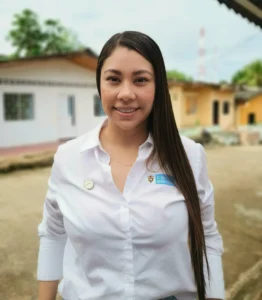
Every morning Luz Estela Velandia wakes up to jog. A spry woman in her late sixties, she is vivacious as ever. She has hundreds of medals from a career in athletics, but these days jogging is as much about her health as it is about her community.

While roosters squawk, she runs by neighboring farms and thinks about her neighbors. She considers a variety of land conflicts common in her village that have split families and divided neighbors. In one family, two brothers are fighting over who gets what land after their father passed away. Over there, a family has built a shack and occupied an empty space next to the dirt road. On another plot of land, which was granted to them by the government in the 90s, some 17 families are living and farming under one single land title, and none can agree on anything.

La Luna is located in the municipality of Fuentedeoro where 6 out of 10 parcels are informally owned. Historically, Colombian land owners are responsible for titling and registering their properties with the state, but due to costs, complicated land laws, and the absence of government services in rural areas, informal land markets thrive.


Some 60% of the properties in Fuentedeoro lack a registered land title. USAID is supporting government to update the land cadaster and deliver land titles.

In La Luna the majority of people do not have a registered property title, and the conflicts seem to be endless. The subject of land tenure has become one of Velandia’s passions. Over the last year, she has learned more about property issues facing her neighbors than ever before. So, when she finds time between jogging, crafting, and leading La Luna’s Community Action Committee, she is teaching people about land rights and how property is titled and administered under Colombia’s arcane laws. Like hundreds of other rural municipalities in Colombia, Fuentedeoro has a decades-long history of violence, tragedy, and the struggle for land rights that has shaped its collective psyche. Under these conditions, reaching the community is not always simple.

“Fuentedeoro is the kind of place where people won’t open the door to strangers or give out personal information. People do not feel safe, and with the recent presidential elections, there is still a lot of uncertainty in the air.
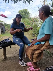
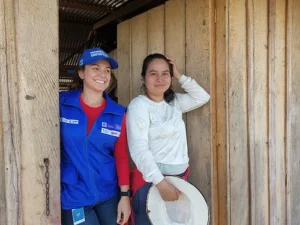
Velandia’s job is to allay some of these fears and assure her neighbors that the government’s objective to increase land tenure security in rural areas is a legitimate, long-term commitment. For the last five years, pressure to title property and strengthen the formal land market has been percolating in the municipality thanks in part to USAID-funded programming to establish a Municipal Land Office and to examine the titling of properties of families living on many parcels under one land title.

In 2021, Velandia became one of dozens of community outreach volunteers raising awareness about land rights, the benefits of land titling, and the ongoing land formalization campaign in Fuentedeoro. As a volunteer, she received training in land formalization issues and social issues with supporting a culture of formal land ownership. The training, which is provided under the USAID funded Land for Prosperity program, includes a kit of teaching tools designed to simplify concepts.

“Before this, I knew nothing about land administration and Colombia’s land laws,” she admits.

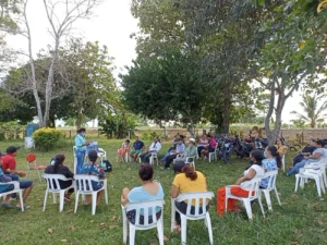
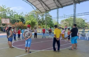
Volunteers and land titling specialists at work in Fuentedeoro, Meta in 2022.

Massive Land Titling

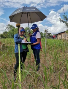
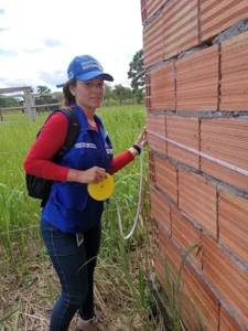
A land surveyor and social worker compare notes in Fuentedeoro, Meta.

Fuentedeoro is one of 11 initiatives funded by USAID and supported by Colombia’s land entities, including the National Land Agency. In total, the Fuentedeoro parcel sweep or barrido predial, as it is commonly referred to in town, aims to net over 2,000 rural property titles for landowners, some of whom have waited 40 years for a registered property title.

Just as important, the campaign will update the municipality’s rural cadaster for more than 6,000 parcels. The cadaster, which was last updated in 2006, is a master chart of all rural properties. Not only have properties changed owners since then, but land has been subdivided among families or sold to newcomers.

This methodology was created and refined by USAID and the Colombian government following the 2016 Peace Accords. Parcel sweeps streamline the collection and processing of property information in order to reduce costs and provide land agencies with integrated and reliable land data. Until recently, neither local nor national government agencies had complete control over this information.

With USAID funding and technical leadership, for the first time ever, Colombia’s three major land administration agencies are cooperating, sharing information, and supporting land titling campaigns to reach a goal of updating more than 100,000 parcels and delivering up to 40,000 land titles over the next five years.

Playing Games

Large land formalization campaigns rely heavily on social workers and outreach, and community liaisons like Luz Estela Velandia are one of the most effective ways to ensure participation. Trusted and motivated neighbors can fill the spaces where the government has been absent. Many in Fuentedeoro have long distrusted the government and believe land titling is just a ploy to take their land away. To overcome this information barrier, Velandia mobilizes her neighbors through neighborhood Whatsapp groups, where she can quickly reach 150 families living in her village.
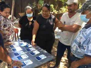
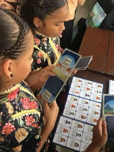
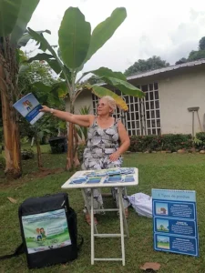
In the groups, she advertises outreach meetings where she then uses the teaching kit, which includes flip charts, games, and puzzles to improve recognition of complicated land topics. The memory matching game, which requires participants to match land administration concepts, is a crowd favorite.

“The kit is didactic and participatory,” she explains. “It has to be this way, because the subject matter is complex, especially for people who may not have a very high level of education.” The teaching resources are also an attraction. In her first outreach event, 60 people came to learn about the land titling.

“One of the first things we learn together is the difference between a registered land title and a carta-venta,” she says. The carta-venta is a notarized receipt typical of a land transaction in rural Colombia. Over three months, she has reached over 100 people with the community crash course in land rights.

Velandia is not always successful. One group of families living on a collective land parcel say they do not want to participate in the massive land titling campaign, which is free of charge. Over the last five years, the families have invested thousands of dollars in a lawyer who claims he will individually title their properties. Though the government cannot force people to title their land, the campaign still updates property information in the rural cadaster.

Benefits of a formal land market

“I tell people that, yes, they will have to pay property taxes, but a land title can also bring them government subsidies, programs, and better services. I tell them a land title represents their rights. And I tell them that women have the same rights as men to appear on a property title as a man.”

These campaigns to title thousands of properties at once form part of the government strategy to move away from a demand-driven land administration policy to one in which the government assumes the cost of first-time formalization. By doing so, it will alleviate major time and cost burdens that prevent most low-income rural landholders from seeking a valid title. Once a property is registered, future title transfers will be much less time and cost intensive. The Fuentedeoro campaign started in October 2021 and will take place over a period of 12-18 months.

For now, community volunteers like Velandia are becoming the government’s most important allies to increase public participation.


The Land for Prosperity Activity is raising awareness about land formalization among citizens and partnering with academic and educational institutions to prepare the next generations of Colombians for a culture of formal land ownership.

Luz Estela Velandia (Left) with fellow outreach volunteers

“The key is personalizing all these relationships. We spend time together and have coffee and teatime and we can be honest about what is happening in our lives. Especially for the women, I give the program more credibility.”

Cross posted from Land for Prosperity Exposure site

Protecting a Public Monument

With USAID support, Puerto Rico, Colombia is strengthening land governance and improving opportunities to invest in public spaces

A Tragic Day

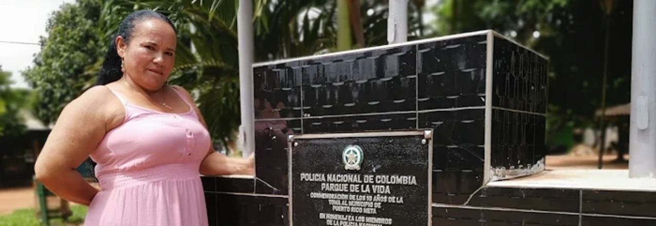
As she walks, Elizabeth Ríos seems to carry images of the guerrilla and paramilitary violence that shook the municipality of Puerto Rico for much of the 1990s and 2000s.

“We had security problems,” says Ríos looking off into the distance, recalling times she doesn’t know how she survived. “One day there were two dead, another day, three. The town was divided until 1999, when the guerrillas took control.”

It was on July 10, 1999, when some 2,000 guerrillas of the FARC’s now defunct 42nd Front stormed and besieged the entrance to Puerto Rico and surrounded the police station, which at the time was staffed by about 30 policemen.

“Those policemen were like cannon fodder,” Ríos still recalls with fear, evoking the images of horror in her mind. “The guerrilla shot them with rifles and threw gas canisters at them.”

The bloodshed ended after a 40-hour siege of the police station leaving five policemen dead. The remaining tired 28 policemen gave up when they had no more ammunition or food and were kidnapped by the insurgents.

For Ríos, who has been a member of the Puerto Rico municipal council for 15 years and knows the history of the conflict in the municipality, the FARC takeover also destroyed the local branch of the Caja Agraria, a gas station, and left the town’s population without electricity. To never forget this difficult chapter, with the support of Ríos and the council, the battle site was converted into a memorial park in 2013.

Untitled Parcels

The Parque de la Vida y de la Paz, as the memorial park is officially known, has a monument commemorating the fallen policemen and those who were kidnapped during the three-day siege. But the parcel of land where the battalion was once located has never been titled in the name of the municipality. In fact, hardly any public properties in Puerto Rico are titled. Following the 2016 Peace Accords signed with the FARC, formalizing public properties became a priority. Clear land rights are necessary for rural development investments. With support from USAID, through the Land for Prosperity program, Puerto Rico titled the parcel where the park stands. The procedure is relatively simple, but no less important.

In 2022, USAID partnered with Puerto Rico leaders to create a Municipal Land Office. In its first six months, the local land office, which is embedded under the municipality’s Secretary of Planning has identified dozens of public parcels in the municipality that cannot receive national or regional funding without a registered land title.

“Legalizing property is fundamental. If not, we find ourselves in this bottleneck that, if they are not legalized, no investment can be made in them. Historically, no one cared about legalizing property, and the land administration process was poorly executed. This is an example of a mistake from the past that brings us consequences today.”-Diana Navarro, Mayor of Puerto Rico
In the Municipality’s Name

With USAID’s support, the Municipal Land Office has titled 10 public properties including the parcels of the Municipality Offices, the Fire Department, Villa García Park, El Morichal school, Villa Suárez Park and the memorial to the police battalion, Parque de la Vida.

“To have a local land office in the municipality, with the support of development partners, is very important,” said Mayor Navarro. “We still need to title 43 schools, four health centers, and another 51 community spaces.”

In addition to legalizing and titling the municipality’s public properties, the Municipal Land Office can title private properties in urban areas. The office’s staff includes land surveyors, lawyers, and social workers who raise awareness and promote a culture of formal land ownership. For the 12,000 inhabitants of Puerto Rico, the office represents a place to go with questions and learn about the land formalization processes. This year, Puerto Rico has already delivered the 32 land titles for urban parcels, all free of charge. The initial goal is to title 400 properties.

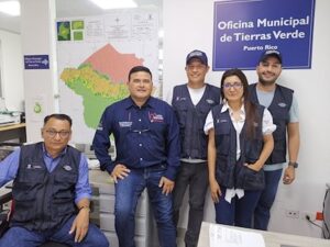
Juan Eduardo Ruiz, Puerto Rico’s Secretary of Planning

Juan Eduardo Ruiz, Puerto Rico’s Secretary of Planning, says it was vital to create a municipal land office in Puerto Rico because the office decentralizes land administration and improves coordination with Colombia’s national land agencies and property registry.

“Before this, the measurements of properties were never accepted by the IGAC’s cadastral offices because of differences, and a cadastral correction process had to be done,” says Secretary Ruiz. “Now we have the capacity to get it right.”

In the Meta Department, USAID is supporting a handful of land offices that have already titled hundreds of properties, including in neighboring Puerto Lleras and Fuentedeoro.

“I already knew about the Fuentedeoro Land Office,” Ruiz said. “I knew Puerto Rico would give strong results with an office here. It has been very well received in the municipality.”

Besides providing land tenure security for families who have lived in Puerto Rico for decades, among other benefits, landowners can access credit and government subsidies to improve their homes or for agricultural projects in rural areas since financial entities are more likely to lend money to people who have a registered property title.

“Now it is essential to legalize property in rural areas”, adds Mayor Navarro. With the resources that come from the payment of the property tax of the legalized properties, the Mayor’s Office will be able to raise money through property taxes to improve basic services in the municipality.

Puerto Rico has already delivered the 32 land titles for urban parcels and aims to title 400 properties.

This blog is cross-posted from the Land for Prosperity exposure site

Putting community land rights first: responsible private-sector divestment in Mozambique

This post originally appeared on Land Portal.

In Mozambique, community land rights are recognised under the country’s progressive land laws. Yet many private-sector companies also hold long-term leases on wide swathes of land that once belonged to communities. Here, Sarah Lowery of USAID’s Land and Resource Governance Division discusses how USAID partnered with agroforestry firm Green Resources to help it responsibly divest its land-use rights back to local communities.

How private-sector leaseholds affect community land rights

Mozambique has a complex history of land tenure that dates back to colonial times. Some private companies were given large tracts of land for development under Portuguese rule and, after independence, those companies retained use rights to that land. Other companies have been granted land concessions in more recent years. Conflicts surrounding these company lands, including the country’s vast plantation forests and the land upon which they stand, have increased over the past 10 years. Although all land in Mozambique is officially owned by the state (as is common in most of sub-Saharan Africa), the country recognises the land-use rights of communities and individuals acquired through customary systems and good faith occupancy, and it allows communities to register those rights. However, over 75 per cent of rural land in the country is unregistered, and millions of rural people are left without secure land tenure. Communities, especially women, are vulnerable to the outcomes of decisions made by government and community leaders who negotiate and make deals with companies, including forestry firms, to use or lease the community’s lands (often without much input from community members).

A recipe for local mistrust

Over the course of several years, the multinational forestry company Green Resources acquired four forestry companies with land-use rights in Mozambique. This gave them land-use rights to 360,000 hectares in Mozambique’s Niassa, Nampula, and Zambezia provinces. With these acquisitions, Green Resources became one of Africa’s largest forestry operators, active in Mozambique, Tanzania, and Uganda.

Yet Green Resources has struggled to manage these vast landholdings in Mozambique. Many of the companies Green Resources purchased had made commitments to local communities that they failed to deliver on, such as building or improving schools, health clinics and infrastructure, and generating employment opportunities. Many of the parcels held by these companies were effectively abandoned after Green Resources acquired the companies. Yet the land was not returned to the communities, increasing feelings of uncertainty and mistrust.

Rebuilding relations: the USAID-Green Resources partnership

By 2019, the amount of scattered landholdings Green Resources had acquired in Mozambique had become a liability and too onerous to manage. The company decided then to disinvest, or relinquish, its land rights to more than 230,000 hectares. Much of the land was never developed into forestry plantations, but some are high-value parcels with existing tree plantations and infrastructure.

Not surprisingly, this process of ceding land-use rights can be fraught with attempts by various parties to grab land or resources. The company’s board was eager to ensure that the return of land was done in an inclusive manner that benefitted local communities. Green Resources wanted to prioritise an approach where local communities could document their rights to the land in parallel with the company’s disinvestment efforts and also ensure that communities were prepared to manage the land.

Over 350,000 people stand to benefit from the land being disinvested by the company across Nampula, Niassa, and Zambezia provinces. To successfully bring to fruition this land disinvestment process that protects communities’ rights, USAID partnered with Green Resources and a number of local civil society organisations (including iTC-F, ANAM Niassa, and Terra Nossa) with expertise in land-tenure documentation.

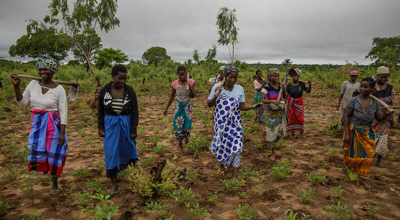
Under USAID’s Integrated Land and Resource Governance (ILRG) programme, communities are supported to clarify community boundaries using a participatory land-documentation methodology known as mobile approaches to secure tenure (MAST). The MAST approach for communities includes: raising communities’ awareness of their rights and the ensuing documentation process; establishing inclusive community land associations that reflect the diversity of communities, including women; physically walking and delimiting communities’ boundaries; leading communities through a participatory land-use planning process that reflects current uses, needs, and a changing climate; and, finally, developing and adopting community-level land-use regulations. The participatory land-use planning process assists communities to look at agricultural practices, water resources and use, as well as environmental risks, which helps them devise mitigation efforts to curb deforestation, reverse erosion, reduce environmental pollution and guarantee sustainable use of the land and forestry resources.

The MAST approach goes beyond delimitation to make sure that the communities can manage their land with transparency and equity, emphasising socially-inclusive and gender-equitable outreach efforts to ensure that women, youth, and other marginalised groups are represented and actively participate and benefit. High-value resources, including standing timber, are transferred to the community associations who are charged with responsible management.

In addition to USAID-supported training on land governance and natural resource management, Green Resources is providing communities with technical support to manage eucalyptus trees on high-value parcels so these resources can be a renewable source of community wealth. Communities that have valuable timber plantations and infrastructure on their land will also receive follow-on support to sustainably manage these resources and run viable businesses.

Impacts and next steps

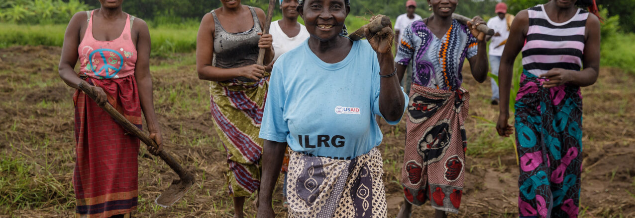
To date, Green Resources has disinvested from 230,000 hectares of land, and USAID and local civil society organisations have helped 86 communities obtain or apply for certificates of community land rights that provide them with secure land tenure. The certificates cover over 466,000 hectares, including both lands renounced by the company and other land that communities historically occupied, benefiting over 200,000 people (52 per cent women).

Some communities adjacent to Green Resources’ land had previously been delimited, and work in these areas has focused on establishing and training community land associations. In total, the USAID-Green Resources partnership has helped 125 communities establish land associations to manage and make decisions regarding communal land and natural resources. Women make up 43 per cent of the associations’ founding members, ensuring their needs are considered now and in the future.

For communities, land delimitation has led to a decrease in conflict. According to Régulo Canhaua, a traditional leader in Mecuburi, Nampula Province:

There used to be community conflicts about land limits and use of the land. Now people know where each village begins and ends.

Having community associations increases accountability and transparency in the use of resources, preventing a small group of people from selling resources for their own benefit. As communities learn to manage newly held natural resources and pursue sustainable resource-based livelihood strategies, they will be able to generate income for long-awaited community development projects such as bridges, clinics, and schools.

This disinvestment initiative is poised to be a win for both Green Resources and communities. The company hopes this effort will help repair broken relationships with and within communities and make its current landholdings more manageable. The communities stand to benefit from the newly relinquished land and existing resources by asserting and formalising their rights to these holdings, reducing land conflicts, and investing in sustainable land and natural resource management practices.

As companies around the world audit their land-based investments and responsibilities to surrounding communities, the concept of responsible land divestment may become increasingly compelling. Whether divesting entire properties due to business closure or downsizing landholdings for other reasons, the process of allowing local communities and stakeholders to participate will reduce opportunities for corruption and empower communities to assert their rights and proactively benefit from their land. These efforts do require enabling policy conditions that allow communities to register their rights to divested landholdings, which necessitates continued engagement with national governments to promote inclusive land governance systems.

For a more in-depth look at the USAID’s private sector partnerships in the land and natural resource space, see the Responsible Land-Based Investments Case Study Series.

From conflict to public-private partnerships: Securing land-use rights and livelihoods in Mozambique

This post originally appeared on LandPortal.

Mozambique’s 1997 land law recognises land rights acquired through customary practice and good faith occupancy, even without a formal title. However, the lack of transparent public confirmation or documentation can lead to conflict. Sr. Land and Resource Governance Advisor Karol Boudreaux discusses how a partnership between USAID and agribusiness Grupo Madal has helped the company and local communities address long-standing land-access issues and improve livelihoods.

What is causing conflict over land rights?

Mozambique’s land laws allow citizens to have their land rights confirmed by the verbal testimony of other community members – and this testimony creates a legal claim that is just as valid as title documentation, even without documented proof. Despite this, the lack of documentation of community and individual land rights can lead to tensions between neighbours over boundaries or rights to specific areas. It also places many Mozambicans in a weak position when investors seek rights to their land for forestry, farming, and other uses.

In central Mozambique’s Zambézia province, due to a lack of available farmland, roughly 50,000 smallholder farmers have started growing their crops on unused land legally held by the agribusiness Grupo Madal. Most of these farmers are women, using small tracts of land to grow mostly food for their families. At the same time, in the communities adjacent to Grupo Madal’s farms, thousands of others have acquired land rights, but very few have documented proof. This lack of documentation has led to tensions and conflicts between people within these communities competing over scarce land.

USAID’s Integrated Land and Resource Governance (ILRG) programme is partnering with Grupo Madal and a local civil society organisation (CSO), the Associação de Apoio ao Desenvolvimento (Development Support Association or NANA) to raise awareness of land and resource rights and improving tenure security, while addressing harmful gender norms and promoting women’s empowerment and economic security.

The USAID-Grupo Madal partnership

In 2016, Grupo Madal changed ownership, prompting a shift away from an estate-based production model, which had been in place since Mozambique’s colonial period, to a more inclusive business model designed to intentionally integrate and benefit neighbouring communities. The company’s new approach has included an initiative to help resource-poor farmers who were using Madal land to transition into a more secure situation. The goal was to help the farmers feed their families and earn income, while providing a source of revenue for the company.

How the public-private partnership works

The partnership initially worked with 3,300 smallholder farmers (over 67% were women) from 14 communities adjacent to four Madal plantations. Through an innovative model for ‘ingrowers’ (mostly landless women farming on Madal land) and ‘outgrowers’ (women and men farmers with land in neighbouring communities), the partnership seeks to include these smallholder farmers in Madal’s supply chains.

After an initial assessment to gauge community needs, the partnership has focused on introducing land-use agreements and farming contracts for ingrower families to strengthen their land-use rights and provide an opportunity to enter commercial value chains to help increase incomes. Families farming on Madal lands now have access to larger plots, allowing them to grow and sell commodities to Madal and grow food crops for household consumption. Madal specifies the crops it requires, provides appropriate inputs and technical advice, and guarantees to buy the resulting harvest.

Madal has also recruited seven community members, four of them women, with farming experience and communication skills to support the company’s extension officers and increase engagement within the communities. Most Madal extension agents are men, so engaging women as community facilitators has improved the company’s ability to reach women farmers. This community-based extension model inspires other women by increasing their technical skills, self-esteem, and confidence.

Now, with greater tenure security, these farmers have also organised themselves into producers’ clubs. “Before, each one of us women farmers worked separately. Now we are organised in producers’ clubs,” said Florinda Francisco, an ingrower farmer. “We have confidence in working with Madal and we want to sell our production to the company because they are the ones who made the land available for us.”

Documenting and managing community lands

Neighbouring outgrower communities have also received help to document their collective land rights and their individual farms. Similar to the ingrower agreement, some may decide to sign contracts to produce crops for Madal, receiving inputs and technical support.

With support from NANA, communities clarify their boundaries using mobile applications to secure tenure (MAST), a participatory land-documentation approach that improves transparency and equity and emphasises social inclusion and gender equality. The approach begins by raising communities’ awareness of their legal land rights. Communities then establish land associations to manage their land and natural resources, engage in participatory land-use planning, and develop community land-use regulations.

Impacts and next steps

Since 2020, the USAID-Madal partnership has mapped 8,000 hectares in 14 communities adjacent to Madal lands through participatory processes, enabling 6,500 families to receive certificates of community land rights from the provincial government. A total of 1,300 ingrower farmers (85% women) have entered into land-use agreements on Madal lands, and 2,000 outgrower farmers (55% women) have delimited their family lands, opening up opportunities for them to benefit from contract farming.

The partnership’s approach to strengthen land claims and build trusting and beneficial relationships between companies and neighbouring farmers is uncommon in Mozambique. It has the potential to create a viable model for responsible land-based investment that benefits private-sector actors and communities, and improves women’s economic security. The Mozambique Ministry of Agriculture and Rural Development has already expressed interest in supporting expansion of this innovative model to other companies and provinces.

Grupo Madal sees this activity as a major opportunity to clarify land rights and build trust with communities. The partnership has helped Madal to focus on rehabilitating its historically unused landholdings and integrating communities into their supply chain with benefits for both. The company has also welcomed USAID’s support in engaging with farmers – most of whom are women – in a gender-responsive way.

Sensitising private companies to land-related issues and supporting them to set up inclusive models can benefit communities and help secure their long-term rights to access and use land. Despite inherent power imbalances, with support, farmers can work with companies to clarify their land holdings, giving them the security they need to invest in their plots. Smallholders can also increase their access to inputs, technical skills, and markets, thereby improving their livelihoods, food security, and well-being. Public-private partnerships can be particularly beneficial for women, allowing them to feed their families while helping to earn additional income. Working with companies and CSOs can help ensure community rights and needs are considered, and help aggregate community voices for greater impact. Further support from the Government of Mozambique is essential to scale-up and institutionalise these approaches. Taking this holistic approach, USAID is helping improve livelihoods for thousands of Mozambique’s women and men.

Natural Climate Solutions: How Spatial Data Can Help Prioritize Land-Based Climate Mitigation Investments

USAID’s Sustainable Landscape Opportunity Analyses (SLOAs) provide an overview of options available to reduce greenhouse gas emissions from land conservation, management, and restoration. SLOAs are created through a collaborative process with USAID Missions to help develop programming that aims to reduce carbon emissions and/or increase carbon sequestration. They provide an assessment of land-based climate mitigation opportunities at the national and sub-national level, reflecting the biophysical potential of the land, as well as potential priorities and constraints on different mitigation pathways.

To accompany the SLOA for Papua New Guinea (PNG), USAID has developed a new Geospatial Companion that can assist USAID/PNG in leveraging its SLOA findings for spatial planning, as described below. The Geospatial Companion is a visual tool that brings the maps and data included in the SLOA, as well as additional datasets as applicable, to life as dynamic resources that can be updated to reflect changes in information or priorities. Its user-friendly maps and data can be manipulated and combined to help decision makers visualize and identify where investments in land-based climate mitigation can be most effective, as well as help decision makers integrate climate outcomes with other development priorities. This Geospatial Companion can also serve as a model for the development of other SLOA Geospatial Companions in assisting USAID Missions and partners in leveraging SLOA findings.

SLOA Geospatial Companion: Papua New Guinea

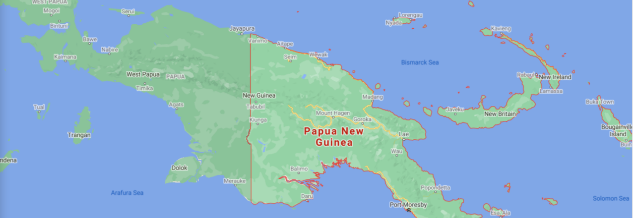
The island of New Guinea hosts the third largest expanse of tropical rainforests on the planet, among other geographically diverse terrestrial and aquatic environments. PNG comprises the eastern half of the island and is the largest Pacific Island country both by landmass and population. The country has pledged to completely end deforestation by the year 2030 to combat climate change. At the same time, it is undertaking large road and electricity infrastructure projects to spur economic growth and address widespread poverty.

Understanding where to prioritize investments in PNG to most effectively make advancements in land-based climate mitigation efforts is complicated. There are a wide variety of land governance systems that exist for different types of land resources—from protected areas to agriculture concessions. Furthermore, among the country’s population of over 10 million people, more than 850 languages are spoken and there are more than 600 distinct tribes, each with their own traditional land governance rules.

To effectively support both PNG’s economic development and the country’s international commitment to protect its forests, USAID’s Geospatial Companion integrates and analyzes land-based climate mitigation datasets together with USAID geographic and programming priorities. It features maps of datasets that are referenced in the PNG SLOA and also includes additional information, such as the forest cover loss “hotspots” shown in Figure 1.

Looking at the SLOA data alongside complementary datasets allows users to visualize trade-offs or opportunities to develop programming that combines emissions reductions with other priority outcomes, such as biodiversity conservation (Figure 2) or infrastructure development. Dedicated climate change mitigation programs, as well as contributions from other development sector programs, are necessary for achieving USAID’s target of reducing, avoiding, or sequestering six billion metric tons of carbon dioxide equivalent emissions by 2030.

The Geospatial Companion data and maps are part of a larger package of support that can be provided to USAID Missions. The scenario map shown in Figure 2 is one example–iIt is based on a spatial model that considers multiple criteria to identify locations where the potential for both climate mitigation and conservation benefits are highest.

Figure 2: By combining and strategically weighting different datasets in a spatial model, locations are identified where the potential for both climate mitigation and conservation benefits is highest.
Credit: USAID

The Power of Geospatial Information
Understanding the geographic scope of where the most effective mitigation opportunities might exist under a variety of scenarios can be extremely complex and difficult to conceptualize. In addition, a number of important local factors that are critical to sustainable and resilient development programming could be overlooked without proper analysis. Maps and spatial data are powerful tools to visualize this kind of complex information in space and time.

The SLOA Geospatial Companion helps guide USAID decision-making and is designed to improve the efficacy of USAID programming related to land-based climate mitigation and biodiversity conservation on the ground. Its scenarios can help USAID Missions and operating units identify pathways for reducing emissions while also responding to other development challenges. In PNG, the Geospatial Companion shows at a glance where climate mitigation potential, biodiversity, and land rights intersect. In other regions, governance, health, livelihoods, population, agriculture, water stress, energy, infrastructure, or other types of data might be used to determine further opportunities for increased climate action.