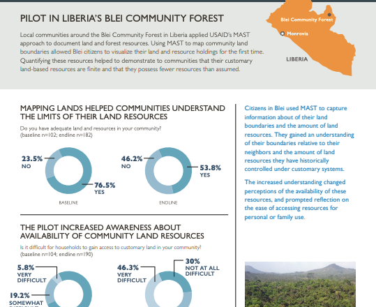
PILOT IN LIBERIA’S BLEI COMMUNITY FOREST
Local communities around the Blei Community Forest in Liberia applied USAID’s MAST approach to document land and forest resources. Using MAST to map community land boundaries allowed Blei citizens to visualize their land and resource holdings for the first time. Quantifying these resources helped to demonstrate to communities that their customary land-based resources are finite and that they possess fewer resources than assumed.