A visionary information-sharing platform promises to reshape the Colombian government’s approach to land restitution.
The tide is turning. Ten government agencies responsible for Colombia’s land-related issues are meeting regularly, bringing their engineers, their lawyers, and their administrators to do something that Colombia has never done: allow the real-time exchange of information among a group of institutions working on a common issue.
This ambitious endeavor, dubbed the Land Node, is the government’s official response to Colombia’s Victims Law, which requires that certain land-related agencies share information in real time to facilitate the land restitution process for victims of the armed conflict.
“I can’t imagine a future where people have to wait in lines to have their rights recognized, when we have the technology to avoid that,” says Luis Alberto Clavijo, director of technology at the Land Restitution Unit (LRU). “In the commercial and financial worlds, people often don’t even have to leave their houses. Why can’t it be the same for land services? Either we change the way things are being done, or the state isn’t doing its job.”
The “end users” Clavijo is referring to are the thousands of victims of dispossession or displacement who need to fill out their applications in paper at a local land restitution office to initiate the process for getting their land back. This is one of the things the Land Node seeks to change.
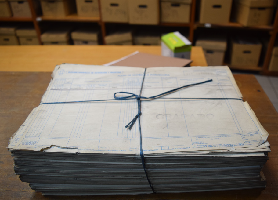
But the real headaches are the silent and agonizing ones on the “provider” side: the onerous delays involved in the requesting, mailing, authorizing, and exchanging of information between agencies. This is where the Land Node seeks to be a pioneer.“Right now, when the Land Restitution Unit needs a certain kind of information for a victim’s case, we send a letter to the entity that has that information,” explains Clavijo. “For example, if I need a property registration file, I send a letter to the public registry office asking for the file. The recipient must then search for the file and take whatever other steps are necessary to release the information.” Then, of course, that person needs to mail the information back to the restitution office.
Each restitution case can involve several requests for information needed to build a victim’s case. For instance, the LRU or a restitution judge might need testimony about a victim’s displacement (information housed by the Attorney General’s Office), information on the presence of land mines (housed by Daicma, the agency charged with taking action to eliminate land mines), cartographic information (housed by the Agustin Codazzi Geographic Institute), or copies of property titles (housed by public registry offices).
Colombian law gives these entities ten days to respond to information requests emanating from the LRU or a restitution judge. But when it can take several days simply for a letter to travel from one place to another, deadlines are rarely met. The Land Node will eliminate this barrier by making land information available through a few clicks of the mouse. It will also protect the integrity of land information by making it electronic; when such information is managed only on paper, it is vulnerable to modification by unscrupulous individuals.
What this means for government workers and restitution judges throughout the country is no more letter writing, stamp licking, or endless waiting for information to arrive. What it means for victims is less time spent in limbo; it means rebuilding their lives sooner rather than later.
Behind the Scenes
Bringing together so many government entities to build the Land Node has not been easy. But as Clavijo points out, “It’s a process where everyone is an equal. No one entity has more privileges than the other.”
Because the Node has been framed as a solution to a common need—the need for all government entities to respond rapidly to information requests—its members have put their institutional differences aside to build it. They have also learned from previous mistakes: earlier efforts to overhaul processes related to information management and sharing were unsuccessful in large part because of institutions’ unwillingness to cede control over the information they manage.
In addition, the coordinating role played by USAID has lent an air of neutrality to the project. “USAID has contributed a specialized and comprehensive team that has taken the lead in supporting each member every step of the way,” says Carlos Ernesto Jaramillo, deputy director of the National Information Network, which houses information on victims of the armed conflict. “USAID’s advice and orientation are taking the Node down a path toward the benefit of victims of displacement and forced abandonment.”
To date, USAID has invested approximately US$2.5 million in the Land Node, including software, architecture, and the digitization of paper-based files. Once the software and architecture are complete, they will be transferred to and maintained by the Colombian government. In addition, although the Land Node is being created to respond to a specific and immediate need regarding restitution, after the Victims Law has run its course in 2021, the network will remain available to facilitate interinstitutional information sharing for other purposes related to land administration.
A Techie’s Challenge
The Land Node’s technical requirements are intimidating, even for seasoned engineers. It is not as simple as connecting the databases of different institutions. Challenges include determining who has permission to view what information; ensuring the security of data so it doesn’t get intercepted by unauthorized third parties; being able to track the users within each entity who are downloading data; being able to share files while also retaining control over their content; and digitizing millions of paper-based files to make the information electronically accessible in the first place.
And perhaps most challenging of all is making ten data management systems communicate with one another in the same language.
“This particular aspect of the node requires extremely specific technological skills,” explains Oscar Montañez, the Node’s project manager. “At the same time, it requires a great deal of tact—being able to communicate clearly with all of the entities so they can agree on how to implement the network.”
These and other complexities will be resolved by the time the Land Node is launched in 2018. Currently, the Node is over halfway complete, and a pilot project has recently made a small portion of the Land Node operational immediately.