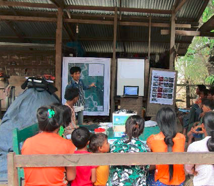
Political transitions in Burma are creating new opportunities for local organizations to engage as intermediaries between community members and local government authorities. USAID is supporting four such organizations to implement participatory community resource documentation activities in four regions of Burma: Ayeyarwaddy, Shan, Sagaing, and Bago. These activities involve community-led participatory mapping to support land dispute resolution, land use planning and clarifications of community resource rights. This type of bottom-up, participatory approach is new to Burma’s rapidly changing context and introduces new challenges to local organizations. To help bridge these gaps, USAID’s Land Tenure Project (LTP) staff provide a mix of formal trainings and field-based technical assistance to build the capacity of these organizations. Trainings focus on skills to implement field-based interviews for land resource assessments, mobile data collection, fundamentals of photography, participatory mapping, and geographic information systems (GIS).
Soe Naing Htay, a training participant who works for the Myanmar Institute for Integrated Development, said, “Before I joined to trainings provided by LTP, mapping was quite a new subject to me. But after being participating at several trainings broadens my knowledge and spurs my curiosity on mapping technologies.”
Formal training builds critical skills for land tenure partners and develops a network of local organizations that can be service providers capable of addressing land tenure issues in Burma. While building mapping skills, LTP project staff also support and develop each organization’s ability to engage with government stakeholders for recognition of mapping efforts. This effort is fundamental to building trust and constructive relationships among the government, civil society, and local communities – a critical element for Burma’s continued development.

