Discussions on tree tenure law and policy in Ghana revolve around the exploitation of timber with little policy debate on tenure of other forest products. This brief examines existing policies on timber exploitation and the reforms that are currently being proposed. It is informed by consultant reports commissioned by the Forestry Commission (FC) and tentative findings garnered from a pilot undertaken under the Tenure and Global Climate Change (TGCC) Program in Nyame Nnae, a cocoa farming community in the Asankrangwa district of Ghana. This brief argues that Ghana’s timber policy has produced unintended outcomes and has never been aligned with the interests of customary landowners whose land management decisions have a direct impact on forest cover. Reforms being proposed skirt the main cause of the problem, create additional administrative hurdles for farmers and the FC, and do not address perverse incentives that work against landowner and farmer interests. This brief argues that to effectively create a balanced and sustainable sector, tree tenure law and policy needs to be simplified and re-aligned with the interests of landowners and farmers by transferring rights to all natural and planted trees to customary landowners off-reserve.
Document Type: Briefs
LRDP Success Story: Putting Public Land on Display
How strengthening the capacity of local governments to formalize land opens doors to investment and rural development.
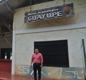
The small town of Puerto Santander anxiously awaited the installation of its first sewage system when city workers unearthed quite the surprise. Calcified human bones, ceramic shards, and urns turned up in a layer of sediment less than a meter below the surface. It turns out the town, which borders the Ariari River in Meta, sits on land that was once a burial ground for the ancient Guayupe people.
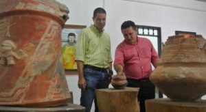
Following the discovery, residents began digging up their yards, yielding fascinating pieces like bowls, tools, and funeral urns with ornate designs depicting bats with human characteristics. At first, they stored all these pieces in a room behind the police station. Eventually, they converted this room into a makeshift museum. But due to humidity and a lack of protection, some of the pieces began falling apart.
Oscar Ortiz, who lives in the area, began to worry about losing what up until that point was arguably the most important archaeological discovery in the region of Meta.
“It was hard to find help to support this initiative. We had experts visit who taught the community the importance of not moving artifacts from the ground,” explains Ortiz, who is now the museum’s tour guide and de facto curator. “Much of our knowledge of the Guayupe depends on carbon dating, and when the pieces are not carefully handled, we lose that history.”
In 2001, the Fuentedeoro municipal government spent its own money to convert the police stand into a small museum. However, the land on which the police station stands had never been formalized, and this lack of a registered property title made it difficult for the municipality to mobilize funds from regional and national government agencies to invest in the museum.
Until today, the museum has financed its activities with money from entry fees and donations. In 2016, more than 1,500 visitors walked through its doors. Ortiz continued to advocate for formalizing the land in the name of the municipality so that investments could be substantially increased, but the municipality lacked the experience and technical expertise to make it happen.
A Model for a Land Office
In 2016, Fuentedeoro’s mayor, Antonio Londoño, joined a group of mayors and land administrators in Santander de Quilichao, Cauca, to learn about their experience establishing and running a municipal land office. The USAID funded Land and Rural Development Program is currently spearheading the municipal land office concept, which forms a critical part of a larger land formalization strategy in partnership with regional and national land agencies. By adding a land formalization team to the municipality, mayors can title and register lands that house public properties in the name of the municipality, thereby enabling public investment and boosting rural development.
In early 2017, Fuentedeoro’s mayor created a municipal land office using existing financial and human resources within his administration. The team first made a diagnosis of the municipality’s more than 400 public properties to decide which ones to tackle first. In 2017, the five-person formalization team has already titled 16 public properties, including the Guayupe Museum, health clinics, a cemetery, and public parks.
Throughout Colombia, municipalities have traditionally lacked this type of capacity, in part due to insufficient funds and capacity. Further, decades of informality have meant that there are few records in place documenting each property’s history. In many cases, local residents with large landholdings donated the land, but legally speaking, the ownership of the properties is anything but clear.
“If we don’t change the mentality of public administration, Colombian mayors will never realize that the municipality can also title public properties for itself. Until that happens, they will continue following the old model, which involves hiring lawyers and surveyors to do the work,” says Juan Pablo Bernal, the legal expert in Fuentedeoro’s municipal land office.
Unlocking Investment
Now that the mayor’s team has momentum, it expects to title 40 properties in the name of the municipality by 2019. In addition, the formalization team is reorganizing the chaotic state of a series of community housing projects in Fuentedeoro that sit on land donated by the municipality.
“The cadastral information doesn’t match up with the reality of where properties are located. For example, the large park in the middle of the neighborhood is located in a different neighborhood than what is indicated in the cadaster. It’s our job to sort that out,” says Bernal.
In addition to providing technical assistance to the municipal land office, USAID is supporting the land survey team working on the community housing project, which will provide homes for 300 low-income families.
Now that the Guayupe Museum has a proper land title, the museum’s curator, Oscar Ortiz, is working with the regional government to access funding from the Ministry of Culture—hopefully enough to establish a curatorial work plan, including the hardware and installations needed to improve the protection and preservation of the Guayupe artifacts.
“These pieces should be of cultural interest to all Colombians, and we and the government share the responsibility to protect them,” says Ortiz.
LRDP Success Story: Ownership, Simplified
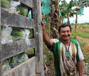 In the wake of the country’s agrarian reforms, thousands of farmers were granted collective ownership of land to boost farmer cooperatives. Many of these businesses never came to fruition, and today the farmers are in an ownership arrangement that makes life difficult for them. In partnership with the government, a USAID land program is disentangling the legal web to deliver individual property titles in Meta.
In 1997, the Colombian government gave Laurencio Avila and 19 other farmers a collective land grant to be divided amongst themselves and their families. The land had not been farmed, though some used it for grazing. The nearest main road was still not paved, and there was no access to basic services like water and electricity. Over ten kilometers away from the municipality center of Fuentedeoro, the 165 hectares of land, known as La Española, felt very isolated.
“We established a main camp up on that hill and started preparing the soil,” explains Avila. Under the deal, each farmer received eight hectares of land and agreed to create an association that would eventually become a cooperative to increase their ability to negotiate with buyers.
The group, which calls itself Asoproes, got off to a rocky start. With no previous experience in running a business this large, members made accusations against one another, and the project slowly fell apart. To make matters worse, the association’s president was disappeared by paramilitaries. Every year, the association had issues with members who could not pay their share of land taxes on time. Soon, the group began looking for ways to turn their communal property into individual parcels; a land title for each family.
“It was embarrassing, because we were these supposedly lucky beneficiaries, and everybody would ask us why we were still poor,” says Avila.
The group sent Julio Cesar Serrano, who was then emerging as the association’s new leader, to Bogotá to meet with public servants from former land administration entity, INCORA, to figure out what they needed to do to get individual property titles. In addition to giving the farmers more power over their futures, property titles are critical for opening doors to financing for rural citizens. Without individual titles, the farmers were losing bank credits that could help them buy inputs or hire labor at the right time. More than 15 years went by with little progress.
“Just two weeks ago, I went to the bank to ask for a loan, but without a cosigner, I don’t qualify. If I had a land title, the evolution of our business would be different,” explains Avila. “Eight million pesos I would have used to buy inputs and hire manual labor. Every year it’s the same, with no capital, the risk of loss is greater.”
Campaigning on Property Rights
In 2015, USAID partnered with Colombia’s leading land administration agencies and local authorities in Fuentedeoro to strengthen institutions and remove some of the bottlenecks in the land formalization process. USAID found a strong ally in the mayor of Fuentedeoro, Alberto Londoño, who in 2016 won the mayoral race with a campaign based on stronger property rights, pledging support for the more than 160 families in the same situation as Avila and his colleagues from La Española.
“I realized that property rights were becoming a major issue for the people of Fuentedeoro. And not just the parceleros [collective landholders], but here in town as well,” says Londoño. “I promised the municipality that I would coordinate this work with the national government or look for a solution with international partners, like USAID.”
When Londoño came into office, the USAID-funded Land and Rural Development Program was looking for motivated partners to work on land formalization issues. While USAID and the National Land Agency worked to disentangle the properties of those families living on communal parcels, Londoño and his administration created a land formalization group within the municipal government. This office took up municipal land titling matters and gave Fuentedeoro’s population a place to go to get answers on property issues.
In addition, the land formalization team served as a liaison to connect the families on the parcels and the USAID contracted experts formalizing their properties.
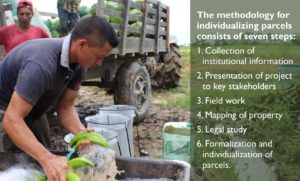
“First, we went to each communal parcel to check if they wanted to participate. One group said no, since at some point they contracted a lawyer to title their properties. As a land office, our job is to ensure they understood the necessary actions and targeted outcomes,” explains Juan Pablo Bernal, the land office legal expert. In September 2017, USAID helped the 20 farmers from La Española send paperwork to a judge who is expected to issue a ruling on their property request by early 2018. USAID’s methodology to individualize these properties will give the National Land Agency the legal pathway to begin delivering land titles to the more than 50,000 households in Colombia that face the same situation.
Business Contacts
Laurencio Avila and the other farmers from La Española specialize in the production of plantain, and every year they alternate their plantain fields with rice. The lack of access to credit remains their main concern, but climate change, flooding from the nearby Ariari River, and few reliable sales channels also concern them.
To consolidate the sustainability of these formalization activities, USAID has created a series of public-private partnerships in Meta that triangulate support from regional governments with local governments and the private sector. Since 2015, three such partnerships have mobilized investments of nearly US$500,000 and reached some 300 farmers in the milk, plantain, and cacao value chains.
The plantain partnership, which will take place over the next six months, includes investments from both the municipal and departmental governments to provide technical assistance to improve plantain production and quality for more than 100 farmers. Avila and five farmers from La Española are participating in the partnership and attend a farmer’s field school session once a week, where they sharpen their multiplication skills and learn about fertilization and pest management.
Once Avila’s land title is secure, he plans to go back to the same bank for a loan. In addition, he will be able to access government programs and farming subsidies, maximizing the potential of the plantain PPP to bring real changes to the welfare of these families.
“Let’s just say that we ran out of places to go for help. The program came, and now we have high expectations,” says Avila.
ARDS Success Story: Land of Plenty: Helping Communities Realize the Benefits of Rural Land
A result of the Ukrainian Government decentralization program is the establishment of 665 Consolidated Territorial Communities (CTCs), new rural units comprised of small communities, with decision-making powers and budgets transferred from central state authorities. 87 percent of CTCs heads report positive effects of the reform according to a July 2017 DESPRO survey.
Land resources are the main source for rural economic development and CTC budget revenues, but 95 percent of CTCs described limited abilities to manage land.
Understanding that effectively managing land is both a challenge and growth opportunity for CTCs nationwide, Agriculture and Rural Development Support (ARDS) designed and supported a pilot project to establish a CTC-level electronic land management system combined with the creation of local economic development strategies. The pilot in the Kipti CTC, a typically-sized CTC comprised of 12 villages, 5,500 people, and 29,5000 hectares, had three goals: obtaining and archiving data on quality and quantity of land resources; creating a plan for efficient land use that addresses CTC needs and is compliant with environmental legislation; and increasing land use efficiency, enabling CTCs to manage community-owned land.
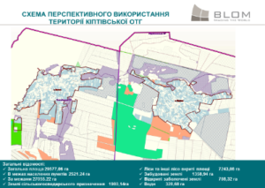
The first project of its kind in Ukraine, the Kipti pilot has become a model for local land management:
- The electronic land management system allows for immediate access on available land, resources, property, infrastructure, and land use restrictions. The Kipti CTC electronic land management system revealed that just by renting available land, UAH 1.8 million in taxes could be generated for the CTC’s budget. This is significant for Ukraine when multiplied across the other 412 CTCs.
- The system proved to be an efficient tool for engaging the public in land management, and identifying new economic opportunities and for attracting local investments.
The system helped the Kipti CTC develop solutions for citizen needs, e.g. waste management and infrastructure. - The pilot helped Kipti CTC create a viable local economic development strategy based on efficient land use that balances the interests of citizens, businesses, and the community.
- The effort fostered community leadership and citizen behavior change: CTC witnessed proactive engagement by the CTC and citizens in CTC management and community wellbeing and future growth.
Based on lessons learned across the pilot elements – community engagement, electronic land management systems, and local economic strategy development – ARDS has developed a toolkit for CTCs nationwide to guide community leaders on more effective land use and strategic planning.
The pilot also helped identify regulatory and legislative steps which need to be taken to fully enable land management systems for all CTCs.
LTA Success Story: 359 Kinywang’anga Village Residents to Receive CCROs
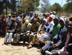
For the first time since Tanzania’s (or at that time, Tanganyika’s) independence in 1961, 359 people of Kinywang’anga Village in Iringa Rural District will receive a certificate of customary right of occupancy (CCRO) that gives them formal legal rights and secure tenure as the owners of their land since before colonialism. While Tanzania’s legal framework provides clear land tenure protections, the reality is that most villagers do not have a CCRO for their land, and the district government offices responsible for issuing CCROs often lack the capacity and resources to complete them. Furthermore, many villages have not yet completed the village land use management plans that are a prerequisite for CCRO issuance.
In September 2016, the Feed the Future Tanzania Land Tenure Assistance activity (LTA) in partnership with the Iringa District Department of Land and Natural Resources successfully completed fieldwork in the project’s first target village, Kinywang’anga. A total of 359 villagers registered land claims to 838 parcels. The average number of parcels per claimant was 2.5, but individuals claimed between one and 12 parcels. Women comprised 55 percent of claimants, and 21 percent of the claimants were young people (under 35 years). Secure tenure for women and youth provides empowerment and can catalyze agricultural investment and economic growth especially for vulnerable households.
The LTA team introduced themselves to the Kinywang’anga Village Council on July 19, 2016. The Village Council was very excited and motivated to participate and they quickly nominated the members of the Village Adjudication Committee. Together with LTA Field Manager Mustapha Issa, they selected 10 youth to be trained as para-surveyors which are individuals with the skills to utilize mobile platforms for land parcel boundary mapping, but who lack the formal training necessary to receive licensing as a professional surveyor. The Village Council organized a village assembly on July 22, during which the LTA team trained all participants in the Village Land Act No. 5, and the process that LTA and the District Land Office (DLO) would use to map and register all the claims in the village.
A five-day intensive training was given to the Village Council, Adjudication Committee, and parasurveyors using the Mobile Application to Secure Tenure (MAST), a mobile mapping technology that makes it easy and fast to create maps of parcel boundaries.
The para-surveyors, adjudicators, and hamlet leaders met with each one of the 359 claimants on their land during a one month period. Together they walked around the boundaries of each parcel, using an Android tablet and the MAST application to create a map of the parcel. The adjudicators recorded all the details about the claimants, including their choice of tenancy (e.g. single or joint tenancy).
The LTA team worked with the DLO to analyze the data and to create large public displays of all of the parcel maps and the claimant information. The maps and information were displayed at the Village Executive Office for the “objections and corrections” period. During this period, all claimants were responsible to verify that the parcel map and the claimant information were correct, and to request any changes.
Now that all the information and maps are ready, the DLO will prepare the CCROs to be delivered soon to the land owners in Kinywang’anga Village.
The Feed the Future Tanzania Land Tenure Assistance activity will support district and village authorities to complete village land use management plans and issue 50,000 CCROs in 41 villages in Iringa Rural and Mbeya Districts. LTA will collaborate with and build districts’ capacity to develop a comprehensive system for community-based, low-cost, large scale first registration/regularization of land tenure that will be replicable, scalable, and sustainable for future implementation by the Tanzanian Ministry of Lands (MLHSSD).
It is envisioned that such large scale issuance of CCROs in rural villages will reduce land tenure-related risks and lay the groundwork for sustainable agricultural investment for both smallholders and commercial investors, particularly in the Southern Agricultural Growth Corridor of Tanzania (SAGCOT), and in the value chains of focus for Feed the Future’s activities in Tanzania.
LTA Success Story: Kinywang’anga Women Realize their Land Rights
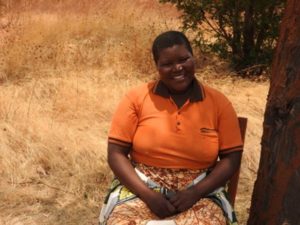
Anita Mfilinge is a farmer in Kinywang’anga village, in Iringa Rural District. When her father died several years ago, Anita and her six siblings inherited the family land, but in accordance with local custom, the boys inherited bigger parcels than the girls.
Before the Feed the Future Tanzania Land Tenure Assistance (LTA) project reached her village, Anita thought that for a woman to own land was a privilege, not a right. She believed a woman’s land rights were dependent on her father, husband, brothers, or sons. Anita learned the truth about women’s land rights during LTA’s training on women’s land registration, which informed women about their rights under the law, and how they could gain secure land tenure through LTA’s activities. “I am very grateful that I now understand that women’s land rights are fundamental human rights, and that everyone has the right to own land alone as well as in association with others.”
Inspired, Anita discussed with her husband the various types of land tenure. They chose joint tenancy, in which they both would register their names and have equal ownership of their eight farm parcels and one residential plot. Joint occupancy is a good option for couples as it protects the woman’s rights if her husband dies.
Anita is not alone. Most women interviewed in Kinywang’anga village said that they were not aware of their rights to land. Most women had less information and understanding than men about land-related laws and how to get secure access to land. LTA seeks to change this, while assisting district and village authorities to complete land use planning and issue certificates of customary right of occupancy (CCROs) in 41 villages in Iringa and Mbeya Districts. Secure property rights are vital as they reduce women’s dependence on male partners, facilitate land transactions, protect women’s rights to land, ensure efficient and sustainable resource use, improve the business climate, and promote investment.
LTA’s first activities were in Kinywang’anga Village, where the project has successfully completed mapping and registering land claims for 838 parcels. A total of 359 villagers registered land claims, 55 percent of who were women. Interestingly, 68 percent of these women claimants chose single occupancy, meaning that they are the sole owner of their land whether they are married, single, or widowed. Following District Land Office processing, these claimants will soon receive their CCRO.
LTA will collaborate with and build districts’ capacity to develop a comprehensive system for community-based, low-cost, large scale first registration/regularization of land tenure that will be replicable, scalable and sustainable for future implementation by the Tanzanian Ministry of Lands. The activity will support district and village authorities to complete village land use management plans and issue 50,000 CCROs in 41 villages in Iringa Rural and Mbeya Districts. It is envisioned that such large scale issuance of CCROs in rural villages will reduce land tenure-related risks and lay the groundwork for sustainable agricultural investment for women and men smallholders and commercial investors particularly in the Southern Agricultural Growth Corridor of Tanzania (SAGCOT), as well as Feed the Future focus value chains.
LMDA Success Story: Simplified Registration Offices for Immovable Property Rolled Out in Nine Districts of Khatlon Region
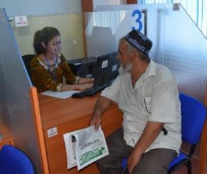
The Feed the Future Tajikistan Land Market Development Activity collaborated with the State Unitary Enterprise “Registration of Immovable Property” (SUERIP) to open regional registration offices based on single-window principles in nine districts of Khatlon region: Khuroson, A. Jomi, N. Khisrav, Shahritus, Vakhsh, Sarband, Jayhun, J. Balkhi, and Qurghonteppa. The new offices will streamline registration procedures in the project’s target districts. These nine offices join three registration offices in the Bokhtar, Yovon, and Dusti districts, which were opened under the USAID Land Reform and Farm Restructuring Project in 2016, that currently operate based on single-window principles.
Following the opening of the new registration offices, the project equipped the offices with furniture and electronic equipment. In addition, the project trained all Subsidiary Enterprise for Registration of Immovable Property (SSERIP) staff on the new, simplified registration procedures for immovable property that accompany the implementation of single-window principles.
These registration offices have become a convenient “one stop shop” for registration of immovable property. All the documents necessary for registration can now be submitted in one place, and all the steps necessary to prepare land documents can be completed by SSERIP specialists on site. Customers can then receive their registration certificates at the same registration office.
As a result, farmers are now able to formalize their property rights in significantly less time and at a lower cost. While it previously took between six and seven day to register immovable property, the new registration offices based on single-window principles have reduced the time to two to three days. Furthermore, the average time spent on registration has dropped by 50 percent. It is expected that SUERIP will implement a simplified “one stop shop” registration system throughout Tajikistan, based on its successful implementation in Khatlon region.
TGCC Success Story: Shan State Pilot Site Completes Mapping Activities with Government and Community Dialogue
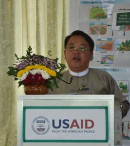
Irrigation, U Sai Lone Kyaw, speaks to community
members at the folio handover ceremony
In Burma, USAID’s Land Tenure Project (LTP) and the Farmers Labor Union (FLU), a local civil society organization, presented community resource documentation to community members of Let Maung Kway Village Tract in southern Shan State. To mark the completion of mapping and resource documentation activities, LTP hosted a multi-stakeholder dialogue that invited community members and local and state authorities to review the community-produced maps documenting village tract boundaries and land use. The State Minister for the Ministry of Agriculture, Livestock and Irrigation presented opening remarks and the local Forest Depart Officer provided an update on the area’s strategic plan.
Ma Nge Nge of FLU stated, “Now they’ll be able to share all these documents with other people like their brothers and sisters, and the next generation. I’m so happy to see everyone participate so actively in this project.”
This event marks the culmination of LTP’s work in the village tract, where activities commenced in late 2016. Through an LTP-supported local civil society organization, the project helped boost the understanding of the National Land Use Policy within the participating communities. The project also led community members through a series of mapping activities, helping them to examine and identify their village boundaries and land use. With the knowledge of the land policy and the documentation from mapping activities, local communities will be empowered when land issues arise. The project also promoted engagement and dialogue between community members and government officials, something historically rare in Burma, which benefits all stakeholders.
Property Rights Bring Jobs, Business Growth to Women in Kosovo
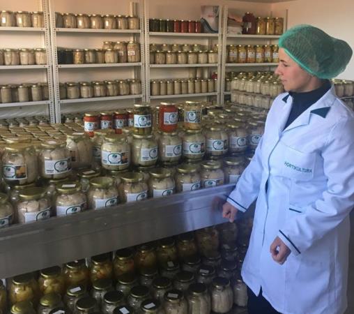
December 2017 — Valbona Ajeti is one of the most enthusiastic, strong-willed, and determined people you will ever meet. She lives with her family in Sllatine e Eperme—a village in the Kosovo municipality of Viti. Her company GRASEP — an acronym that translates to “women of Sllatina e Epërme”—has 20 women employees and produces preserved vegetables and pickles, but its main product is Ajvar, a famous sauce made from red peppers that goes with virtually everything.
“When I first started, people thought we are just a bunch of women wasting time. No one took us seriously, mainly, well, because no women run a business where I live,” says Ajeti, laughing.
Ajeti, together with other women and men from Viti, attended continuous training in 2016 on women’s rights, with a focus on property and inheritance rights, business, and other managerial skills organized by the local NGO Kosova Women 4 Women (KW4W). The training was part of USAID’s Engagement for Equity program that helps civil society to develop policies supporting vulnerable and marginalized groups in Kosovo.
The country has good laws on the books that guarantee a woman’s equal right to property, but implementation of such laws is very slow, mainly because of the traditional attitude of Kosovar society. In the Balkans, and specifically in Kosovo, only male members of the family inherit property, with daughters left out of the will. Although laws ensure an equal share among heirs when there is no will, strong social pressure coerces daughters to withdraw from inheritance leaving brothers as the only benefactors. The same pressure is placed on men who register property jointly with their wives.
After learning about her rights, Ajeti and her husband registered their property in both of their names instead of just his. This ensured that Ajeti would not be rejected a loan from a local bank to develop her business.
“My business was not always this big, I had some machines and a small number of people engaged. Now, having a parcel carried in my name from my husband’s inheritance will be a boost to my success as a businesswoman,” declares Ajeti. She now has no limitations on getting loans and expanding her business in terms of space, larger equipment and an additional workshop for her staff.
“Registering the property on my name gave me strength and empowered me a lot!” she says.
Ajeti knew her rights, knew the laws, but her determination to claim her rights ensured by the law was crucial. “I encourage other women, too. Their right on property is guaranteed by the law. No woman should hesitate on her rights,” she says.
According to a USAID sponsored property rights survey conducted in 2015, only 16 percent of women in Kosovo own land. Most of the land is registered under the husband or eldest male member of the family. But thanks to women like Ajeti the situation is slowly changing. More and more couples are registering their land in both of their names and more women are claiming inheritance.
While Ajeti’s business has grown into something bigger than anyone in the village could have imagined, it wasn’t the only change in Sllatine. Villagers’ attitudes toward gender equity have changed as well now that more women are employed and realizing their property rights.
Since 2015, USAID’s Engagement for Equity program has trained 1,540 women and over 500 men on property rights in the municipalities of Viti, Kaçanik, and Strpce, and plans to train an additional 400 men and women before the program ends in 2018.
LRDP Success Story: Mobilizing Funds for Small-Scale Coffee Growers
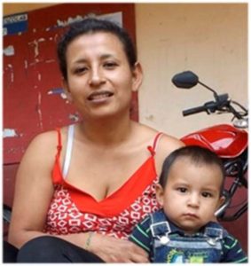
—María Aurora Ipia Belálcazar
María Aurora Ipia Belálcazar is a coffee grower in El Cidral, Caldono (Cauca). A single mother, she not only cares for her two children (aged 18 months and 7 years) but also looks after her two aging parents, whose delicate health prevents them from working in the fields. Since María Aurora’s coffee-growing activities on her one-hectare plot do not provide her with enough income, she also works as a day laborer on other people’s farms, using a machete as her tool.
This is all changing, however, thanks to a productive project subsidy from the Colombian Institute for Rural Development, facilitated by the USAID Land and Rural Development Program. With USAID assistance, María Aurora and 13 other coffee-growing families successfully designed a proposal for an income-generating productive project centered on the cultivation of coffee and plantains. By securing the subsidy, they now have access to the funds, machinery, and know-how that was previously out of reach. María Aurora, for example, will be able to expand her one-hectare plot to two hectares, and will have the resources to ensure that her crops get the nutrients, water, and attention they need to thrive.
In five focus regions of Colombia (Cauca, Cesar, Meta, Montes de María, and Tolima), the Land and Rural Development Program works with government entities to address the barriers that hamper the flow of money into rural areas. In the department of Cauca, the program has helped mobilize 148 subsidies valued at US$1.07 million. In addition to mobilizing resources, USAID is supporting the design of a model that improves the efficiency of funding mechanisms, making the funding process less cumbersome and increasing harmonization between government entities at the local, regional, and national levels

