LRDP Success Story: Untying the Land Claim Knot

The Teran family was displaced and became secondary occupants on land that is being disputed by its previous owner.

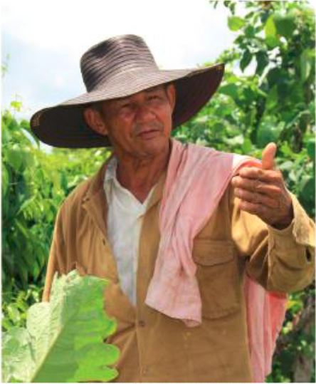
Omar Teran and his family had already invested four years of sweat into land preparation, built a house, and survived armed militia shootouts in the hills of northern Colombia. That was in 2009, and the most violent period of the conflict was behind them. He and 35 people from his extended family—all from the Zenú indigenous community—living on the nine-hectare parcel saw a peaceful and prosperous future.There was only one problem: the land did not belong to Omar, and the owner wanted it back.

Omar’s story is nothing new in Colombia, where the 50-plus years of conflict displaced over six million people. In the desperate shuffle, thousands of families ended up settling on lands owned or claimed by others. Today. the country’s Land Restitution Unit, an institution mandated to represent displaced land owners and deliver restitution to victims, is helping local authorities sort out the situation.

Until recently, the government had not taken stock of the situation of “secondary occupants”—good-faith occupants of land being claimed by others—and restitution rulings have lacked sustainable solutions for victims like Omar. The challenges run even deeper: most such occupants are not aware of their land rights, and families like Omar’s never had a public defender to support their case.

“I searched for the owners in 2004. Back then, neighbors told us that the land was worth what was planted on it,” says Omar. “It would be hard to leave this now. It hurts to think of losing all the life we have created.”

Twelve years later, Omar and his family turned nine hectares of land wedged between two hillsides into a productive farm providing the family with yucca, maize, and tropical fruit. Omar has planted over 50  fruit trees, from mango to avocado and carries forth the Zenú weaving tradition. His family grows caña de fleche, the raw material used to make Colombia’s famous cowboy hat.

Land restitution is a fundamental part of Colombia’s current peace deal, which spells out the government’s duty to provide integrated rural reform. The government estimates that over 160,000 people are still in need of land restitution, a tall order for an institution that has processed 23,000 cases in the last five years. The USAID-funded Land and Rural Development Program (LRDP) is supporting the government with strengthening it’s institutional framwork—the foundation of effective land governance—to implement the peace accords. Guided by the government, LRDP focuses on priority areas with high concentrations of vulnerable groups such as indigenous communities and secondary occupants.

Public Defenders

Legal assistance for secondary occupants is one aspect of the program’s comprehensive approach to improving the quality of legal assistance to improve the quality of legal assistance provided to restitution cases. In 2015, through LRDP support, public defender Carlos Beltrán visited Omar’s parcel to offer his family legal assistance and defend their case during the restitution proceedings.

Beltrán was hired as a public defender in Sucre Department in 2014 and has over 100 secondary occupant cases on his plate. Omar and his family provided him with a power of attorney and the background on the family’s arrival to the parcel. The case—which is complicated by the fact that the land is supporting so many famlies—is currently in the evidentiary phase and is expected to go in front of a judge this year.

There are over 1,600 secondary occupants living in LRDP’s five target regions, many of whom are entwined in complex legal cases but cannot afford the legal representation they need. LRDP has trained and supported some 250 public defenders and reached more than 800 secondary occupants.

“These victims are always saying to me: the land is of those who work it,” Beltrán explains. “There is a lot of desperation and for many of our clients, the public defender is their final hope.”


LRDP Success Story: The Weight of Water

A farmer and his trellised yam crop irrigated by a sprinkler system in San Rafael, Montes de Maria.

During one of the country’s most violent periods, the Revolutionary Armed Forces of Colombia (Farc) and the paramilitary forces roamed northern Colombia sending thousands of farmers fleeing their homes, refugees in their own country. Often, the groups terrorized villages in the interest of acquiring their lands, cattle, or any other valuable asset.

In the strategically located region Montes de Maria, armed groups destroyed entire irrigation systems and stole kilometers of pipelines installed by the government to support agriculture and rural development. They also stole or destroyed the pumps that fed the system from large water basins. In many cases, the water systems were rendered inoperable shortly after farmers had begun to utilize them. Fear and destruction dissuaded many farmers from returning to their lands.

Before the violence, 27 irrigation, districts were distributed across 15 municipalities in the region. Each district provided water to 40 hectares of land, benefiting hundreds of small landowners. Back then, Montes de Maria was known for food production Yam, plantain, corn, avocado, cacao, eggplant, and sesame harvested in the region reached markets in cities such a Barranquilla, Bucaramanga, nad Bogota. Other farmers specialized in tobacco, a profitable commodity with various market channels.

In the aftermath of the violence, more than 90% of the farmers in this area depend on rain for growing their products; food production dipped to levels of subsistence.

The story of Jamie Narvaez Marquez, whose father was murdered by the Farc, is like hundreds of farmers in Montes de Maria who were victims and witness to violent atrocities.

In 1998, Marquez was displaced from his hometown San Rafael in the municipality of Ovejas. He returned in 2004 to recover his land, the irrigation systems, and the time lost due to violence. He started from scratch after finding his former plots abandoned and overgrown. the lack of water, climate change, and unreliable rains forced Marquez and farmers like him to adjust to the conditions, plant a smaller area and conform to crops suited for rain-fed agriculture.

“Unable to irrigate, during the dry seasons we couldn’t count on the yam and manioc crops. The dry season killed them, left us without seeds, and made us lose our crops,” says Jaime.

More Drops, More Crops

In 2013, as the people of Montes de Maria began to breathe the airs of post-conflict, the USAID Land and Rural Development Program (LRDP) began supporting the National Institute of Rural Development (Incoder) and the regional government to rehabilitate five irrigation systems including El Flechal and San Rafael, both in Ovejas.

For three years, Incoder had studied how to improve and optimize the irrigation systems, and even studied the possibility of building them all over again. But it wasn’t until 2015 when LRDP assisted the government in conceptualizing and drafting the designs and proposals for the rehabilitation projects, that the finding from the national government was secured and the project underway.

“USAID’s help was key to do this work in a rapid and efficient manner. At the moment, farmers have a finished project, and they participated hand in hand with engineers to work on its design in order for it to be adjusted to reality, that is, for districts to work according to the crops they are planting,” said Hector Blanco Barraza, Incoder officer who led the district rehabilitation project.

Regional governments in Montes de Maria are investing approximately US$540,000 to rehabilitate the El Flechal and San Rafael irrigation systems and three more irrigation districts. LRDP works with government partners in three departments to support the design and implementation of a total of 10 irrigation projects that together will bring reliable irrigation to approximately 450 hectares of farmland and benefit over 150 families.

At San Rafael, Marquez and 27 other farmers are no longer waiting for the rain. Using the reservoir pump sprinkler system, they are now irrigating yucca, yam, eggplant, and tobacco crops for the first time in nearly two decades.

Reliable irrigation also allows the farmer to employ advanced agriculture practices, such as trellising and crop rotation, resulting in healthier soils, higher productivity, and increased sustainability. Authorities in Monets de Maria are now looking at how to expand irrigation to other districts. In 2017, 10 new irrigation districts have already been identified and prioritized for rehabilitation.

By applying multiple capacities strengthening endeavors targeting local and national government entities, the USAID Land and Rural Development has helped department governors, agriculture offices and municipal leaders in five former conflict regions of Colombia mobilize more than US$15 million to fund agriculture and infrastructure projects for rural farmers and victims of the conflict.


LRDP Success Story: Working on Land Issues from the Ground Up

Achieving Multi-functional Cadasters through Inter-Institutional Co-operation

CHALLENGE    

Insecure land and property rights and weak state presence in rural areas are root causes of conflict in Colombia. With the recent passage of the Victims and Land Restitution Law in 2011, the Government of Colombia (GOC) is now financing a comprehensive reparations program for victims and displaced landowners through the expansion of infrastructure and public services in rural areas. This will require unprecedented inter-institutional coordination between GOC agencies. The focus is now on the Agustin Codazzi Geographical Institute (IGAC) and the Superintendent of Registry and Notary (SNR) because the national rural cadaster is only 50% up to date and there are significant differences in land data of the two different entities. IGAC is in charge of maintaining the official national cadaster while the SNR is the public registry of titles and land transactions. IGAC’s lack of collaboration has been identified as the main constraint by all GOC entities working on land restitution, formalization, and rural development. 40% of claimant cases for restitution is not identified in the cadaster increasing the cost of claim processing in many cases more than the value of the land in question.

INITIATIVE    

USAID’s Land & Rural Development Program is helping to build the capacity of GOC institutions to implement programs to restitute land to victims of conflict, extend land titling and property formalization in prioritized rural areas, and promote comprehensive rural development that enables citizens to make productive and sustainable use of their land. Of paramount importance is facilitating inter-agency national and regional coordination in order to remove procedural bottlenecks and constraints for the effective implementation of an integral land policy.

RESULTS

Under new management and with a new institutional approach, LRDP’s invitation for collaborative participation has been key to heightened IGAC willingness to actively support restitution and formalization processes. IGAC is embracing their new mandate to create a multifunctional cadaster for land policy and has revealed a commitment to update the rural cadaster in an innovative, expeditious and articulated fashion.


LRDP Success Story: Empowering Local Leaders Using Participatory Facilitation Techniques

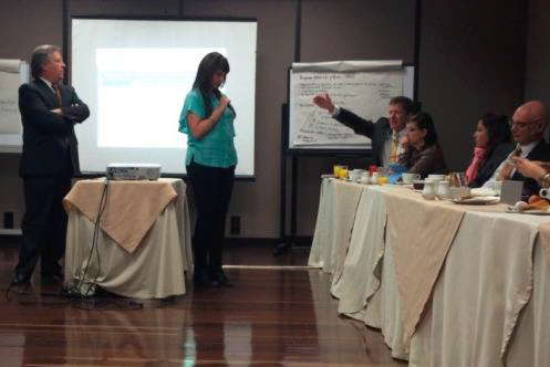
Group “Brainstorming” is a technique development practitioners can use to build inclusive spaces for dialogue.

The USAID Land and Rural Development Program (LRDP) provides technical support to the Government of Colombia (GOC) to implement its land and rural development agenda. One of LRDP’s focus areas is Montes de María (MdM), an area in northern Colombia with approximately half a million inhabitants. Between 1996 and 2003, MdM was the principal zone of confrontation between paramilitaries and the Revolutionary Armed Forces of Colombia (FARC in Spanish) in the Colombian Caribbean region. MdM was infamous for being the site where armed actors began to use massacres and forced displacement to break the social tie between the FARC and rural communities. Many rural areas were abandoned as a result of the massive displacement that followed in the wake of violence. However, after years of bloodshed and fear, citizens are beginning to return home and rebuild their lives. Currently, 68 percent of MdM’s population does not enjoy adequate public goods and poverty is widespread. Local fiscal and administrative capacity are in short supply and the GOC has a lot of work ahead.

Because broad-based, inclusive rural development is based on partnership and participation, LRDP’s staff has been trained in Advanced Participation Methods (APM). APM provides an effective way to focus people on determining what course a group should take to achieve the desired result, address potential roadblocks, and conceptualize solutions.

Using the toolbox of APM skills, staff members from the MdM LRDP regional office are bringing local GOC counterparts together to gather information about institutional bottlenecks and establish spaces where regional actors can envision joint solutions. LRDP had expected that interagency coordination and dialogue would be stronger at the local level and instead found it to be the opposite. Typically, when a local entity employee encounters an obstacle in obtaining critical information or an agreement from another institution, rather than work toward a solution, he or she simply stops action. The LRDP APM-guided workshops represented the first time many local entity employees from different local organizations sat down together to discuss issues, despite the physical closeness of living in a small rural communities.

To date, the team has held five APM-guided workshops, including:

  • An interagency working group with public officials to identify ways to resolve a regional barrier limiting the effective implementation of INCODER’s Accord 266 under Law 1448 of 2011 (Victims and Land Restitution Law)
  • Four focus groups with civil society members, public officials and land experts as part of the construction of the LRDP MdM regional office’s stakeholder map

LRDP has empowered public officials working with GOC partners to become change agents who are better equipped to resolve institutional impasses and enhance service delivery capacity to the benefit of the rural poor.


ERC Success Story: From Concept to Collaboration

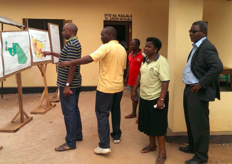
Officials of Tanzania’s Ministry of Land review land use planning documents in Mvomero. Photo Credit: Karol Boudreaux/ Cloudburst

In 2011, land administration expert Robin McLaren published a provocative paper that challenged land professionals to think more creatively about how to use local knowledge, local capacity, and technology to close a massive “tenure gap” and improve the tenure security of large numbers of households around the world. McLaren suggested that by using local volunteers to crowdsource land rights information, governments, donors, and communities could collaborate to close this gap using mobile cell phones—a near ubiquitous, portable, inexpensive, and flexible tool. To better ensure the authenticity of data collection efforts, McLaren also proposed using “local intermediaries,” who are trusted local people that would work directly with community members to collect and validate information. The locally produced data would then be made available either as a “shadow” registry or, for use by formal land administration offices.

USAID’s Mobile Technology Pilot is testing this bottom-up approach to help close the “tenure gap” on the ground in Tanzania. The pilot is developing a cloud-based database and a mobile application that can be used on a smartphone to map parcels and capture demographic and other information that the Government of Tanzania needs in order to issue a CCRO to families and individuals in rural Tanzania. CCROs should provide families with enhanced security and protect against wrongful transfers of land.

After discussions with officials from the Ministry of Lands and the National Land Use Planning Commission, pilot team members conducted site visits in Ulanga, Irigina and Mvomero to identify a pilot village. Based on a number of factors, including accessibility, number of households, number of parcels, capacity of the district land office and level of local conflict over land, the team decided to work with community members of Ilalasimba Village in Iringa Rural District.

With a site selection and the technical specifications for the mobile application completed, the project is planning the process of training local intermediaries and raising the awareness of Ilalasimba villagers about their land rights. Working with a local implementing partner, the project will highlight the importance to the community of recognizing women’s rights to land by recording their names along with the names of husbands, fathers, or brothers. This is especially important as Tanzania’s proposed new Constitution enshrines women’s rights to hold property securely. At the same time, the pilot will work with the District Land Office to ensure that the information that is being captured and stored in the cloud-based database meets government requirements for issuing formal documentation.

The technology and local approach to capturing land information will be tested in Ilalasimba later in 2014 and may be replicated in another Tanzanian village in 2015. If the MTP process meets the needs of the government for accurate and reliable information and the needs of local people for a transparent, trustworthy, and cost effective process to register rights, Mr. McLaren’s provocative approach may turn into a scalable solution.

ERC Success Story: Project Expands to Second Village in Tanzania

Scaling Technology Innovations in Tanzania. Photo Credit: Jeff Euwema/Cloudburst

In October 2015 the Mobile Application to Secure Tenure (MAST) pilot project launched Phase 2, which is focused on scaling the use of the innovative mobile technology tools to collect land rights information in rural Tanzania.

MAST was the first field tested in Ilalasimba, a rural village of 345 families. In late April and early May, local youth in Ilalasimba were trained to use MAST’s two applications to record parcel boundaries and land rights information for their neighbors. These eight young “Trusted Intermediaries” collected over 900 parcel boundaries in just under three weeks, along with information about the parcel owners, their family members and the kinds of claims they hold over land. This information, which is stored on a cloud-based database, was validated by District Land officials in Iringa and then used to issue formal documentation of tenure rights called Certificates of Customary Rights of Occupancy (CCROs).  In a ceremony, in July 2015 910 CCROs were delivered to these families.

In October, after additional adjustments to the applications were complete, MAST began its process of community engagement, working with the Village Council and Village Assembly as well as District Land Officials, Ministry of Lands officials, and local partners CARE Tanzania and TAGRODE in Itagutwa.Villagers in Itagutwa were trained on the components of the 1999 Village Land Act and they received special training on women’s land rights under the law and dispute resolution.

Finally, new Trusted Intermediaries were selected – these young women and men worked with four of the Trusted Intermediaries from Ilalasimba for several days to learn how to use the mobile applications, how to conduct a field mapping exercise and why this effort is helpful for villagers. Itagutwa’s young mappers were able to collect over 1,000 parcel boundaries and information about parcel owners in late October and early November and the project is now working to validate this data in advance of another CCRO delivery ceremony in early 2016.

Working with these talented youth has helped USAID test the concept of participatory data collection for land information. Partnering with young villagers, and with village leaders, in an open and participatory process reduces the time and costs associated formalizing land right and it empowers local people by putting part of the land administration service delivery process literally in their hands.

ERC Success Story: Sharing Lessons Learned from USAID’s MAST Pilot Project

In Tanzania, USAID used mobile technology to help villagers secure their most important asset: the land. Poto Credit: Karol Boudreaux / Cloudburst

The Mobile Application to Secure Tenure (MAST) Pilot project in Tanzania came to end during this quarter.  The pilot tested a new technology designed to assist local people and local government officials in the process of demarcating parcel boundaries, collecting demographic and tenure information, and then issuing formal documentation of land rights in a more transparent and participatory manner.  The MAST pilot operated in Iringa Rural District in rural Tanzania, training local youth to use GPS-enabled smartphones to collect information to support community-driven land adjudication.  The pilot also trained local officials and villagers on the formal land laws in the country, including the rights that women hold under these laws.  These formal legal provisions can, in certain contexts, be at odds with local customary norms and practices that restrict women’s ability to use, own, inherit and transfer lands in their own name.

Over the course of the pilot, hundreds of local people in three villages received this important training.  Also important, formal documentation of land rights for thousands of land parcels was printed and delivered.  In the initial pilot village, Ilalasimba, 910 parcels were mapped, registered and recorded.  In the second village, Itagutwa, 1139 parcels were mapped, registered and recorded while in village three, Kitawaya, 1886 parcels were mapped, registered and recorded.  Working closely with the Irgina Rural District Land Office, local villagers and the national government, USAID helped people secure land rights to just under 4,000 parcels during this effort.

Among the people whose land rights were recognized, a significant percentage were women. Across the three villages, nearly 29 percent of parcels were titled in the names of women only (single occupancy/female). In addition, nearly 18.5 percent of other parcels were jointly titled, meaning men and women were listed as co-owners. Interestingly, the process also helped to identify parcels that needed to be transferred from a deceased individual to heirs, a process that can help address intra-familial conflicts and also put lands into more productive use once ownership claims are resolved. The Through the MAST pilot project USAID was able to bring greater clarity, enhanced security and stronger incentives to invest to rural Tanzanians—which should help to support goals of enhancing food security, empowering women and reducing conflicts in this important partner country.


ERC Success Story: MAST Delivers CCROs in Ilalasimba

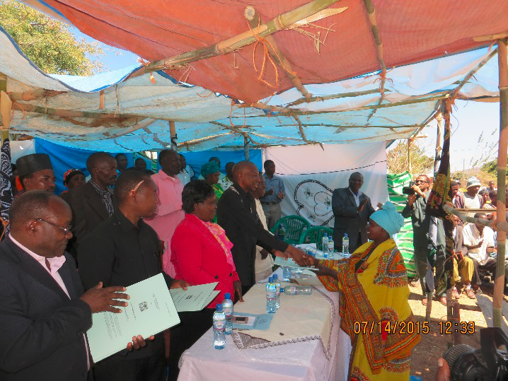
Villagers in Ilalasimba Tanzania receive Certificates of Customary Rights of Occupancy (CCROs) at Delivery Ceremony in July, 2015. Photo Credit: Jeffery Euwema/Cloudburst

On July 14, 2015, the Mobile Application to Secure Tenure (MAST) pilot project reached a major milestone by holding a Delivery Ceremony for villagers in Ilalasimba, Tanzania. The Delivery Ceremony, which was attended by villagers, national officials from the Ministry of Lands, Housing and Human Settlements Development, district government officials from Iringa District, USAID staff, MAST local implementing partners CARE TZ and TAGRODE and ERC staff, was a celebration of what villagers, working with the District Land Office and USAID, had accomplished:  the successful mapping, registration and validation of land rights for 914 parcels in the rural village.

The MAST project was designed to test the hypothesis that land rights could be successfully crowdsourced by local people. Beginning in March and running through late June, the MAST project trained local women and men in the terms and conditions of Tanzania’s land laws, provided specific training on the rights women hold under these laws, trained 8 local villagers to use the MAST mobile application to capture geospatial coordinates and map village parcel boundaries, verify demographic and tenure information with parcel holders and neighbors, validate the data captured in the field at the District Land Office, and then print and verify formal documentation of land rights:  the CCROs. The Delivery Ceremony marked the completion of this effort.

Based on our experiences in the field during the first phase of the MAST project we are able to share the following lessons:

  • Outreach at the hamlet level was an important element of our engagement and allowed us to engage more villagers to build buy-in and support for the effort;
  • An expanded focus on women’s rights to land was necessary to address social norms;
  • Creating a participatory approach that built local knowledge and skills was a key element of the success of the project; and
  • Strong collaboration between all stakeholders and especially between the District and National level land offices, the MAST project and village leadership was also extremely helpful in maintaining project timelines and in overcoming technical glitches.

ERC Success Story: Communicating Project Benefits

Putting a Human Face on Technology Innovations in Tanzania. Photo Credit: Freddy Feruzii

In January 2016 ERC staff traveled to Tanzania to visit the Mobile Application to Secure Tenure (MAST) pilot project and pilot activities in Itagutwa—the second pilot village in which the project has worked. By the time the visit took place, the villagers had already been trained on Tanzania’s land laws, on the land adjudication process, and on women’s rights to land. In addition, ten local youth called Trusted Intermediaries (TIs) had worked alongside community members to map and record land rights.

Once this mapping information is validated by local government officials the process of printing, registering and signing brand new Certificates of Customary Rights of Occupancy (CCROs) can begin.  These CCROs provide a legal record of the rights of these women and men have to use, benefit from, and transfer the lands that they use for their livelihoods, their homes and their small businesses.

In January, villagers had completed mapping but CCROS were still waiting to be delivered. During this “waiting” period ERC and USAID had an opportunity to meet with villagers and hear from them how the process worked, what did and did not work well and what their hopes were based on the experience. The team heard that the MAST process opened people’s eyes to the importance of and the requirement to provide women with land rights. In this traditional part of the country, women still face constraints around claiming land rights but MAST has worked in each pilot village to provide trainings on why it is important for all community members to have these rights. We also learned that Trusted Intermediaries valued working with and learning from other Trusted Intermediaries—the youth from the first pilot village who helped to train and mentor this new batch of skilled mappers. One young TI said that having the other youth help with training increased his confidence—if the youth from Ilalasimba could map effectively he felt that he could do this also.

In addition to sharing these experiences with villagers, the ERC team worked with a local photographer/videographer to collect still photos and video of the villagers, the village, and the process of mapping land rights using MAST. This provided a new trove of material to use for communications efforts. These photos were used in a new brochure highlighting all MAST projects and the video was used to create a short film that was launched at the 2016 WBC. These materials provide a stock of high-quality imagery that E3/Land can use for years to come.


ERC Success Story: Field Testing the Mobile Application to Secure Tenure

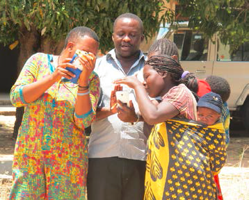
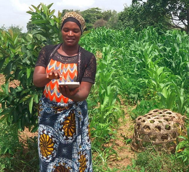
A woman in Ilalasimba village in the Iringa Rural District in Tanzania uses a mobile phone to capture land rights information.

In January 2015, USAID tested an early version of the mobile application it is developing to map and register land rights information in rural Tanzania. The Mobile Application to Secure Tenure (MAST) project is being piloted in Ilalasimba village in the Iringa Rural District. The project will provide an easy-to-use, open-source mobile phone application that local people can employ to capture parcel boundaries and the household information needed to apply for formal documentation of rural land rights. The mobile application is coupled with a cloud-based data management system that stores the collected geospatial and household information. Together, these components test whether a bottom-up, participatory approach to mapping and registering rights, provides a low-cost and timely alternative to current approaches that often involve significant delays and costs and that are not as transparent as possible.

The project consists of two components:  an Android-based smartphone application that will capture the information needed to apply for a Certificate of Customary Rights of Occupancy, and a cloud-based data management infrastructure that will securely store information that is gathered directly from villagers. Data can be captured in an offline mode and transferred to the cloud-based data management server when a connection is available. These components provide land administration tools that can be customized to meet different objectives (e.g., land use planning, sustainability planning, spot or systematic registration, among others). The MAST technology is configured based on the Land Administration Domain Model/Social Tenure Domain Model frameworks and is attentive to concerns related to a wide variety of land and resource rights and access issues.

Early testing was conducted with officials from the Ministry of Lands and the District Land Office in Iringa Rural District. The testing allowed USAID to determine the accuracy of the GPS technology that is built into the application. It also allowed USAID to work with local women and men to get a feel for how user-friendly the technology is. Finally, testing also allowed USAID to get immediate feedback from government land officials. The project began community engagement and sensitization regarding Tanzania’s land laws in March 2015 and will begin mapping and working with local families to collect the information needed to apply for thecertificates in April 2015.