LAND Success Story: LAND Establishes Regional Stakeholder Forum

LAND negotiates establishment of the OROMIA Region OPAC

Lessons learned from previous USAID assistance to improve livelihoods and increase resiliency in pastoral areas demonstrate that in order to achieve sustainable outcomes, projects need to work closely with and secure government recognition and legitimization of participatory, grassroots activities to map community boundaries and manage natural resources. This is especially true for LAND as it seeks, for the first time in Ethiopia, to formalize participatory mapping activities by supporting adjudication, demarcation, and government certification of community and rangeland boundaries.

LAND successfully negotiated with the Oromia Bureau of Rural Land and Environmental Protection (OBRLEP) to establish the Oromia Pastoralist Advisory Committee (OPAC) on Land Administration & Natural Resources Management on February 13, 2104. OPAC will provide a joint government and community stakeholder forum for ensuring all project stakeholders are clearly informed about project activities, procedures, outcomes, and benefits as well as their respective roles and responsibilities.

Effective information sharing and coordination of activities between government officials and community representatives and the LAND and USAID Pastoralists Resiliency Improvement and Market Expansion (PRIME) project will help ensure stakeholder buy-in and support for project activities as well as assist USAID to maximize development impacts. Most importantly, the forum will promote sustainable project outcomes by helping to ensure regional government legitimizes and certifies boundaries demarcated and natural resource management plans and agreements produced with LAND assistance. Lessons learned through collaboration with regional officials will be shared with the Land Administration and Use Directorate of the Ministry of Agriculture (LAUD/MOA) so LAND achievements can be replicated in other regions, further promoting project sustainability. Oromia officials wholly supported LAND’s initiative and requested LAND establish Zonal-level OPACs to include zonal officials and customary leadership of rangeland management units (dhedas) to ensure LAND activities at the grass roots level are fully coordinated with the government.

In addition to OBRLEP and LAUD/MOA, OPAC stakeholders include the Oromia Pastoralists Association, Oromia Pastoral Development Commission, USAID, and the LAND and PRIME projects. LAND will serve as the OPAC secretariat.

LAND Success Story: Ethiopia to Develop Comprehensive and Integrated National Land Use Policy

Ethiopia’s land use over the past few decades has shown a significant change with an increased engagement of different government institutions and the private sector that have been using the country’s land for a myriad of development projects.

Studies have also shown that the land use changes that include fragmentation of agricultural land and its intensification of use have led to degradation of resources and subsequently a reduced productivity which has profound impacts on the livelihoods and food security of people as well as on the national economy.

After analyzing the legal and policy documents related to land use, LAND sponsored studies revealed that they are overlapping, competing, conflicting, incomplete and contradictory and do not in any way make for a comprehensive land use policy that would embrace the priorities of all sectors and guide the efficient use of land in an integrated manner. LAND’s studies underline the need to develop a national land use policy to reverse the negative trends and optimize land use and investments in land and natural resources for now and in the future.

Other land use studies conducted also pointed out the need to have a policy framework which is the foundation for putting the country on the right path to achieve a continued and sustainable social and economic development.

It is against this backdrop that LAND started advocating for an overarching and comprehensive national land utilization policy that provides a framework for a holistic, regulated, and integrated use of land to advance social and economic development of the country.

As part of the efforts to advocate for an overarching land use policy, LAND primarily focused on generating and gathering evidence that shows the trends of land use in the country. Apart from analyzing the legal and policy framework, LAND closely worked and supported renowned research institutions including the Water and Land Resource Center Institute and recognized researchers who have excellent track records in the area of land use policy.

LAND’s efforts to gather evidence finally led to five studies that analyzed landscape transformation and subsequent changes observed on natural resources and socioeconomic development in Ethiopia in the last three decades; review of current Ethiopian policies and laws on land use; international experience on preparing and implementing national land use policies and their impacts on socioeconomic development; and the importance of a sound and robust land use policy.

Based on the evidence, LAND started to create a platform for discussing findings of the studies and the way forward with its key government partner, the Ministry of Agriculture and Natural Resources. Presentations were made to the Minister of Agriculture and Natural Resources and his management team as well as senior officials of other sector ministries and relevant institutions. The Minister realized the seriousness of the problems caused by lack of a comprehensive and integrated national land use policy and made a commitment to move the policy development forward. The Minister and his team were instrumental in putting the land use policy development high on the government’s agenda, as manifested by the Prime Minister’s decision to set up a high-level ministerial committee comprising eight ministers to oversee the development of a national land use policy and its implementation.

The policy development process reached another milestone in June when H.E. Prime Minister Hailemariam Desalegn officially announced his government’s decision to develop a comprehensive national land use policy that provides a framework for a holistic and sustainable use of land to achieve social and economic development at a high-level meeting.

The Prime Minister, who also chaired the meeting, said, “Land use policy is at the heart of all development endeavors that aim to bring about economic transformation. Our success in achieving the transformation depends on the effective use of our land according to its potential.

Accordingly, he officially ordered the development of a comprehensive and integrated national land use policy immediately and a national land use plan within the coming three years for implementation in the third Growth and Transformation Plan. He also urged all federal and regional government officials to ensure that the country’s land and natural resources are put to their best use until the policy comes into effect and the national land use plan is implemented.

More than 230 participants including ministers, regional presidents, the Prime Minister’s senior advisors and leaders of renowned academic institutions in the country attended the high-level event.

Two committees in charge of the policy development were set up prior to the meeting. The first is a technical committee or taskforce which is composed of all ministries and government agencies that have a mandate on using or regulating the use of land and natural resources. Under the auspices and coordination of MoANR, this taskforce is charged with preparing a draft of the policy by bringing together expertise and perspectives and priorities of all sectors on land use. The second is a high-level ministerial committee comprising eight ministers that will oversee the activities of the technical committee and the formulation of a sound and robust national land use policy and plans for its implementation. Members of the Ministerial committee include the MoANR; Ministry of Environment, Forest and Climate Change; Ministry of Livestock and Fish Resources; Ministry of Water, Irrigation and Electricity; Ministry of Urban Development and Housing; Ministry of Mines, Petroleum and Natural Gas; Ministry of Industry; and Ministry of Culture and Tourism.

LAND had already drafted the TOR for the technical committee and the team of consultants that would be engaged in carrying out the technical work for these tasks.

Moving forward, the consultants to be hired to assist the technical committee and the technical committee are in charge of identifying major land use policy issues and preparing the road map that would enable the government to develop an integrated land use plan in line with the national land use policy. Accordingly, LAND began the recruitment of consultants.
LAND Success Story: LAND and Ministry of Agriculture and Natural Resources Organize a National Land Utilization Policy Workshop

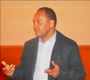
Ato Tigistu Gebremeskel, Director of Rural Land Administration and Use Directorate, MoANR

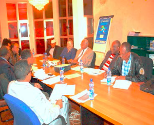
The Ministry of Agriculture and Natural Resources (MoANR), with the support of LAND, organized a national workshop that aimed to discuss the state of land utilization policy in Ethiopia and the way forward. Some 50 experts invited from 33 organizations participated in the workshop conducted on October 20-21, 2015 in Adama town.

Five peer-reviewed papers were presented at the workshop. The papers provided analysis on topics including landscape transformation in selected fast developing corridors in Ethiopia and consequent changes observed on natural resources; review of current Ethiopian policies and laws on land use; international experience in preparing and implementing national and regional land utilization policies and their impacts on socioeconomic development; the importance of a sound and robust land utilization policy; and past performance of land use planning in Ethiopia.

In his introductory remarks, Ato Tigistu Gebremeskel, Director of Rural Land Administration and Use Directorate at MoANR said, “It is high time for the country, which is rapidly growing, to revisit its utilization of land. Effective and efficient use of land is at the heart of sustainable development and failure.

LAND Success Story: Ensuring LAND’s Interventions Benefit Women and Men Equally

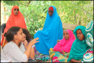
Gender gap assessment discussion with Somali women at Shinile

USAID/Ethiopia’s Land Administration to Nurture Development (LAND) Project recently developed a Gender Assessment and Action Plan (GAAP) that will assist the project to identify root causes of existing gender inequalities or obstacles to female empowerment. The GAAP will assist project design and help identify opportunities to promote women’s leadership and participation. Moreover, the GAAP will provide USAID and the LAND technical team with a better understanding of how cultural and community norms related to power dynamics, resource access and control, decision making, and participation (or lack of participation) in civil society impact women and men within the context of LAND’s project activities. This understanding will be used to design gender-responsive project activities and monitoring and evaluation criteria that will indicate the extent to which the activities are implemented. The GAAP examined the following issues:

  • Biases of customary practices and formal and informal justice systems in relation to women’s land and resources rights;
  • How gender relations shape, control, and mediate access to and control over valuable resources;
  • How securing land tenure and property rights for women complements other development objectives, including improving food security, economic growth, and global climate change;
  • Relationship of gender inequity to poverty and access to resources and financing;
  • Roles played by women and men in different aspects of land and resource management and household livelihoods; and
  • Current practices related to land administration and land use planning and whether these practices are serving men and women equally.

International Gender Expert Renee Giovarelli conducted extensive field research in Ethiopia to develop the GAAP, assisted by Land Administration Expert Ms. Hirut Girma and Gender Specialist Ms. Medhanit Adamu, who conducted focus group discussions with Ministry officials and women pastoralists in Somali, Afar, and Oromia regions in September and October 2013.

The GAAP will set out findings, requirements, activities, and monitoring and evaluation criteria that will lead to integration of gender equality into LAND’s programming and ensure that LAND does not negatively impact women and that it delivers benefits equally to all LAND stakeholders in support of Ethiopia’s development objectives. It is expected the GAAP will be finalized at the end of November 2013.

LAND Success Story: LAND Assists Streamlining of Mapping Agency’s Technologies

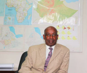
Sultan Mohammed, Director General of Ethiopian Mapping Agency EMA, lauds USAID support to EMA through Land Administration to Nurture Project to modernize its services and build the capacity of his team.

The Ethiopian Mapping Authority (EMA) is the official organization responsible for mapping, surveying and remote sensing activities in Ethiopia. The organization was established in 1954 under the reign of Emperor Haile Selassie I as a department in the Imperial Ethiopian Ministry of Education.

Currently, EMA’s key responsibilities and duties include collection, compilation, analysis, production/publication, administration, and distribution of the following sets of fundamental geospatial information data sets in Ethiopia: geodetic control networks (ground control points); remotely sensed imagery (aerial photographs, satellite imagery); topographic (base) maps; thematic maps including transportation, utilities and services, the natural environment and tourist maps; hypsography which includes contours, digital elevation model and spot heights ; hydrography involving lakes, rivers and streams; administrative boundaries (international, regional, zonal, woreda, etc.); geographic names; and national Atlas.

Although EMA has made significant contributions to the success of large river valley projects, including hydroelectric power generation and irrigation schemes by sharing reliable mapping and surveying data, limited resources and lack of trained professionals have hampered it from introducing state-of-the-art technologies and meeting current needs of its service users.

In 2007, USAID/Ethiopia and the United States Geodetic Survey assisted EMA to establish Continuously Reference Stations (CORS) network which provides the infrastructure that supports correction factors for GIS-based applications. The CORS were set up in four strategic locations in Ethiopia to provide Global Positioning System (GPS) users with a modern 3-dimensional geocentric spatial reference system. The Institute of Geophysics, Space Sciences and Astronomy of the Addis Ababa University also invested in CORS technology to monitor seismologic activity. The CORS network was set up along with an Online Positioning User Service (OPUS) which is an automated web-based utility that provides correction factors for submitted GPS observation data using the CORS network information.

Land Reform Project Success Story: Becoming More than Just a Farm Member

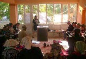
Lawyer and Trainer Muharram Rasulova from USAID legal aid center NGO Saodat conducts a training for Abdurakhmon Sarkor Dehkan Farmers on how to create individual dehkan farms.

For years, the 28 members of the Abdurakhom Sarkor dehkan farm in the Gafurov district of Sughd province worked long days to grow cotton. Despite their hard work, farm members received meager in-kind payments, usually cotton stalks at the end of the season, and only erratic cash salary payments that never exceeded $250 per year. Most members had to minimize expenses and take menial jobs to provide the basic needs for their families — food, shelter, clothing, and school supplies for their children.

Privately, many members wished they could take control of their economic futures by creating their own farms. Unfortunately, the members lacked adequate knowledge of their land use rights, which allowed the farm director to divvy up revenues as he liked and also prevent the members, particularly those not related to him, from exercising their right to withdraw from the farm to form independent farms. Dadojon Khobilov, one of the USAID Land Reform Project’s tashabbuskors (rural land activists), learned about the farmers’ plight during a focus group he facilitated in the Gafurov district.

Dadojon then arranged for the USAID Land Reform Project legal aid center NGO Saodat to conduct training for the farmers on the steps necessary to establish an individual dehkan farm.

Dadojon Khobilov, one of the USAID Land Reform Project’s tashabbuskors (rural land activists), learned about the farmers’ plight during a focus group he facilitated in the Gafurov district. Dadojon then arranged for the USAID Land Reform Project legal aid center NGO Saodat to conduct training for the farmers on the steps necessary to establish an individual dehkan farm.

Immediately following the training in October 2011, NGO Saodat lawyer Muharram Rasulova assisted eight members of Abdurakhom Sarkor farm, none of whom were related to the farm director, to prepare and execute applications to create individual dehkan farms. Less than two months later all eight members were tilling land on their own individual dehkan farms.

Those eight members now enjoy full freedom of choice over what to grow on their land, how to manage their crops, and when and how to disburse their revenues. One of the new individual dehkan farmers exclaimed, “Now nobody can tell me what to grow on my land, and now I work for exclusively for myself, and will decide what to do with the income I earn!” 

During the first two years of activity, the USAID Land Reform Project has helped more than 1,200 farmers, including 718 women, to take control over their economic lives by helping them to establish their own independent and family dehkan farms.

LAND Success Story: Addressing Issues of Communal Land in Afar Regional State

The workshop took place Awash town from 28-31May 2014. LAND’s Property Rights Lawyer and LAUD’s Senior Land Administration expert participated in the training.

USAID/Ethiopia, through the Ethiopia Land Administration Project (2008-2013) supported the development of Afar Regional State’s Pastoral Lands Administration and Use Proclamation. The Proclamation specifically provided for the survey and registration of communal lands. Nonetheless, drafters of the regulation that guides implementation of the Proclamation did not include these provisions for fear they may result in disputes over boundary demarcation. To remedy this omission and strengthen the land rights of pastoral communities, USAID/Ethiopia’s Land Administration to Nurture Development (LAND) project will pilot registration and surveying of communal lands as foreseen in the regional proclamation in selected woredas of the region. The lessons learned from the pilot will be instrumental for strengthening the land use rights of pastoralists and the management of communal lands in other pastoral regions of Ethiopia.

In preparation for this pilot, LAND organized an awareness-raising workshop for 39 woreda and Zonal officials, where the pastoral land laws, including the rights and obligations of pastoralists and registration and protection of communal lands as well as LAND’s plans for the pilot, were explained and discussed.

LAND’s follow-up visits to the region indicate that Zones and woreda governments and pastoralist communities are keen to work with LAND in registering and certifying communal pastoral lands to secure the land use rights of pastoralists.


LRDP Success Story: After Forced Displacement, Sweet Victory

“For 15 years we have been trying to bring the village back to life, and these rulings really give us hope.” —Jairo Barreto López

More than six million Colombians were displaced from their homes over the course of the country’s 50-year civil war. On January 17, 2001, the violence hit Chengue, a village in the coastal region of Montes de María. Residents were forced to flee their village, leaving behind their land, homes, and—in some cases—family members. “We managed to escape after they set our house on fire with us inside it. We ran to the hills to save our lives,” said 33

“We managed to escape after they set our house on fire with us inside it. We ran to the hills to save our lives,” said 33-year-old Jairo Barreto López, who lost three uncles and two cousins in the massacre. Fifteen years after the massacre, victims had still not been compensated or returned to their land. Fifteen years after the massacre, victims had still not been compensated or returned to their land. Today, thanks to the support of the USAID Land and Rural Development Program (LRDP), their situation is improving. In 2014, LRDP brought together restitution judges and a range of land-related agencies to examine the difficult restitution case of Chengue claimants, identify barriers preventing the processing of their claim, and implement solutions.

In April 2016, due in part to LRDP’s support in preparing the case, a judge ruled that Chengue residents must be returned to their land and have their property formalized. Thirty-seven families will be provided secure land tenure through this ruling. LRDP is working with Colombian agencies to ensure that these families receive a wide range of government services, including legal assistance, productive projects, housing, and property tax debt relief.

Megan Peluffo Meriño, who was displaced from Chengue, said, “This ruling is a big, big advance for us. Ever since I was a little girl, I kept hearing that help was on its way, but it never came. It is a means of providing us with a better future, the chance to start over and to invest in our lands, which were abandoned.”

TGCC Success Story: Yway Gone Village Tract Carries Out Mapping and Land Inventory to Strengthen Land Rights Security

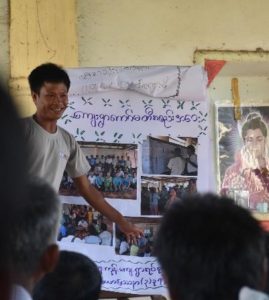
A representative of a local civil society organization outlining the participatory mapping process undertaken at the folio handover ceremony. Photo Credit: Tetra Tech

Land administration in Burma has historically been characterized by a centralized, static approach that does not incorporate community perspectives in a transparent manner. With the endorsement of the National Land Use Policy (NLUP) in January 2016, which promotes bottom-up approaches, USAID is supporting pilot communities to test implementation of the NLUP in practice.

The participatory mapping and land use inventory activities undertaken by the USAID-funded Land Tenure Project (LTP) in Yway Gone Village Tract in Burma culminated in November 2016 with the LTP team’s presentation of the final village folios of mapping and inventory information. The folios include the final agreed maps for each village, comprehensive boundary points, and information about land usage in the area.

The project brought together community members (including women and youth), civil society organizations (CSOs), and local authorities to document community land rights and uses. Project staff and representatives of local CSOs facilitated the process, including educating the communities about the NLUP and land-related laws in the country.

USAID’s support has resulted in information products, including map data that for the first time accurately describe the perspectives of community members on their land and can be used by them when discussing land resource issues with local government officials. The use of inclusive, participatory, data-driven methods introduces participatory engagement between communities, CSOs, and local government. This participatory engagement represents a change from traditional top-down governance and promotes more accountability and transparent resource governance.

Nick Thomas, LTP Country Coordinator, said, “The information gathered with the support of all stakeholders will serve communities well in communications with local authorities and private companies in the event of access and land use disputes.”

TGCC Success Story: Customary Land Certification Reaches Zambia’s Vulnerable Populations

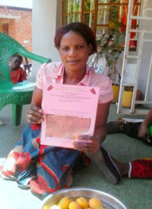
Ireen Sakala, a disabled, single mother in Langa Village of Mkanda Chiefdom in Zambia’s Eastern Province proudly displays her customary land certificate issued by the Chief with the support of Chipata District Land Alliance, through the USAID-funded Tenure and Global Climate Change Program. Photo Credit: Chipata District Land Alliance

When Ireen Sakala, a smallholder farmer in Mkanda Chiefdom, heard about a new effort to document land ownership, she feared that as a disabled, single woman, she might be excluded. Confined to a wheelchair since childhood and unable to find employment, Ireen depends on land inherited from her parents for her family’s livelihood. Her land, like most rural land in Zambia, has no documentation and is administered through inheritance from family and verbal histories under the authority of a village headperson and the chief. With a growing population and increased land scarcity, pressures on property rights and land security are rising.

Since 2014, a local civil society organization, the Chipata District Land Alliance (CDLA), with USAID support, has helped chiefs and hundreds of villages document land allocations and provide land certificates to Ireen and hundreds of other villagers. Ireen joined her neighbors, including thousands of women, in having her land rights documented. Holding her certificate, Ireen noted, “I am very happy that equal opportunities are being accorded. I now have a certificate to my field issued in my name and I have registered my daughter as a person of interest to my land. I feel my daughter’s future to use my land is guaranteed.”

Elected as the Secretary of the Village Land Committee, Ireen has now undertaken a leadership role administering the village land register to help others in her community access the same rights she has gained.

Working with organizations such as the CDLA, Zambia’s traditional leaders and government are recognizing the benefits of strengthening community and household land rights. With over three-quarters of Zambia’s land falling under customary tenure, leadership and support from chiefs and chieftainesses creates optimism for the future in farmers like Ireen.