TGCC Success Story: First Systematic Customary Land Certificates Distributed in Zambia

In Zambia’s Chipata District, USAID supports the Chipata District Land Alliance (CDLA) to collaborate  with traditional leaders in systematically documenting community and household land rights across four chiefdoms. The certificates will help strengthen local tenure security and increase access to land for women and youth. In April 2016, Chieftainess Mkanda of the Chewa tribe distributed the first 200 certificates at a ceremony held at her palace, attended by the Assistant District Commissioner and representatives from CDLA and USAID.

Distributing the certificates publically, Chieftainess Mkanda stressed, “My people now have more peace, and we will have fewer inheritance challenges. I am the one who certifies and will ensure that land is transferred to the next of kin.”

Upon receiving his certificate, one landholder from Mkanda village said, “Today I am holding this certificate which was promised. It is indeed a dream come true. My children are now safe from being displaced from my land, because their names are on this certificate.”

The certificates are accompanied by land administration tools on low-cost feature phones. These mobile applications to secure tenure (MAST) have the potential to bring land services to rural Zambian chiefdoms. This will increase communication and transparency on land use and allocation between government, community members, and chiefs, who have authority over more than 60% of Zambia’s landmass.

Over 6,400 certificates will be distributed and administered by chiefs across Chipata District, with USAID’s support covering about 180,000 hectares in neighboring Petauke District. USAID is implementing a randomized control trial impact evaluation alongside this certification process, to understand whether improved land tenure security is linked to increased adoption of climate-smart agriculture investments.

TGCC Success Story: Establishing a Balanced Dialogue Between Local Authorities and Community Members in Burma

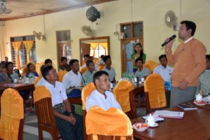
Minhla Member of Parliament Mr. U Aung Aung speaks to land resource stakeholder meeting attendees about the importance of instilling greater trust in local land authorities and his personal commitment to sup-port a process to ensure land issues faced by the com-munities of Yway Gone Village Tract are discussed transparently and resolved peacefully. Photo credit: Aung Myo Htike, Tetra Tech

Historically in Burma, limited communication has occured between community members and local land administration authorities. This has fostered distrust by citizens and a lack of responsiveness from local land authorities. USAID works with both groups as part of participatory mapping activities in the Yway Gone Village Tract to demonstrate models for resolving land disputes and promoting coordination in sustainable land management.

After several months of community engagement, USAID’s local partner facilitated a stakeholder meeting, representing the first time that local residents and government officials have been able to meet collectively to discuss land resource management and tenure issues.

The community used the products of participatory mapping exercises to voice their land resource concerns to local government. The forum also allowed local authorities to explain their role in land management. The newly elected Member of Parliament for Minhla Township, Mr. U Aung Aung, pledged his long-term support in resolving land resource issues faced by community members as a result of land leasing under the Vacant, Fallow and Virgin Land Law, but added that community members themselves must also be involved.

Speaking to meeting attendees, Mr. U Aung Aung said, “In the past, local land authorities have acted without considering the interests of all the community members. This must end if land conflicts are to be avoided in the future. Meetings like this are an important opportunity for all parties to discuss these sensitive issues in a safe environment and will result in improved transparency between citizens and government departments.”

The successful stakeholders meeting also stimulated community members to request additional support to better understand existing land legislation and the relevant provisions in the new National Land Use Policy on community land and resource rights.

TGCC Success Story: Customary Land Certification in Zambia Helps Secure Land for the Next Generation

In Zambia’s Chipata District, USAID has been supporting a local organization, the Chipata District Land Alliance (CDLA), to work with chiefs, village headpersons, and local communities to document village boundaries, community resources, and household land rights. As the current phase of work, which allows for preliminary parcel boundaries to be reviewed and agreed by community members before the issuance of land certificates, comes to an end, headpersons and community members have expressed their support for the work carried out thus far.

One such community member is Mr. Stephen Mbewe, a visually impaired resident of Mgombe village in Mshawa Chiefdom. Mr. Mbewe explained that his land was originally allocated to his parents by the village headperson; once his parents died and he married, the land passed to him. He said, “There has always been issues concerning boundaries since my neighbors thought I would not be able to tell exactly where the boundary was passing through the two fields… Each time there was a conflict I would appeal to the headperson who was always there to resolve the issue at hand.”

When asked whether the customary land certification work had made any difference to the situation, Mr Mbewe stated, “Firstly, the demarcation exercise sealed off any future dispute on field boundaries… Secondly, with the issuance of certificates by the chief, my wife and children will be secure until the next generation to come. I am so happy that CDLA came to our village at the right time and I am looking forward to the day when I and the family will receive the certificate.”

TGCC Success Story: Building the Capacity of Civil Society to Document Community Tenure with Geospatial Tools

Participants at the CSO training on geospatial tools watch a demonstration of mapping data collection using an unmanned aerial vehicle (UAV). Photo credit: TGCC

Many civil society organizations (CSOs) in Burma are actively working with communities to document land resources, but have limited exposure to community-led participatory mapping tools and methods. USAID Burma Land Tenure Project (LTP) has supported local CSOs with thematic training that supports their work with rural smallholders on securing tenure.  USAID’s support to CSOs leads to more equitable agricultural and economic development throughout the country.

The National Land Use Policy, recently endorsed by the government, acknowledges the importance and recognition of community or customary rights to land, though at present, these rights are frequently not recognized by local authorities. CSOs are critical to bridging the gap between communities and local authorities, meaning that building their mapping and spatial data capacity is a priority.

The rise in the use of GPS-enabled mobile devices has led to an ever increasing array of applications for users to rapidly locate themselves and then collect spatial data. While these present huge opportunities, clarity as to which applications are most suitable is lacking for CSOs. To address this issue, the USAID Burma LTP provided a technology-focused training program to 25 CSO representatives.

Participants conducted practical exercises with handheld GPS devices, tablet-based data collection, and mapping applications, and were able to work with an unmanned aerial vehicle (UAV).

Theingi May Soe, the Community Engagement Officer for the USAID Burma LTP, said, “The training on such tools is especially important for local CSOs. Their strong knowledge on the legal side of land tenure is let down by a lack of basic mapping skills needed to document community resource information. Improving CSO capacity in this area will greatly strengthen community tenure in many areas of the country beyond the current scope of our project.”

The training was the first in a series of USAID-supported institutional capacity development activities that will include additional training and financial support for CSOs to execute participatory mapping methods throughout Burma.

TGCC Success Story: Building Momentum for Land and Resource Rights Documentation in Zambia

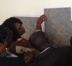
Civil society and implementing partners in Zambia are increasingly interested in applying inclusive and sustainable customary rights recognition processes piloted by USAID partner, Chipata District Land Alliance. In October 2015, more than 20 civil society leaders and USAID implementing partners from across Zambia visited Chipata District to learn about the community engagement, computer-based mapping, and political processes associated with CDLA’s customary land mapping in Zambia. The participants were encouraged to critique the approach and consider whether it is applicable to other contexts.

Gilbert Mwale of Frankfurt Zoological Society said, “The land demarcation process would help local communities in the Game Management Areas around North Luangwa National Park reduce land disputes, develop land use plans to increase investment partnerships around tourism development, and empower communities to negotiate concession terms with the Zambia Wildlife Authority.”

“Mapping and resource inventories have been on the Mwembezyi Natural Conservation Society’s (MNCS) road map long before we found out about USAID’s work. Your study tour to Eastern Province has given us an idea how to do this,” noted Rolf Shenton. Since the study tour, the Senior Chief and the District Development Committee in Mwembezyi area have adopted a plan to begin customary resource mapping in 2016.

Further technical trainings are being planned to build on this momentum and to help civil society organizations, USAID partners, and government further pilot the USAID-supported methodologies. These trainings will deepen the capacities for participatory mapping and land use planning that links local communities and chiefs with formally recognized government processes.

TGCC Success Story: Supporting Villagers in Burma to Document and Map Community Boundaries for Improved Tenure Security

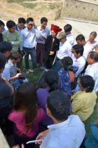
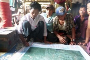
Community members in Yway Gone Village Tract using participatory mapping techniques to describe and illustrate their community boundaries for the first time.

In Burma, weak land tenure security and unsustainable land use management are issues faced by many rural communities.  Reasons for this include a poor understanding of existing land legislation, the involvement of multiple government departments in land administration, and a failure to recognize community-based land rights.  The issues are particularly acute for landless citizens in these communities.

Daw Thin Yee, a resident of Yway Kone village, said, “Since landless members of our community like me have lost access to communal lands, we have a big problem grazing cattle and collecting thatch for our homes.” Such situations may lead to future land disputes and conflict, as well as inhibit smallholder agricultural development.

To address this situation, the Land Tenure Project (LTP) has brought together relevant stakeholders, including local authorities, community members, and civil society groups, at the Yway Kone Village Tract pilot site to document the perceived land rights of communities.  Project staff have provided educational materials and technical support through a process that begins with community sensitization to land issues and continues with participatory mapping activities undertaken at a series of community events.

Nicholas Thomas, Country Coordinator for the project, stated, “The information gathered with the support of all stakeholders will serve communities well in communications with local authorities and private companies in the event of access and land use disputes.”

Community members appreciate the outputs of the work to date and understand how they will support their land rights in the future.    As work continues into 2016, community boundary information will be supplemented by community-level land use inventory data that can then be used for sustainable land use planning.

USAID’s support has resulted in information products, including map data that, for the first time, accurately describe the perspectives of community members and can be used by them when discussing land resource issues with local authorities.  Community empowerment through information generation and exchange as witnessed by LTP actions provides others interested in community land tenure in Burma with a framework for work in additional areas throughout the country.

TGCC Success Story: Securing the Land Rights of Rural Zambian Communities

Clear and enforceable rights are central to farmers’ decisions to invest time, labor, and money in sustainable land use. In Zambia, the rights of smallholder farmers and communities are undocumented for the majority of the country. USAID is supporting local traditional leaders and government to pilot low-cost approaches that systematically document, and ultimately protect, the land rights of rural communities.

One of the main challenges of documenting large areas of land at once, is ensuring that all stakeholders, even those outside the community, know that their land will be surveyed. USAID’s partner, Chipata District Land Alliance (CDLA), has deployed a robust communications campaign including community theater performances and cartoons, as well as community meetings.

The message reached Ephraim Kamoto Phiri of Chipata Town, who has family land in rural Kasinzina Village. Mr. Phiri noted: “When I heard that there are people in the village who are demarcating potions of land, I did not at first fully understand why they were there and so my first reaction was to rush to the village and defend my land. But upon reaching the village, the community explained everything and I was happy that my field too would be demarcated and protected from future grabbers of land. I further appreciate the work that CDLA is doing in making our communities aware of their land rights.”

The importance of communication and outreach does not end at the field demarcation stage. After initial maps are created CDLA will deploy a corrections period to publically vet village maps, increasing transparency and conflict resolution before the local chiefs deliver customary land certificates.

Across Chipata District and with the growing threat of commercialization of traditionally held land, rural farmers are beginning to demand documentation of their rights. USAID’s work is providing sustainable models to help government and civil society meet these needs.

TGCC Success Story: Supporting Traditional Leaders to Manage Land through Securing Rights and Enhancing Dialogue

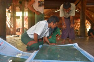
Chieftainess Mkanda reviews the boundaries between her chiefdom and neighboring chiefs for the first time. Photo credit: Matt Sommerville / Tetra Tech

Zambia’s chiefs are the official custodians of vast areas of rural agricultural land that provides livelihoods for millions of rural farmers, as well as the game management areas that are home to forests and habitats for Zambia’s renowned wildlife. Chiefs have enormous powers to allocate land and, with their headpersons and advisors (indunas), to define what practices are permitted and by whom. Yet each chief has his or her own customs to follow and may have little knowledge of the decisions of their predecessors, as customary decisions are rarely recorded.

As pressure for land increases and as city dwellers, investors, and even local governments search for virgin land to build on or develop, local farmers are at a disadvantage in protecting their existing rights to land. As a result, USAID is supporting chiefs and villages to systematically document boundaries and engage in participatory land use planning to protect communal resources like grazing areas and forests. USAID and its local partners are subsequently helping individual households to register household land with chiefs and village headperson.

“Having a map and register will help me manage my chiefdom,” said Chief Mnukwa. “Now when new settlers come, I can allocate land without the disputes that used to emerge.”

“I have a small chiefdom,” said Chieftainess Mkanda. “We have many conflicts with our neighboring chiefs. I believe these maps can be used to bring peace to the chiefdom.”

In addition to improving tenure security in chiefdoms, USAID has been supporting dialogue between chiefs and local government. Local government has welcomed the chiefdom mapping work. “We used to help investors convert land from traditional use to leasehold, with only the signature of the chief. Now, we have more tools to ensure we do not convert land that is another family’s,” highlighted a local council secretary.

TGCC Success Story: Strengthening the Capacity of Civil Society to Undertake Land Tenure Assessments in Burma

U Win Htut, Public Network CSO, Thayarwaddy District examining supporting a recent community based tenure assessment in Yway Gone Village Tract

Across Burma there is limited access to information on local populations’ legal and customary rights to own, use, and manage land and natural resources. This lack of information presents a challenge to civil society organizations (CSOs) and village communities that need a clear picture of the land and resource tenure situation to contribute to sustainable land use planning.

Working in close coordination with the Land Core Group (LCG), Burma’s leading CSO focusing on land issues, USAID is supporting capacity-building activities for civil society organizations to implement land tenure assessments.   Importantly, the assessment methodology seeks to increase interaction between local government officials and community members, thereby reducing distrust between these parties.

Based upon participatory rural appraisal techniques, the training allows CSOs to identify key land resource issues faced by a communities.  These standardized outputs can then be used to guide future efforts for tenure recognition and dispute resolution.

Representing the Public Network CSO of Thayarwaddy District, North of Yangon, U Win Htut believes that the delivery of such training clearly supports rural development objectives.  “Training youth-based CSOs, like ours, means that information on this subject can be given to residents to create opportunities to improve community welfare.”

The answers to the assessment questions, allow CSOs to generate findings that can be compared between different locations, are used to formulate broader community education efforts associated with land rights and ultimately support regional or national land administration efforts to protect rural community and customary tenure arrangements.

TGCC Success Story: USAID Supports Government of Burma to Officially Recognize and Adopt National Land Use Policy

To support the government of Burma to increase land access for the rural poor—including women and minority groups—the USAID Land Tenure Project worked with government stakeholders to draft the country’s first-ever National Land Use Policy (NLUP). The policy was adopted by the government in 2015, after a two-year participatory, inclusive public consultation process that was funded and designed by the Land Tenure Project to ensure the needs of landless and vulnerable groups were represented. Approximately 67% of Burma’s population lives in rural areas, and the majority depend on the agricultural land to earn a living. Yet up to 50% of rural households in Burma are landless, and poverty in rural areas is high. The new policy will increase access to land for this population.

In November 2015, elections brought new leadership to the country of Burma. The NLUP was seen by some as a policy associated with the outgoing administration. Through extensive outreach with the new administration, the Land Tenure Project was able to effectively articulate the importance of the NLUP and was ultimately able to usher this policy through two administrations successfully.

In August 2016, the Land Tenure Project supported a meeting in Naypyitaw in which 200 stakeholders from Parliament, farmers’ associations, and civil society, along with international experts, shared and learned methods for increasing tenure security for smallholder farmers. The meeting was opened by Dr. Tun Win, Deputy Minister of Agriculture, who reinforced the importance of an equitable land resource management approach, while reminding attendees that while the NLUP has been endorsed, work remains to be done on formulating new land-related legislation, and updating existing laws in line with the articles of the NLUP.

In his closing remarks, Dr. Tun Win confirmed that the new administration has fully adopted the NLUP and considers it the official land use policy of Burma—the first time the policy was officially recognized by the government, and signaling an incredibly successful outcome for the program.