TGCC Success Story: Participatory Mapping Exercise Resolves Land Conflict in Zambia

In rural Zambia, village boundaries are not formally documented, and conflict often emerges from boundary ambiguities. Local traditional leaders and village headmen responsible for resolving land disputes often lack the maps and other tools they need to make informed decisions. In March 2015, USAID supported completion of a participatory mapping exercise that peacefully resolved a decade-long dispute between two communities.

Each planting season, community members of the Kakota and Kamiya villages in Eastern Zambia engage in heated exchanges over the ownership of agricultural land and “bush” areas that both communities hope to use for agricultural expansion. USAID’s local implementing partner, the Chipata District Land Alliance (CDLA), worked with these communities to conduct “boundary walks” and create maps illustrating village boundaries and community-managed resources. Community members validated the maps, and for the first time saw the area of long-standing conflict illustrated on paper; a powerful visual for all.

Village members gathered to review the maps, and a discussion of the history of the land ensued. A village elder from Kamiya explained the story of the founding of the two villages. The contested area originally belonged to Kakota, but as demand for land increased, community members from both villages began establishing fields in the area.

The communities agreed that the land would be administered by Kakota’s headperson, but that residents of Kamiya could continue to farm and request land in the neighboring village.

Members of both communities were grateful for the exercise. One Kakota community member noted that because the land ownership has been clarified, he will be able to farm the land without fear of expropriation. “We are grateful that you helped us resolve this wrangle,” he said to the CDLA. “I can now reserve some of my family land as bush until we need it, because we have proof that it belongs to us.”

Rwanda LAND Policy Brief: The Implementation of Rwanda’s Expropriation Law and Outcomes on the Population

By Andrews Kananga, Hadley Rose, Frank Mugisha, Clarise Munezero, Jean Baptiste Nyarwaya, Zacharie Ndayishimiye, with assistance and advice from Dr. Daniel Clay

This Policy Brief contains a synthesis of the findings and recommendations drawn from a research project conducted by the Legal Aid Forum on the Implementation of Rwanda’s Expropriation Law and its Outcomes on the Population. The research was funded by the USAID-funded LAND Project as a component of a broader research agenda developed in early 2014 through a multi-stakeholder consultative process in Rwanda supported by the LAND Project.

The current Expropriation Law was adopted in 2007, as legislation implementing the 2005 Organic Land Law. The Organic Land Law was replaced in 2013 by an ordinary law regulating land. The 2013 Land Law reaffirms the right to private property ownership that is subject to expropriation in the public interest. The 2007 Expropriation Law created the procedures and regulations by which the government could expropriate private property in the public interest.

Rwanda’s ambitious development plans have led to much growth and prosperity in Rwanda, but those plans have often required the expropriation of property from its citizens. Prior to this research, no systematic, comprehensive empirical review had been conducted on the extent of expropriation in Rwanda, the valuation and compensation processes for expropriated properties, and the impacts of expropriation on the expropriated population. In order to estimate a baseline number of households impacted by expropriation, the research team visited all 30 Districts in Rwanda to obtain numbers of expropriated households, and also to identify more detailed numbers and lists of names of expropriated people in the 15 sampled Districts. From this two-stage listing process, the team was able to estimate that 30,050 households have been affected by expropriation since the 2007 Expropriation Law was adopted. This policy brief presents the key findings and recommendations derived from this study.

PRADD II Snapshot: Registration of Diamonds in Forecariah

Registration of Diamonds in Forecariah: First Time Ever in the Prefecture

Spurred by a massive influx of refugees from Sierra Leone and Liberia, artisanal diamond mining commenced in the 1990s in the Forecariah prefecture in Guinea and along the alluvial river courses of this coastal area.

Artisanal diamond mining in Forecariah has long been unorganized with little to no supervision by the government mining agency. Incoming diamond miners simply negotiated access to a piece of land from customary landowners and begin digging without regard for the laws and regulations governing this sector. The Forecariah Prefecture Director of Mines tried in vain with only one staff member and a volunteer to supervise more than twenty diamond mining sites with very limited means at his disposal. In effect, the state was truly absent in the majority of the diamond mining areas.

With the arrival of the Property Rights and Artisanal Diamond Development II program (PRADD II), the Ministry of Mines and Geology and the project staff placed a strong emphasis on expanding the presence of government in the artisanal diamond mining areas of the Forecariah Prefecture. PRADD II focuses on selecting and training a cadre of three young ministry geologists, called by the project “Junior Experts,” to take up positions in the prefecture and thereby strengthen the presence of the state. The project works very closely with the ministry to carry out training on the Kimberley Process Certification Scheme (KPCS), provide hands-on instruction in diamond identification and registration in production notebooks, and use eTablets and specially configured software to register diamonds collected at mining sites.

From March to June 2015, 292.83 carats of diamonds (including 156.82 ct. of jewelry quality, 130.98 ct. of industrial quality and 5.03 ct. of boart quality) were registered. Even though the diamonds so far found in Forecariah are small in size compared to those from the mining major zone of Banankoro in the southeast of the country, the progressively expanding registration of diamonds strengthens Guinea’s compliance with the Kimberly Process.For the first time in Forecariah, diamonds are now beginning to be registered in compliance with Kimberly Process Certification Scheme requirements. In expressing his satisfaction about this effort, the National Director of Mines stated that “to date, our young experts are registering diamonds in the field and transmitting the data to us instantaneously. We receive everything in real time.” These procedures assure that diamonds are not being illicitly traded and used to finance wars and violent conflicts. “Thanks to the registration process set up by the project, we were able to locate a diamond from a site that has an invalid license,” noted the Head of the ASM Division in a conversation with the PRADD team. Trust is being progressively built between the Junior Experts and the diamond miners. One of the Junior Experts noted that “80% of miners are allowing their findings to be registered.” The Director of Mines added: “when miners understood that the Junior Experts were not there to take their diamonds away from them, they immediately accepted registration of their findings. When they were told that they will not be asked to pay taxes and registration will be discreet, and when they understood that all we need is to capture the statistics of production, they accepted immediately.” Gone are the days of secrecy when artisanal diamond miners refused to register diamonds. “Even if the diamond is a half carat, miners reach out to us for registration. Initially, miners were opposed to having their photos taken but thanks to the trust that is settling in, they now accept and require their photos to be taken for inclusion in the database,” concluded one of the Junior Experts.

From March to June 2015, 292.83 carats of diamonds (including 156.82 ct. of jewelry quality, 130.98 ct. of industrial quality and 5.03 ct. of boart quality) were registered. Even though the diamonds so far found in Forecariah are small in size compared to those from the mining major zone of Banankoro in the southeast of the country, the progressively expanding registration of diamonds strengthens Guinea’s compliance with the Kimberly Process.

Much more work remains to further address illicit mining and smuggling across the nearby porous border with Sierra Leone. But, this first step, the registration of diamonds through official government channels, is a far cry from the chaotic situation of the early 1990’s when a free-for-all reigned in Forecariah. Certainly, more work is needed to incentivize miners to rehabilitate the land with improved mining techniques and to strengthen relations between government and customary land owners in diamond rich mining areas. But this first steps needs to be applauded – the core objective of the PRADD II program in Guinea.

Rwanda LAND Policy Research Brief: Climate Change Adaptation Within Land Use and Tenure Reforms in Rwanda

Across equatorial and east Africa, climate change is affecting the frequency, intensity and variability of regional climate patterns.1 Changes in rainfall patterns, temperatures and storm intensity are having significant effects on national economies, regional infrastructure, land use and local livelihoods. These changes are forcing national and local governments to adjust and adapt how they plan, prepare and implement day to day operations today and larger visions for the future. The ability of governmental policies and programs to address challenges from climate change will ultimately determine how economies grow and how social welfare and the environment are preserved and protected.

In Rwanda, climate change impacts are forcing the government to integrate adaptation measures to ensure that its environment, its economy, and, most importantly, its people are able to withstand the negative effects of floods, storms and droughts. Within the last two decades, and even more so in recent years, Rwanda has included climate change adaptation elements into some land use policies, regulations, programs and national growth strategies, although these elements are often weak and lack substantive direction or mandate for land use planners and managers. Additionally, since the implementation of those policies is, in many cases, too recent to determine how effective they are at reducing risks and vulnerabilities to climate change, there still exist opportunities for Rwanda to learn from the performance of matured policies, strengthen current adaptation approaches, adopt best practices from regional examples sharing similar experiences, and better integrate climate change adaptation interventions across governmental action.

This policy brief will: examine key impacts of climate change in Rwanda, assess the performance and implementation of climate change adaptation measures in land use policy frameworks and suggest key recommendations that could strengthen Rwanda’s land use policies to better integrate climate change adaptation measures.

LRFRP Success Story: USAID Restores Land Rights for 72 Shareholders

In 2008, a group of 72 shareholders of the dehkan farm Mirzo Gado were assigned 65 hectares of land. Four years later, a local government official illegally withdrew eight hectares of that land without asking their permission and transferred the land to another dehkan farm for fishery purposes. For years, the shareholders were unsuccessful in trying to get their land back. Despite awareness-building efforts, many farmers remain uninformed of laws on land-use rights and as a result, some local officials are able to manipulate or obstruct dehkan farm members’ ability to exercise their rights.

The USAID Tajikistan Land Reform and Farm Restructuring Project (LRFRP) regularly supports roundtables to promote dialogue between farmers and government officials. On February 25, 2014, shareholders from Mirzo Gado participated in a roundtable on farm restructuring conducted by USAID-sponsored Legal Aid Centers (LAC), Ilhom and Tajagrofond.

The farmers were able to talk directly to the representative of the rayon State Unitary Enterprise Registration of Immovable Property, and asked for clarification regarding their case. The representative explained that the chairperson’s decision was illegal, and detailed the specific measures the farmers needed to take to regain their land.

Then, the LAC Tajagrofond lawyer worked with LRFRP lawyers to help the farmers petition for the return of their land. The farmers submitted their claim to the Economic Court of the Khatlon District on March 2, 2015.

On March 13, 2015, the court declared that the actions of the chairperson of the Jomi district were illegal and ruled the eight hectares of land be returned to the 72 shareholders. The farmers received their lands back and started to cultivate their eight hectares. Their restored shares of land will increase Mirzo Gado’s harvest production yields.

Expanding land-use rights of farmers fosters greater transparency in land administration, leading to more efficient use of land and improve the livelihoods for Tajiks living in rural areas.

Photo Caption: LAC lawyer Ibrobim Sharipov consults Mr. Said Sharipov and other shareholders of the dehkan farm Mirzo Gado, March 5, 2015.

LRDP Success Story: Disaggregating Data to Address Inequities in Land Restitution Process

CHALLENGE: Colombia’s 2011 Victims and Land Restitution Law promises to provide comprehensive reparations to victims of the conflict, including land restitution. The law explicitly adopts a gender-sensitive approach and extends its sensitivity to characteristics of age, sexual orientation and disability. For the Government of Colombia (GOC) to best protect vulnerable populations, the Land Restitution Unit (LRU) must capture appropriate information in restitution requests. The form the LRU was using to conduct a situational analysis had very few fields about groups with a special protected status, and in the instructions for filling out the form, the LRU had not considered situations applying to women, children and youth, persons with a disability, elders, and/or LGBTI. Because the tool was general, the LRU did not have all the information it needed to implement the law.

INTIATIVE: LRDP provided technical assistance to the LRU to secure the inclusion of more gender/age/disability-sensitive variables. For example, in Bogota, a disability rights expert reviewed and proposed new fields to include in the LRU’s tool and held a series of strategic sessions with LRU regional offices. LRDP gave regional trainings to LRU lawyers and social experts on how to better apply the law in light of relevant legislation protecting human rights. Local LRU staff shared their experiences incorporating a disability-sensitive approach in their implementation of restitution policy and LRDP structured and modified products based on the feedback received.

RESULTS: A key modification to the LRU’s forms concerned disability. Although the LRU did ask about this previously, the question was limited to only asking about the title holder’s status. In suggesting the LRU modify the form to collect more disaggregated data (asking about disability of all members of the family group), LRDP helped position the LRU to be better able to ensure the restituted plot is accessible by the entire family.

TGCC Success Story: Connecting Public Voices with Government Ears

As the Government of Burma opens up its political process and undertakes democratic reforms, USAID has been actively supporting a meaningful public consultation process on the draft National Land Use Policy in Burma. As stated by U Shwe Thein, Chairman of the Land Core Group, the “process of conducting public consultation on a policy such as this is unprecedented and most welcome.” While the government of Burma conducted 17 public consultations in every state and region of the country, an equally meaningful process of grassroots consultation on the draft policy has been taking place, with civil society organizations across the country leading over 60 local-level events. These forums have included farmer associations, retired government officials, local politicians, members of monastic organizations and representatives from various unions, allowing the public to delve deeply into the substance, purpose and meaning of the draft National Land Use Policy.

One of the clearest responses coming out of the national consultations and the parallel civil society process was the need for more time for the public consultation process. USAID and other donors helped give voice to these concerns. Ultimately, the government made the welcomed decision in late December to extend the process through March 2015. As Tin Maung Than, Deputy Director of the Land Information Unit within the Forest Department stated, “we have heard the voice of the people and the Government has listened to this voice.”

Another consistent message has been the need to strengthen land administration and governance at township and village levels. There is a common perception that township administrators are inefficient, corrupt, high-handed and uncaring. According to Dr. Kin Zaw Win from the Tampadipa Institute, “This is where the state’s weakness lies and there is no remedy in the near term. This is the main reef upon which the Government’s reforms have foundered.” USAID is supporting local land administration through a pilot program to document traditional land rights in and around townships and village tracts.

The public consultation process continues into 2015 as the government consolidates and responds to feedback with technical support from USAID. As Dr. Kin Zaw Win further stated on the public consultations, “the government encouraged the process and facilitated this process, which is good for the people of Burma so their voices may be heard.”

TGCC Success Story: Supporting Transparent Land Administration in Zambia

The majority of land in Zambia, including that of millions of smallholder farmers, is administered by traditional authorities such as chiefs and village headpersons. As investment flows into Zambia, communities are increasingly looking to traditional authorities for guidance, support, and protection of individual and community land assets. Historically, traditional authorities have not documented their land allocation or land dispute decisions, leaving community members with tenure insecurity in the event of a change in leaders or outside pressures emerging for land. USAID is addressing these challenges by working with traditional authorities to explore models that build transparency and documentation into customary land administration, securing resource rights for local communities.

USAID is working with local implementing partner Chipata District Land Alliance to support local-level land administration. The activity focuses on building land administration capacity at the village and chiefdom levels, encouraging local leaders to become advocates for transparent land administration, and helping traditional authorities form positive working relationships with provincial and district governments. Acting Chief Mshawa highlights the importance of this program, and the land-related challenges that have afflicted communities in the past:

“In my reign of 13 years as Acting Chief Mshawa I have attended and solved more land problems than anything else; many unresolved boundary disputes, illegal allocation of land, issues to do with land inheritance. Every day of my life as chief, I have to attend to some person or group of people who have differed over land or who has/have been wrongly settled.”

Through sustained engagement with traditional authorities, USAID is facilitating a dialogue that will help rural Zambians and their traditional authorities respond to the 21st century land challenges facing Zambia.

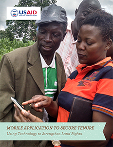
Mobile Application to Secure Tenure (MAST) Brochure

Around the world, millions of people lack documented land rights. This may be the result of weak land governance systems or limited capacity to provide accessible and accountable land administration services. These institutional challenges are widespread and drive costly and systemic problems on the ground.

Without documentation, people often lack secure tenure over land and natural resources. They are more vulnerable to wrongful displacements that disrupt their livelihoods and important social networks. They also have fewer incentives to invest labor and capital to improve productivity and enhance the future value of their land. For too many, tenure insecurity means that agricultural productivity and incomes remain low; resources are used in unsustainable ways; and, costly conflicts are all-too common. Additionally, poor land governance creates special hardships for women and other vulnerable groups.

USAID is addressing these problems through an innovative pilot called the Mobile Applications to Secure Tenure (MAST) project. The project team has developed an easy-to-use, open-source smartphone application that can capture the information needed to issue formal documentation of land rights. Coupled with a cloud-based data management system to store geospatial and demographic information, the project is designed to lower costs and time involved in registering land rights and, importantly, to make the process more transparent and accessible to local people.

ERC Success Story: Impact Evaluation Tests Innovative Approach to Securing Communal Rights in Ethiopia

Households belonging to pastoral and agro-pastoral communities often have difficulty tapping into opportunities for the commercial production of livestock and crops, accessing markets, and expanding into new agricultural sectors. Lack of access to inputs (fertilizer, machinery, veterinary supplies, etc.) and credit, insecure land tenure and property rights, and unequal bargaining power all contribute to limiting their economic opportunities. To address these barriers, USAID, in collaboration with the Government of Ethiopia, has recently launched a new project – Land Administration to Nurture Development (LAND). Under LAND, pastoral and agro-pastoral communities are expected to benefit from stronger property rights to their communal lands. The project will also help to improve governance at the local level by providing communities with decision-making rights over their natural assets, such as land and water. With stronger tenure, communities may diversify their agricultural production, engage with outside investors to add value to their livestock and agricultural goods, undertake long-term investment, increase their incomes, and improve their livelihoods.

To measure the effectiveness of the project, USAID has designed an impact evaluation. The evaluation will examine whether the project results in the expected outcomes, including increased livelihoods and opportunities for generating income within the targeted communities.

The evaluation team and the LAND project team met in Ethiopia between September 14 and October 3, 2013. To design a rigorous impact evaluation, both teams worked together to define general guidelines and clarify the type of information needed, including definition of community units, identification of the pool of potential sites where the project will operate, randomizing the selection of implementation sites, and coordinating the evaluation design with the project’s implementation plan.

While designing and implementing a rigorous impact evaluation strategy requires greater up-front effort from both the implementing and evaluation teams, the payoff is being able to more accurately assess program impacts and improve future programming.