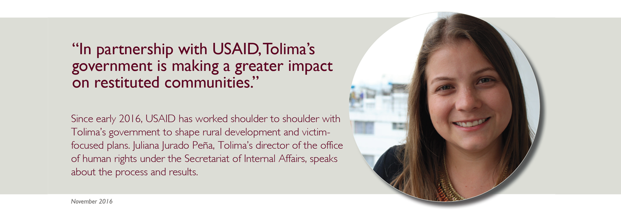
LRDP Q&A: Alvaro Tapia Castelli

In the region of Montes de María, in northern Colombia, citizens have filed more than 6,000 land restitution claims. To date, the government has processed 85% of them. Judges have issued sentences restituting some 4,000 hectares to 300 families. In this interview, Álvaro Tapia Castelli, the Land Restitution Unit’s (LRU) regional director for Sucre, Bolívar, and Córdoba, speaks about the support that USAID’s Land and Rural Development Program has provided for the restitution process and the LRU’s plans to resolve all remaining claims in 2017.

What characteristics have made Montes de María and the LRU’s mission unique? 

Since the creation of Colombia’s land restitution policy, Montes de María has been characterized by a large number of restitution claims, especially in municipalities like Ovejas and El Carmen de Bolívar. And at the same time, our regional LRU office has suffered from a shortage of personnel, which prevented us from processing claims systematically and efficiently.

USAID began partnering with your office in 2013.  How has the partnership helped the LRU attend to restitution claims?

Thanks to USAID, we have enjoyed the support of professionals who could help us accelerate the various phases of the restitution process, including the administrative and judicial phases. The support has allowed us to resolve a large number of pending claims, which has allowed us to be able to provide timely responses to the families seeking the restitution of their land. I would say of the more than 6,000 claims in Montes de María, about 15% were processed with the support of USAID’s Land and Rural Development Program.

Where did USAID and the regional LRU office combine efforts to increase land restitution processes? 

We were able to push forward about 150 cases for people in the village of Macayepo and in the mountainous area of Bolívar. Today, many of these cases have received rulings from restitution judges. Last year, judges delivered 77 rulings that called for the issuing of property titles for families who were forced to abandon their lands, and some of these parcels have already been formalized. Thanks to USAID, today these families are happy with the land restitution policy.

What are some of the challenges in working with the municipalities in terms of attending to restitution beneficiaries? 

Before, everyone seemed to think that the restitution policy was the sole responsibility of the LRU. We know that there are a series of entities that participate in the process—these are the entities that make up the SNARIV1. And for the case of the regional entities, if we hadn’t had a rapprochement with them in terms of organizing participatory forums where they could learn about the restitution policy and their responsibilities in this regard, it would have been quite difficult to implement the policy at the regional level.

Have you been able to change this perception?

Yes, we were able to strengthen interinstitutional coordination in the region, which allowed us to address the issue of secondary occupants. This is an extremely important issue that we wouldn’t have been able to address without USAID’s support. USAID opened up channels of communication with the Ombudsman’s Office, the departmental government, and even mayors’ offices in order to lend support to secondary occupants—families who had nothing to do with abandonment and displacement, but are nonetheless involved in the restitution process.

Did your office improve its approach to secondary occupants?

Our partnership with USAID has strengthened forums like bilateral roundtables, which have become an important place for debating the policy on secondary occupants. USAID’s support has been important in logistical terms, as well as in actions around management and guidance to be able to attend to these families and make restitution a reality.

Do you think USAID’s approach to strengthening the role of municipal governments has been effective?

In some municipalities, this support has been important for the drafting of Territorial Action Plans. Also, thanks to USAID’s support, many mayors’ offices have incorporated the country’s land policy and land restitution into their Municipal Development Plans.

How do local communities perceive USAID’s support to the LRU?

They realized that the LRU was not doing this on its own. In our outreach efforts—through visits and monitoring—the communities came to understand that although the LRU was in charge of overseeing their process, we were not alone in the region and that part of the resources and staff used to decide on their restitution claims benefited from international development efforts.

How will the partnership with USAID impact LRU’s work in the future?

I think there will be two impacts: an institutional impact that leaves an installed capacity in LRU’s personnel, because all of the professionals who have worked in this office now have a solid experience with land restitution and the evidentiary process. Also, USAID’s support will leave behind an established process of inter-institutional coordination. Initially, USAID generated these inter-institutional spaces and ensured the necessary resources for keeping them alive—and today they function on their own.

“Thanks to USAID, today these families are happy with the land restitution policy”
– Álvaro Tapia Castelli, the Land Restitution Unit’s (LRU) regional director for Sucre, Bolívar and Córdoba


LRDP Q&A: Luis Alberto Clavijo

One of USAID’s main institutional partners is Colombia’s Land Restitution Unit (LRU), the entity charged with investigating claims of forced displacement and preparing these cases for restitution judges. The USAID Land and Rural Development program sat down with Luis Alberto Clavijo, director of information technology at the LRU, to talk about the difficulties that the entity has overcome thanks to better information systems.

What was the main challenge with the former system for completing tasks related to land restitution?

When the LRU was formed, we didn’t have time to design methodologies or to really test tools before putting them into action. So our IT team had to prioritize the ones we wanted to develop. Everything had to be created on the fly.

When did LRU start partnering with USAID?

In 2013, we began talking about the projects that required assistance. One of the first was the ethnic module. Then we began discussing systems for managing restitution claims and the post-ruling phase.

How has this partnership changed the way LRU approaches land restitution?

The improvement has been great. Colombia’s official information on restitution comes from the data captured in our system. Before, we couldn’t do this, since we didn’t have everything in the system; to get statistical data, we had to call the regional offices, which made the process more complicated. Today, we do it differently. The data that is in the system is the data that counts. And everyone knows that. USAID helped us finance this work. So what we have on our website—all that information on claims, rulings—comes from the modules USAID helped us develop.

With these new systems in place, how has your work life changed?

These systems represent a huge responsibility for me, since official data come from the office of technology. Many factors are involved in the system’s functioning—a server could go down, and so on—so you have to be on top of a lot of things at once. But on the other hand, when people ask for information on any specific theme, I can give it to them. In this way, my work has changed, because we’re able to respond to these requests. We get requests from the Public Prosecutor’s Office, the Senate, and the Presidency—from lots of people. And we always give them an answer. For me, it’s simpler now, since I know the information is there. The systems are a great tool not just for the office of technology but for the entire LRU. And in the medium term, they’ll be a great tool for other institutions as well.

Has the development of these systems affected or improved relationships within the LRU?

It depends on how you look at it. In the past, an information system meant a registry, and that was it. There was no further management. But here, we want to be able to track any restitution case from start to finish. This implies having controls within our systems—and of course, people don’t like to be controlled.

Some regional offices were resistant in the beginning, because staff were being told, “you need to comply with the terms.” They felt monitored. From a user’s perspective, having to do things this way can feel a bit tense. But later it becomes a necessity, because users no longer have to worry about the little details—the system helps guide them along. They no longer have to think about the mechanical aspects and can focus on the more substantial part of their jobs. It is a relationship going through phases. People are used to having their hard-copy folders—they need to feel something in order to do it—and changing that isn’t easy. But I think that in a year, there will be a cultural change within the entire LRU around information management.

Where do you see land information going in the future?

I hope that with all of this work we’re doing in terms of information sharing, the institutions modernize—because part of what is happening today is due to the fact that before, they weren’t careful with information. You can see for yourself: there’s no official information for many land parcels. That needs to change. Today, we can’t use the excuse that Colombia lacks the appropriate technology. We have just as much technology as any other developed country. It’s an issue of will, of having a vision of how things should be. We need to show that things can be done differently. For instance, as we are doing with the Land Node project—getting all those entities to coordinate, to share information, to show that it can be done without too many complications. USAID’s support has been very important in this regard.

LRDP Q&A: Carlos Eduardo Campo Cuello

Since 2014, the USAID Land and Rural Development Program has partnered with Cesar’s government to deliver more effective responses to institutional challenges that stymie effective land administration and development in a region that has more than 500,000 displaced citizens and 1 of every 3 lots are informally owned. In his own words, Cesar’s Secretary of Agriculture, Carlos Eduardo Campo Cuello, highlights the various ways the government’s work has improved thanks to USAID.

You have led Cesar’s Secretariat of Agriculture for less than a year. What was it like when you arrived?

Historically, the secretariat has suffered from some key organizational weaknesses. The division of labor was unclear, people didn’t know how to make themselves fit in work-wise, there was no clear organizational structure, and we didn’t have teams or work groups. The office always worked in an independent way, as opposed to a cross-cutting one.

This has been a key focus of USAID’s support, hasn’t it?

Definitely. We now have many possibilities before us. USAID has been helping us with the secretariat’s institutional strengthening and with planning around structural organization. Over this past year, we’ve accomplished more than just a planning document—we’ve raised awareness among all employees regarding post-conflict concepts.

How have the secretariat’s roles changed in the post-conflict context?

Based on our work with USAID, we understand that we need to be more than a Secretariat of Agriculture and move toward a Secretariat of Rural Development with integrated components related to education, health, tourism, economy, and productive projects. This is the metamorphosis we are promoting through restructuring and organizational planning, and that we are putting into practice.

What other changes have occurred as a result of your joint effort with USAID?

Another very relevant aspect for us is the digital archive that we’ve worked on with USAID. Having all the documents from 2001 and 2015 digitally classified has improved not just the ease of and access to documentation but also the organizational and work climate. To complement that, we’re implementing a new information system that allows us to track and follow up on the various projects that we’re implementing. Today, that software has been installed on the government’s platform and is undergoing a final testing stage.

How did the secretariat used to manage information?

We used to store our documents in boxes, which were scattered all over the office. We didn’t even know what we had. The only way to locate a document was by relying on the institutional memory of a single staff member who has worked here for 15 years—if that person were to leave, we wouldn’t have been able to find documents or to track any processes. Today, we’re trying to make it so that those processes don’t belong to individuals but rather are part of a system that allows anyone who starts working here to do their job—ending these issues of dependency.

How is the adoption of those changes coming along?

It’s one of the biggest challenges we face with staff. Before, people felt empowered by owning the physical information. Today, we have to take that information and put it into an open system, removing that power. We now see them empowered through efficiency and effectiveness in their work. That’s the secretariat we want to become.

How will the various productive sectors of Cesar benefit from this support?

I think the most important things are agility, effectiveness, and efficiency in results—to be able to quickly attend to a request or respond to a claim. And not just in response times, but also quality. To the extent that we can better manage more information, we’re able to find it more quickly and also to find the most relevant information. With those changes, we’re going to triple our rate of service provision and will improve the quality of our services.

Does it mean that the secretariat has a closer relationship with other entities?

Yes. For example, the Office of the High Commissioner for Peace needs the Secretariat of Agriculture to support victims of the conflict. We will be able to give more agile responses to those processes, to see which processes can be applied, to rely on statistics that we never used to have and which we are now putting together through our new information system.

What are other things worth highlighting with regard to the collaboration between the secretariat and USAID?

We have worked with USAID on the practical components of rural development, such as value chain alliances and the formulation of productive projects. This year, we’re working on an irrigation plan and on the department’s productive and social organizational plan for rural property, both of which are important tasks. USAID has offered technical support and has worked diligently while we finance and learn. In this sense, we have a very committed Governor. Of the 12 projects that we designed with USAID, 11 are now being financed and rolled out. We’re also going to receive 15 more and will do similar things with those. Our agreement is that what the secretariat and USAID plan together, we will provide the capital—or locate funding from another source if need be.

Tell us about your irrigation efforts with USAID. Why did you choose to pursue that issue?

Water is a big challenge in Cesar, and the rehabilitation of the mini irrigation districts will allow us to secure early victories and be able to show the public that we’re executing resources. Having the designs and profiles for these projects has made us agile. Today, we’re moving forward in five mini districts, and USAID is doing the studies and designs for eight more.

And what about your formalization efforts?

Formalization, of course, is a very relevant topic. It is unbelievable we cannot invest in a school unless it has a property title. With USAID, we’re moving forward in securing 200 land titles in nine municipalities. And at the same time, we secured a departmental ordinance that exempts small landowners from paying property registration fees. That’s an incentive to formalize.

What does the secretariat expect to achieve with these new tools developed with USAID’s support?

I hope they contribute to building an honorable secretariat, to resolving the problem of post-conflict, to resolving the problems with production in Cesar today, to opening new markets, to ensuring that our services reach more citizens.

National Action Plan on Responsible Business Conduct

In September 2014 President Obama announced that the United States would create a National Action Plan in order to promote and incentivize responsible business conduct. Following a thorough two year process that included consultations with stakeholders from around the country, as well as significant coordination among over a dozen federal agencies, the United States has published its first National Action Plan on Responsible Business Conduct (RBC).

Over the past eight years, the administration has taken a number of steps to promote fair play, the rule of law, and high standards for global commerce. Moreover, U.S. companies are recognized as global leaders in bringing shared value and acting responsibly in the communities where they do business.

This National Action Plan provides a framework by which the government will continue and, indeed, increase our commitment to coordinate on and clearly articulate policies that seek to further promote responsible business conduct, and work with partners in the private sector, as well as other stakeholders, to continuously build on that progress.

Read more from the White House in this fact sheet and blog.

Mangroves: Where Land Meets the Sea

As global climate change continues to threaten coastal communities in the tropics, governments have increasingly focused on the promotion and conservation of mangrove forests for their protective qualities.

Mangroves—trees and shrubs that grow in tropical estuaries—are among the world’s most productive ecosystems and have an impressive capacity to sequester and store carbon at high rates compared to other forest systems. They also serve as an important physical buffer, protecting coastal areas from storm surges and acting as “bioshields”. Despite these clear benefits, the world has lost approximately 20 percent of its mangrove forests since 1980.

Marine Tenure and Coastal Mangroves

Global attention on mangroves has been elevated considerably in recent years. Although there have been many small and large initiatives at the national and local levels to rehabilitate and restore mangrove areas, particularly after the 2004 tsunami in the Indian Ocean, these have largely revolved around developing a strong knowledge base about the biophysical dimensions of mangrove planting and protection to achieve better success rates. The central issue of how governance and tenure arrangements provide the enabling framework for achieving an integrated approach to mangrove management has largely been left on the margins. Given that mangrove forests play a critical role in multiple ways within coastal landscapes, support for effective governance institutions that establish clear tenure rights to access, use, and manage mangroves can ensure that institutions of mangrove management meet a wide range of goals.

To help address this gap, USAID, in partnership with the Center for International Forestry Research (CIFOR) and Tetra Tech, are researching the state of mangrove forest governance globally. The first report, Where Land Meets The Sea: A Global Review of the Governance and Tenure Dimensions of Coastal Mangrove Forests, presents analysis of the legal, policy, and institutional frameworks that relate to the governance and tenure dimensions of mangrove forests in key mangrove countries across Africa, Asia, and Latin America. It highlights the spectrum of achievements to date, as well as challenges typically encountered in the governance and tenure dimensions of mangrove forest management. This assessment forms part of a broader study that includes national-level assessments in Indonesia and Tanzania.

Photo Credit: Stephen Brooks / USAID

TGCC Report: Community Land and Natural Resource Tenure Recognition – Burma

In recent years, many governments globally have formally recognized community land and natural resource tenure, either based on existing customary practices or more recently established land governance arrangements. These tenure arrangements have been called by a variety of names, such as community, customary, communal, collective, indigenous, ancestral, or native land rights recognition. In essence, they seek to establish the rights of a group to obtain joint tenure security over their community’s land. This approach is not necessarily limited to use by those communities that largely manage their lands solely on a communal or collective basis, because it can encompass individualized arrangements within it. In fact, recognizing the boundary of all lands held by a community, and then allowing the community itself to define individual rights within that community land boundary, can be much more cost-effective (Deininger, 2003). Neither is it an approach solely used by indigenous, ancestral, or native communities, because any rural community with established occupation of their lands can potentially be eligible for such protections.

We use the term “community land and resource tenure” because many community-based forms of tenure encompass a range of different land use types, including permanent agricultural land, shifting or swidden cultivation areas, forests, grazing areas, and water bodies. In some jurisdictions, rights are limited to settlement and agricultural lands; while in other countries, lands recognized may include forests, shifting or swidden cultivation areas, grazing land, hunting areas, fallow fields, coastal lands, water bodies, and sacred forests. Finally, the set of rights conveyed by various recognition processes vary considerably across countries, particularly with regard to the rights of alienation, such as rights to lease or sell land.

The global experience indicates that there is no one best practice that is applicable to all national contexts. Instead, it is clear that careful tailoring of a national approach to community land and resource tenure recognition requires a detailed understanding of the national government administration, policy, and legal context; the political economy of development; and the diversity of existing land tenure practices (customary or otherwise) that prevail across a country. This review of a wide variety of country experiences aims to support the design of local-level pilots for community land and resource tenure recognition in Myanmar, which will, in turn, inform the national land policy, legislation, and regulatory reform process that is underway with USAID support.

TGCC Report: Community Land and Natural Resource Tenure Recognition – Myanmar

In recent years, many governments globally have formally recognized community land and natural resource tenure, either based on existing customary practices or more recently established land governance arrangements. These tenure arrangements have been called by a variety of names, such as community, customary, communal, collective, indigenous, ancestral, or native land rights recognition. In essence, they seek to establish the rights of a group to obtain joint tenure security over their community’s land. This approach is not necessarily limited to use by those communities that largely manage their lands solely on a communal or collective basis, because it can encompass individualized arrangements within it. In fact, recognizing the boundary of all lands held by a community, and then allowing the community itself to define individual rights within that community land boundary, can be much more cost-effective (Deininger, 2003). Neither is it an approach solely used by indigenous, ancestral, or native communities, because any rural community with established occupation of their lands can potentially be eligible for such protections.

We use the term “community land and resource tenure” because many community-based forms of tenure encompass a range of different land use types, including permanent agricultural land, shifting or swidden cultivation areas, forests, grazing areas, and water bodies. In some jurisdictions, rights are limited to settlement and agricultural lands; while in other countries, lands recognized may include forests, shifting or swidden cultivation areas, grazing land, hunting areas, fallow fields, coastal lands, water bodies, and sacred forests. Finally, the set of rights conveyed by various recognition processes vary considerably across countries, particularly with regard to the rights of alienation, such as rights to lease or sell land.

The global experience indicates that there is no one best practice that is applicable to all national contexts. Instead, it is clear that careful tailoring of a national approach to community land and resource tenure recognition requires a detailed understanding of the national government administration, policy, and legal context; the political economy of development; and the diversity of existing land tenure practices (customary or otherwise) that prevail across a country. This review of a wide variety of country experiences aims to support the design of local-level pilots for community land and resource tenure recognition in Myanmar, which will, in turn, inform the national land policy, legislation, and regulatory reform process that is underway with USAID support.

ABC-LA Work Plan: June 2014 – August 2015

This is an updated version of the second work plan for the USAID-funded Addressing Biodiversity-Social Conflict in Latin America (ABC-LA) project. It covers a 15-month period from June 2014 through August 2015. The project runs for an initial two year base period ending September 2, 2015, with three option years that would extend it through September 2, 2018.

The 15-month work plan is intended to guide interventions and activities through the remaining period of the project’s base period. The first workplan focused on both technical and administrative startup, as well as key tasks and activities associated with ABC-LA’s outreach and engagement, as well as mapping and analysis, especially associated with the initial programmatic assessments (IPAs). The IPAs were conducted to inform priority thematic interventions and sites, and contribute to the development of the project’s theory of change (TOCs). Outputs generated during the project’s initial stage were critical to informing and planning tailored, country-specific interventions and implementation moving forward.

Mano River Union Regional Harmonization Report

This report, produced by the Property Rights and Artisanal Diamond Development Project II (PRADD II) project, summarizes the major achievements and outcomes of the Mano River Union Regional Workshop on Harmonization and Enforcement of the Kimberley Process held in Grand-Bassam, Côte d’Ivoire, from March 4–6, 2014. Fifty-eight participants from Côte d’Ivoire, Guinea, Liberia, and Sierra Leone attended, along with representatives from regional and international organizations of the multilateral, bilateral, and international nongovernmental world.

PRADD II Work Plan: Year 1

This annual work plan is divided into four sections corresponding to the overall programmatic structure of the project―PRADD II programming in Côte d’Ivoire, Guinea, the Regional Support to the Kimberley Process Certification Scheme (KPCS), and Cross-Cutting activities of Partnerships, Monitoring Performance, and Impact Evaluation. At the end of each technical narrative describing Issues, Directions for the First Year Work Plan, and Challenges and Risks, a table is inserted summarizing the activities and sub-activities with corresponding dates of implementation in the respective quarter. The Work Plan is accompanied under separate cover by the Performance Monitoring Plan describing the project indicators, targets, data collection methodologies, and linkages with the USAID Evaluation, Research, and Communication (ERC) project responsible for carrying out an impact evaluation on this pilot project.